|
The lighthouses of Iceland (all roughly 180 of them). This presentation starts in the vicinity of Reykjavik and proceeds clockwise around the island. This page is under construction so please bear with us as I populate (a) what I know and (b) what I have permission to use from others on the web. |
|
Reykjavik City
IC 1
[2160] |
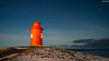
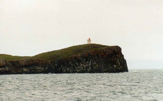
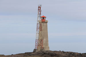
Engey
latitude 64° 10' 29.3" N longitude 21° 55' 27.9" W
access: only boat
Place: Faxaflói
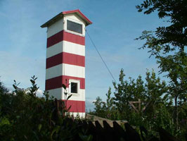
Engey is an island on the east side of Reykjavík's commercial harbor. (L4505) ARLHS # ICE-035
Photo courtesy Richard Schoeller |
|
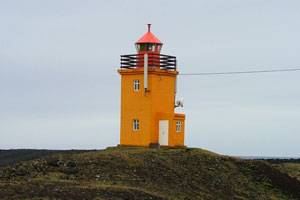
IC 1G
[2150] |
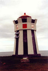
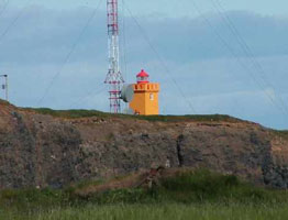
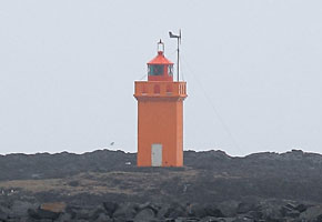
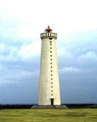
| Grotta
latitude 64° 9' 54.2" N longitude 22° 1' 19.1" W
Grótta is an island off the end of the Seltjarnarnes peninsula about 15 km west of downtown Reykjavík. The lighthouse marks the entrance to the city's harbor. (L4501) ARLHS # ICE-044
Photo courtesy Larry Myhre [Flickr] |
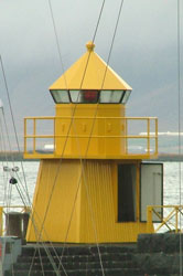
IC 2
[2170] |
Reykjavík Norðurgarði (North Mole Head)
latitude 64° 9' 10.6" N longitude 21° 55' 56.4" W
June 23, 2018 access: boat
Reykjavik Harbor Entrance (L4506)
Photo courtesy Observe the Banana [Flickr] |
|
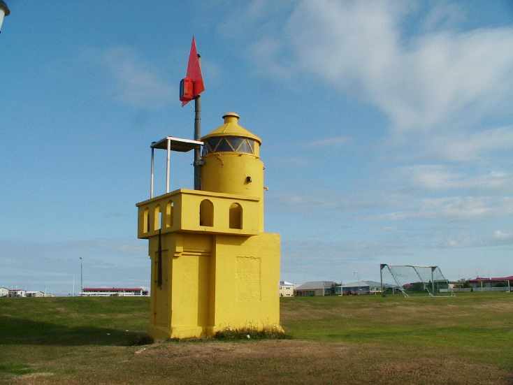
IC 3
[2180] |
| Reykjavík Ingólfsgarði (South Mole Elbow)
latitude 64° 9' 7.1" N longitude 21° 55' 54.5" W
June 23, 2018 access: walk the mole
Elbow of South Breakwater (L4508)
Photo courtesy Larry Myhre [Flickr] |
IC 4
[2190] |
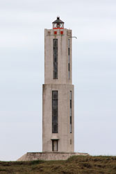
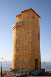
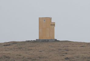
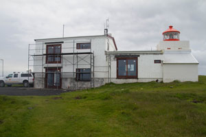
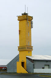
Reykjavik Mariners School
latitude 64° 8' 21.2" N longitude 21° 54' 9.1" W
School for Mariners
Visually blocked by new high rise. Plans for new light are being made (6/23/2018) (L4503) ARLHS # ICE-076
Photo courtesy Erich Hartmann [List of Lights] |
|
IC 5
[2195] |
| Skarfagarðs (Skarfagarth)
latitude 64° 9' 28.1" N longitude 21° 51' 51.9" W
access: walk the mole
Located at the end of the Skarfagarðs jetty, which shelters the Viðey ferry terminal. (L4513.3)
Photo courtesy Erich Hartmann [List of Lights] |
Akranes Area
IC 6
[2200] |
Krossvík Fremra (Range Front)
latitude 64° 18' 56.3" N longitude 22° 3' 15.4" W
Located on the waterfront on the east side of Akranes, adjacent to an athletic field. (L4518)
Photo courtesy Klaus Huelse [Leuchtturm Welt] |

|
IC 7
[2210] |
Akranes (Old)
latitude 64° 18' 27.7" N longitude 22° 5' 43.3" W |
In the photograph, the Old lighthouse is in the front; the new one in the back ARLHS # ICE-003
Photo courtesy © Piotr Somerfeld [Flickr] |
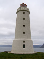
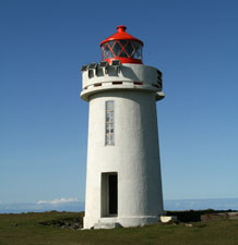
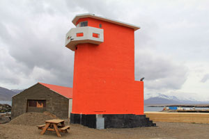
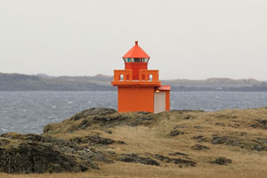
IC 8
[2220] |
Akranes (New)
latitude 64° 18' 31.8" N longitude 22° 5' 42.1" W
1947 Akranes light (L4520) ARLHS # ICE-002
Photo courtesy Pietro Izzo [Flickr] |
|
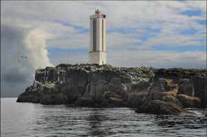
IC 9
[2230] |
Rauðanes
latitude 64° 31' 38" N longitude 21° 58' 38.2" W |
Located on a sharp promontory on the north side of the Faxaflói about 2.5 km southwest of Bogarnes. (L4529) |
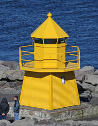
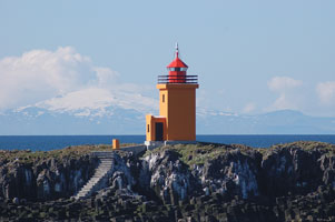
IC 11
[2239] |
Stykkisholmur South /Akrane
June 26, 2018
This is the rear range of a 2 mark system. The front light is only a day-mark. ARLHS # ICE-090
Photo courtesy (c) Siddharth Choksi with permission [Schoksi.com] |
|
IC 12
[2240] |
| Thormudssker Island (Þormóðssker)
latitude 64° 26' 0.3" N longitude 22° 18' 34.8" W
access: boat
Located on Thormodh's Skerry, a small rocky island in the Faxaflói about 13 km northwest of Akranes. (L4526) ARLHS # ICE-101
Photo courtesy © Þórdís Björnsdóttir with permission [Flickr] |
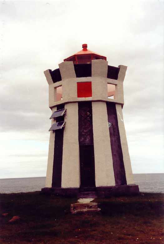
Snæfellsnes South Shore
IC 16
[2250] |
Kirkjuhóll
access: car + walk
Located off highway 54 midway on the south shore of the Snæfells peninsula. It's a walk of about 1/4 mi to the lighthouse. (L4531) ARLHS # ICE-062
Photo courtesy Erich Hartmann [List of Lights] |

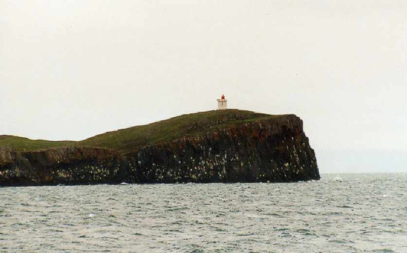
|
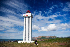
IC 17
[2260] |
| Arnarstapi
latitude 64° 46' 7.3" N longitude 23° 36' 58.8" W
June 26, 2018
Located on a headland on the south side of Arnarstapi, a small harbor on the southwest coast of the Snæfells peninsula. (L4532) ARLHS # ICE-116
Photo courtesy Erich Hartmann [List of Lights] |
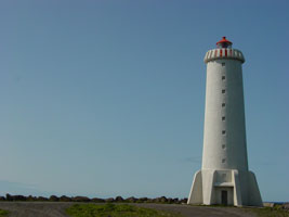
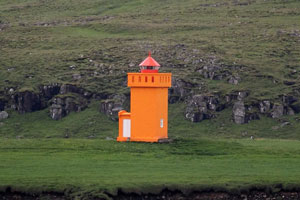
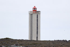
IC 18
[2270] |
Malariff
latitude 64° 43' 41.6" N longitude 23° 48' 10.8" W
June 26, 2018 access: car
Located on the south coast of the Snæfells peninsula about 15 km southwest of Gröf. (L4534) ARLHS # ICE-067
Photo courtesy Ronald Wöhrn [List of Lights] |
|
Snæfellsnes West End
IC 20
[2280] |
| Neshraun (Svörtuloft Thorlakshöfn)
latitude 64° 51' 49.5" N longitude 24° 2' 21" W
Located about 8 km southwest of Hellissandur. (L4538) ARLHS # ICE-091
Photo courtesy Ronald Wöhrn [List of Lights] |
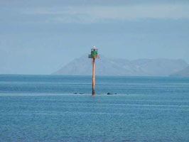
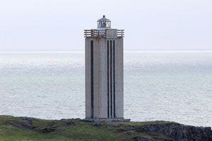
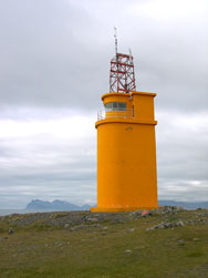
IC 21
[2300] |
Ondverdarnes (Öndverðarnes)
latitude 64° 53' 6.8" N longitude 24° 2' 39.8" W
Located on the extreme northwestern tip of the Snæfells Peninsula, about 2.5 km north of the Svörtuloft lighthouse. (L4540) ARLHS # ICE-099
Photo courtesy Klaus Huelse [Leuchtturm Welt] |

|
IC 22
[2305] |
| Taska (Rif)
latitude 64° 55' 10" N longitude 23° 47' 41.9" W
access: boat
Located in the Breidafjörður off the village of Rif, about 6 km east of Hellissandur. (L4541.8)
Photo courtesy Klaus Huelse [Leuchtturm Welt] |
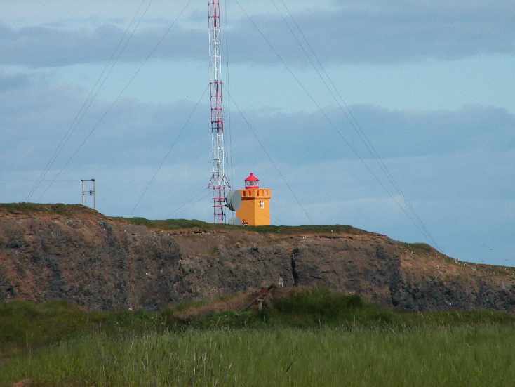
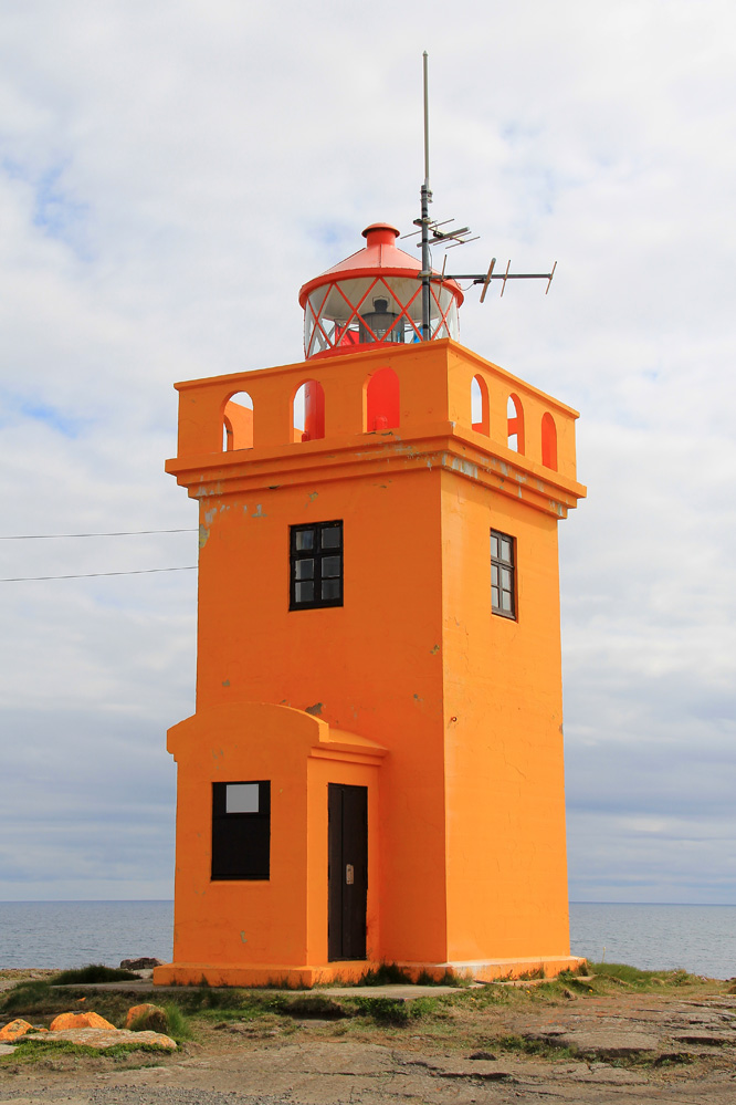
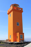
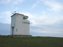
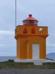
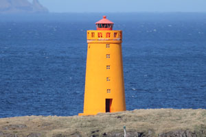
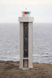
IC 23
[2310] |
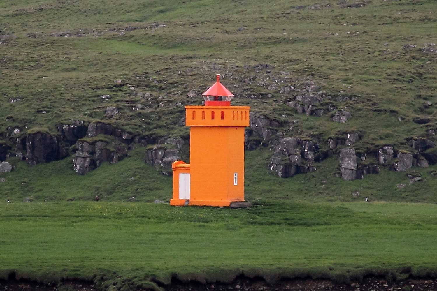
[Ólafsvík]
Breiðafjörður
Located on a headland on the south side of Arnarstapi, a small harbor on the southwest coast of the Snæfells peninsula. (L4542) ARLHS # ICE-098
Photo courtesy Ronald Wöhrn [List of Lights] |
![[Ólafsvík]](SC/Iceland/Olafsvik.jpg)
|
IC 24
[2320] |
| Krossnes (Stod)
latitude 64° 58' 16.5" N longitude 23° 21' 24.6" W
Located at the end of a promontory 8 km northwest of Grundarfjörður. (L4544) ARLHS # ICE-065
Photo courtesy Ronald Wöhrn [List of Lights] |
IC 26
[2330] |
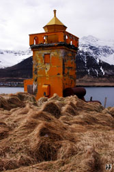
Höskuldsey |
Höskuldsey is a small island in the Breidafjörður about 15 km west of Stykkishölmur. (L4550) ARLHS # ICE-009
Photo courtesy © Ingvar Hreinsson [Flickr] |
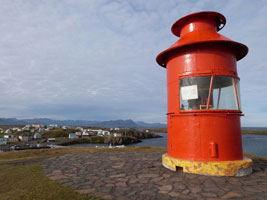
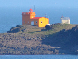
IC 27
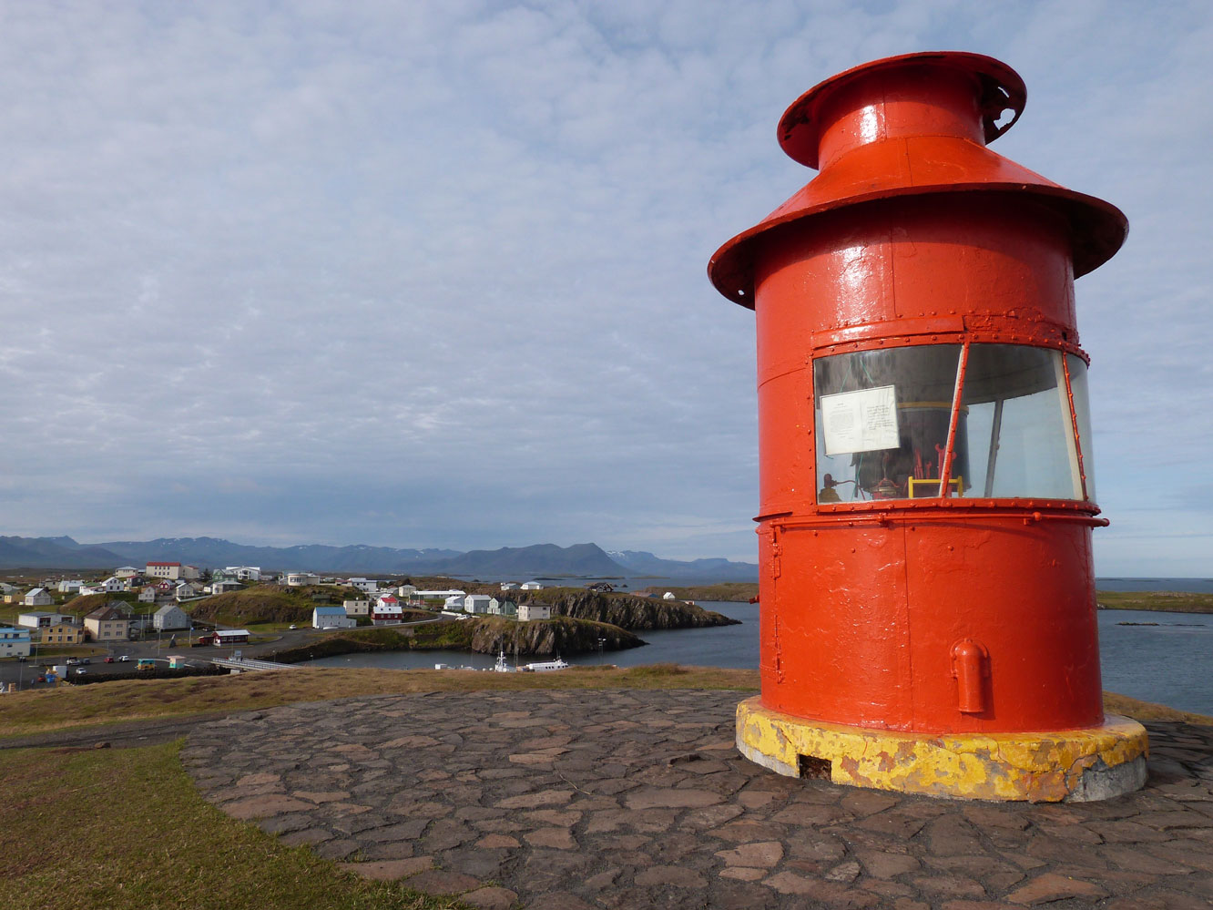
[2340] |
Sugandisey (Stykkishólmur Harbor)
latitude 65° 4' 49.2" N longitude 22° 43' 23.6" W
Located on a hilltop on the north side of the harbor of Stykkisholmúr. (L4554) ARLHS # ICE-114
Photo courtesy Ronald Wöhrn [List of Lights] |
|
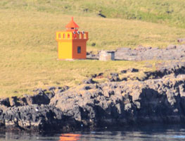
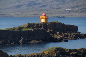
IC 28
[2350] |
| Ellidaey
latitude 65° 8' 44.5" N longitude 22° 48' 11.5" W
access: boat
Elliðaey is a small island in the Breidafjörður about 5 km northwest of Stykkishölmur. (L4552) ARLHS # ICE-004
Photo courtesy Klaus Huelse [Leuchtturm Welt] |
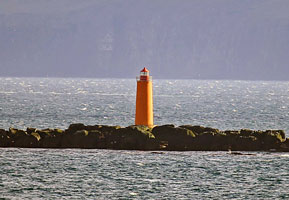
IC 401
[2010] |
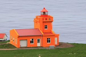
Krísuvíkurberg
latitude 63° 49' 48.5" N longitude 22° 4' 8.9" W |
Located on a bluff at Krísuvíkurberg, about 25 km east of Grindavík. (L4826) |
IC 402
[2020] |
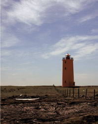
Hópsnes (Grindavik)
Grindavík Harbour
Located on a promontory about 2.5 km southeast of Grindavík. (L4828) ARLHS # ICE-048
Photo courtesy Larry Myhre [Flickr] |
|
Vestfirðir
(Northwest Fjords)
Breidafjörður
| IC 1010 |
| Klofningur (Flatey)
Flatey (Flat Island) Island Lighthouse
The lighthouse is located on Klofningur, a small island about 800 m off the entrance to Flatey's harbor. Note: there is another Flatey Light on the northeast coast of Iceland. (L4556) ARLHS # ICE-063
Photo courtesy © Catriona Walker with permission [Flickr] |
| IC 1020 |
Skor
latitude 65° 24' 53.9" N longitude 23° 57' 8.8" W |
ARLHS # ICE-107 |
| IC 1030 |
Bjargtangar (Látrabjarg)
latitude 65° 30' 8.9" N longitude 24° 31' 53.2" W
The Westernmost point of Iceland. (L4558) ARLHS # ICE-029
Photo courtesy Tommy Bee [Wikimedia] |
|
IC 1032
[1162] |
| Olafsviti (Haanes)
latitude 65° 36' 35.3" N longitude 24° 9' 41.8" W (L4562) ARLHS # ICE-070
Photo courtesy © Atli Týr Ægisson with permission [Flickr] |
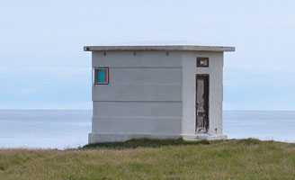
IC 1037
[1170] |
Langanes Arnarfirdi
latitude 65° 43' 10.8" N longitude 23° 31' 58.6" W |
(L4568) ARLHS # ICE-122
Photo courtesy © Arnbjörn Jóhannesson [Flickr] |
Patreksfjörður and Arnarfjörður
| IC 1040 |
Svalvogar /Hraun |
(L4570) ARLHS # ICE-108 |
| IC 1050 |
Fjallasskagi
latitude 66° 30.3" N longitude 23° 48' 41.2" W |
(L4574) ARLHS # ICE-037 |
| IC 1055 |
Saudanes West |
ARLHS # ICE-124 |
| IC 1060 |
[Sauðanes Northwest]
latitude 66° 7' 4.1" N longitude 23° 39' 24.2" W |
See also Sauðanes North IC 1270
Located at the tip of a peninsula about 5 km west of Suðereyi, marking the entrance to the Súgandafjörður. Probably accessible only by boat. (L4575) |
Ísafjörður
| IC 1070 |
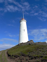
Göltur (Galtarviti)
latitude 66° 9' 47.2" N longitude 23° 34' 15.8" W |
(L4578) ARLHS # ICE-041
Photo courtesy © Ólafur Jónasson [Flickr] |
| IC 1080 |
Óshólar
two miles east of Bolungarvik (L4580) ARLHS # ICE-071
Photo courtesy Christian Bickel [wikimedia] |
|
| IC 1090 |
| Arnarnes
latitude 66° 5' 55.7" N longitude 23° 2' 20.2" W
This lighthouse marks the entrance to the Skutulsfjörður from the Ísafjörður. (L4584) ARLHS # ICE-028
Photo courtesy Klaus Huelse [Leuchtturm Welt] |
| IC 1100 |
Æðey
latitude 66° 5' 28.6" N longitude 22° 39' 39.2" W |
(L4582) ARLHS # ICE-001 |
| IC 1110 |
Sléttaeyri (Slettunes)
latitude 66° 17' 46.3" N longitude 22° 57' 51.1" W |
(L4600) ARLHS # ICE-126 |
|
|
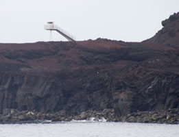
| IC 1115 |
Straumnes Northwest
latitude 66° 25' 49.8" N longitude 23° 8' 5.1" W |
It is one of two Straumnes Lights in northern Iceland. IC1260
This unusual lighthouse stands at the tip of a peninsula marking the northwestern corner of Iceland. (L4604) ARLHS # ICE-088
Photo courtesy Bryan Richter [lightphotos.net] |
Northern Coast
| IC 1120 |
Hornbjarg /Latravik
latitude 66° 24' 37.8" N longitude 22° 22' 45.5" W |
This lighthouse is located a few miles southeast of Horn, the northernmost cape of northwestern Iceland, and only about 17.5 km south of the Arctic Circle. (L4606) ARLHS # ICE-049
Photo courtesy © Gayle [Flickr] |
| IC 1130 |
Selsker |
This lighthouse marks Munaðarnes, a prominent cape on the north coast at the western entrance to the Húnaflói, a broad bay that separates the northwestern fjord region from the rest of northern Iceland. (L4608) ARLHS # ICE-023
Photo courtesy © Ingvar Hreinsson [Flickr] |
| IC 1140 |
Gjögur
latitude 65° 59' 46.5" N longitude 21° 19' 1.2" W |
(L4616) ARLHS # ICE-039
Photo courtesy © Júlíus Ó Ásgeirsson [Flickr] |
Drangnes Area
| IC 1150 |
Grímsey í Steingrímsfirði
latitude 65° 41' 10" N longitude 21° 23' 43.5" W |
Not to be confused with the much better known island of Grímsey in Norðurland Eystra. IC1340
Grímsey is an island off the north side of the entrance to the Steingrimsfjörður near Drangnes. (L4620) ARLHS # ICE-006 |
| IC 1160 |
Malarhorn
latitude 65° 41' 25.1" N longitude 21° 26' 10.5" W |
(L4622) ARLHS # ICE-123 |
| IC 1165 |
Kopanes |
(L4567) ARLHS # ICE-121 |
Norðurland Vestra
(Western Northland)
Húnaflói
| IC 1180 |
Skarð (Vatnsnes)
latitude 65° 29' 7.9" N longitude 20° 59' 14.2" W |
Located on a bluff marking the east side of the entrance to the Miðfjörður, about 11 km north of Hvammstangi. (L4628) ARLHS # ICE-083 |
| IC 1190 |
Skagaströnd Range Rear |
The front light is on a post. Located in the fishing town of Skagaströnd on the east side of the Húnaflói. (L4632.1)
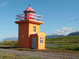
Photo courtesy © Arnbjörn Jóhannesson [Flickr] |
| IC 1200 |
Kálfshamars (Kálfshamarsvík)
latitude 66° 1' 2" N longitude 20° 25' 57.7" W
This lighthouse marks the eastern entrance to the broad bay of the Húnaflói.
Located about 25 km north of Skagaströnd. Accessible by road. (L4635) ARLHS # ICE-058
Photo courtesy Bromr [wikimedia] |
|
Suðurnes Region
(Southwest Peninsula)
Skagafjörður
| IC 1210 |
Skagata
latitude 66° 7' 9.5" N longitude 20° 5' 56.6" W |
Skagatá is one of several very prominent capes on the north coast of Iceland. Located on the cape, about 80 km northwest of Sauðárkrókur. May be accessible only by boat. ARLHS # ICE-082 |
| IC 1220 |
Sauðárkrókur Range Front (1) (Saudarkrokur)
latitude 65° 44' 59.1" N longitude 19° 39' 4.1" W |
Located near the center of town |
| IC 1230 |
Sauðárkrókur Range Front (2) (Saudarkrokur) |
Located off the Freyjugata about 100 m east of the church. (L4640) |
| IC 1231 |
Knarrarós (L4804) ARLHS # ICE-012
Photo courtesy Ronald Wöhrn [List of Lights] |
|
| IC 1240 |
Hegranes
latitude 65° 46' 11.5" N longitude 19° 32' 33.3" W |
Located on a promontory at the southern end of the Skagafjörður, about 5 km east of Sauðárkrókur. Accessible by a walk of about 2 km. (L4644) ARLHS # ICE-046 |
| IC 1250 |
Málmey
latitude 66° 26.9" N longitude 19° 32' 18.2" W |
Málmey is a high island in the eastern entrance to the Skagafjörður; sheer cliffs surround it on all sides. (L4648) ARLHS # ICE-013 |
Siglufjörður Area
| IC 1260 |
Straumnes North
latitude 66° 11' 13.3" N longitude 18° 57' 3.4" W
Located on a promontory facing the Arctic, about 15 km northeast of Hofsós. (L4650) ARLHS # ICE-087
Photo courtesy Klaus Huelse [Leuchtturm Welt] |
|
| IC 1270 |
| Sauðanes North
latitude 66° 11' 13.3" N longitude 18° 57' 3.4" W
June 28, 2018
On the south tip of the fjord leading to: Siglufjörður (L4652)
Photo courtesy Ronald Wöhrn [List of Lights] |
| IC 1285 |
Selvikurnef
latitude 66° 9' 32.9" N longitude 18° 51' 60" W
Located on the east side of the Siglufjörður opposite the fishing village of the same name. (L4654) ARLHS # ICE-125
Photo courtesy Nonna & Nonni © with permission [Flickr] |
|
| IC 1290 |
Siglunes
latitude 66° 11' 33.2" N longitude 18° 49' 15.8" W |
This is the oldest lighthouse on Iceland's north coast, marking one of several very prominent capes on the coast.
Located on heights above the cape, about 6 km northeast of Siglufjörður. (L4656) ARLHS # ICE-080
Photo courtesy © Ingvar Hreinsson [Flickr] |
Norðurland Eystra
(Eastern Northland)
Eyjafjorður
| IC 1300 |
Brik |
Located on the west side of the entrance to the Olafsfjorður and Eyjafjorður about 3 km northeast of the fishing village of Olafsfjorður. (L4660.6) |
| IC 1310 |
Hrólfssker
June 28, 2018
Located on a small island ("Rolf's Skerry") in the center of the entrance to the Eyjafjorður (L4658) ARLHS # ICE-052
Photo courtesy Erich Hartmann [List of Lights] |
|
| IC 1320 |
Hrisey
latitude 66° 1' 5.8" N longitude 18° 24' 2.5" W |
Hrísey is an inhabited island in the Eyjafjorður; 4.7 mi long, it is the second largest island of Iceland. (L4660) ARLHS # ICE-051
Photo courtesy © Svala Hrund [Flickr] |
| IC 1325 |
Svalbarðseyri
latitude 65° 44' 38.7" N longitude 18° 5' 28.3" W
June 29, 2018
Svalbarðseyri is a small village on the east side of the Eyjafjorður, about 6 km north of Akureyri.
Located on the shore on a promontory just north of the village. Accessible by road. (L4668) ARLHS # ICE-096
Photo courtesy Klaus Huelse [Leuchtturm Welt] |
|
| IC 1330 |
| Gjogurta
Located on the east side of the entrance to the Eyjafjorður. Accessible only by boat. (L4657) ARLHS # ICE-110
Photo courtesy Erich Hartmann [List of Lights] |
| IC 1335 |
Hjalteyri
latitude 65° 51' 7" N longitude 18° 11' 28.2" W |
Hjalteyri is a small village on the west side of the Eyjafjorður, about 20 km north of Akureyri. Located on the point of a spit that protects the village harbor. (L4666) ARLHS # ICE-026
Photo courtesy © Daniel Starrason [Flickr] |
| IC 1340 |
Grimsey South
latitude 66° 31' 41" N longitude 17° 58' 53.8" W
June 28, 2018
Grímsey is an island precisely on the Arctic Circle, 25.5 miles north of the mainland.
The light is located on the south point of the island. (L4674) ARLHS # ICE-007
Photo courtesy © David Minkin with permission [Flickr] |
|
Húsavík Area
| IC 1360 |
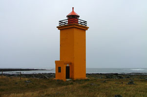
Húsavík
latitude 66° 3' 8.2" N longitude 17° 21' 43.6" W
June 30, 2018 access: Walk from town
A new visitors center is under construction due to be completed in 2018.
Located on a promontory on the north side of the entrance to Húsavík harbor, about 2 km west of town. (L4680) ARLHS # ICE-054
Photo courtesy Daniel [Flickr] |
|
| IC 1370 |
Lundey Island
latitude 66° 6' 58" N longitude 17° 22' 12.7" W |
Lundey (one of several Icelandic islands of that name) is a flat-topped island about 5 km north of Húsavík. (L4686) ARLHS # ICE-095 |
| IC 1380 |
Tjörnes
latitude 66° 12' 23.8" N longitude 17° 8' 41" W
This lighthouse marks a prominent cape on the north coast, about 1 km northwest of Máná. Accessible by road. (L4688) ARLHS # ICE-092
Photo courtesy Klaus Huelse [Leuchtturm Welt] |
|
| IC 1390 |
Mánáreyjar |
Mánáreyjar is a rocky island about 5 km northeast of Tjörnes. Accessible only by boat. (L4689) ARLHS # ICE-014 |
| IC 1400 |
Grimshafnartangi /Kopasker
latitude 66° 18' 23.4" N longitude 16° 28' 3.8" W
Kópasker is a small fishing port on the east side of the Öxarfjörður and the west side of the Melrakkaslétta, Iceland's northeastern peninsula. (L4690) ARLHS # ICE-043
Photo courtesy Lydur Gudmundsson [Flickr] |
|
| IC 1410 |
Rauðinúpur |
Located on a promontory at the northwestern corner of the Melrakkaslétta, Iceland's northeastern peninsula, marking the entrance to the Öxarfjörður. Accessible by road about 15 km north northwest of Kópasker. (L4696) ARLHS # ICE-072 |
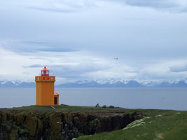
| IC 1420 |
Hraunhafnartangi
latitude 66° 32' 10.1" N longitude 16° 1' 34.8" W |
Iceland's Northernmost lighthouse, just 1/2 mile from the Artic circle
Accessible by road about 10 km northwest of Raufarhöfn. ARLHS # ICE-050 |
| IC 1430 |
Raufarhöfn
latitude 66° 27' 14.5" N longitude 15° 55' 58.3" W
Located on the east side of the entrance to Raufarhöfn harbor. (L4699) ARLHS # ICE-073
Photo courtesy Ronald Wöhrn [List of Lights] |
|
| IC 1440 |

| Raufarhöfn Range Front
latitude 66° 26' 58.2" N longitude 15° 56' 30.1" W
Located on the south side of the harbor at Raufarhöfn. (L4700)
Photo courtesy Ronald Wöhrn [List of Lights] |
| IC 1450 |
Melrakkanes
latitude 66° 23' 46.7" N longitude 15° 42' 19" W |
Located on a cape about 15 km southeast of Raufarhöfn, marking the northern entrance to the bay called the Thistilfjörður. (L4706) ARLHS # ICE-068 |
Langanesbyggð Area
| IC 1460 |
Grejanes
latitude 66° 15' 28.7" N longitude 15° 20' 7.8" W |
Grenjanes is on northeast iceland near Þorshofn village.
Located on a cape at the east entrance to the Lónafjörður, about 5 km north of the fishing town of Þórshöfn. (L4710) ARLHS # ICE-042
Photo courtesy © Ingvar Hreinsson [Flickr] |
| IC 1490 |
Frontur /Langanes/Arnarfirdi
This lighthouse marks the end of Langanes, a long, narrow peninsula that projects from the northeastern corner of Iceland, posing a great hazard to navigation. (L4712) ARLHS # ICE-111
Photo courtesy Katy Nicolson [Flickr] |
|
|
|
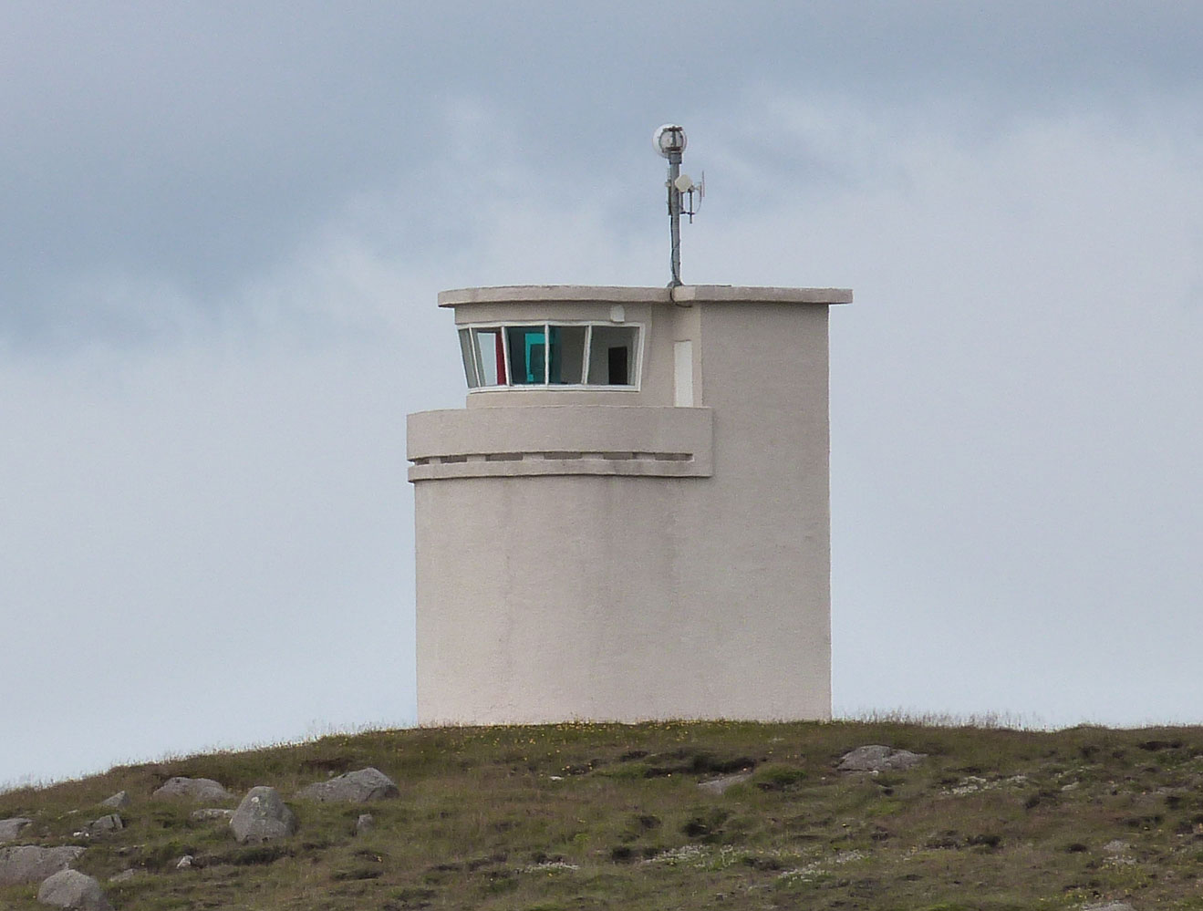
| IC 1500 |
Digranes
latitude 66° 3' 27.4" N longitude 14° 43' 56.8" W |
Located on an islet just off a cape 3 km east of the fishing town of Bakkafjörður. A footbridge connects the islet to the mainland. (L4714) ARLHS # ICE-033
Photo courtesy © SirrýJó [Flickr] |
Northern Austerland (NE Coast)
IC 1502
[10] |
Kolbeinstangi
Vopnafjörður (L4716) ARLHS # ICE-064
Photo courtesy Ronald Wöhrn [List of Lights] |
|
IC 1503
[20] |
Bjararey
latitude 65° 47' 8.5" N longitude 14° 18' 29.4" W |
Bjarnarey is an island on the east coast of Iceland near the small village Vopnafjordur. (L4721) ARLHS # ICE-030
Photo courtesy Ingvarh Reinsson © [Flickr] |
IC 1504
[30] |
Kögur
latitude 65° 36' 31.3" N longitude 13° 51' 45.8" W |
Kogur is on east iceland near small village - Borgarfjordur east. (L4722) ARLHS # ICE-109
Photo courtesy Ingvarh Reinsson © [Flickr] |
IC 1505
[40] |
Glettinganes
latitude 65° 30' 37.9" N longitude 13° 36' 27.5" W |
(L4724) ARLHS # ICE-040
Photo courtesy Ingvarh Reinsson © [Flickr] |
| IC 1506 |
Brimmes
latitude 65° 18' 30" N longitude 13° 46' 9.1" W
Seyðisfjörður (L4726) ARLHS # ICE-031
Photo courtesy Richard Schoeller |
|
| IC 1507 |
Dalatangi (1895)
latitude 65° 16' 14.7" N longitude 13° 34' 33.1" W |
Photo courtesy Eygló Haraldsdóttir [Flickr] |
| IC 1508 |
Dalatangi
latitude 65° 16' 12.8" N longitude 13° 34' 30.7" W
July 1, 2018
The light house at Dalatangi and the old one to the left. According to the sign on the door the old one is the second oldest one in Iceland and the oldest one in the eastern part of Iceland built in 1895. (L4730) ARLHS # ICE-032
Photo courtesy Richard Schoeller |
|
| IC 1509 |
Norðfjörður
latitude 65° 8' 59.3" N longitude 13° 39' 19.1" W |
Norðfjarðarflói (L4731) ARLHS # ICE-069 |
Central Austerland
| IC 1511 |
Seley |
Icelands easternmost lighthouse. (L4733) ARLHS # ICE-022 |
| IC 1513 |
Vattarnes
latitude 64° 56' 10.3" N longitude 13° 41' 7.2" W
Reyðarfjörður
Located on a prominent cape on the south side of the entrance to the Reyðarfjörður. Accessible by road. (L4734) ARLHS # ICE-053
Photo courtesy Ronald Wöhrn [List of Lights] |
|
| IC 1514 |
| Hafnarnes
latitude 64° 56' 10.3" N longitude 13° 41' 7.2" W
Entrée de fjord signalée entre les ruines du hameau (L4738) ARLHS # ICE-045
Photo courtesy Julien Carnot [Flickr] |
| IC 1515 |
Landahóll Langanes /Arnarfirdi
latitude 64° 49' 33.8" N longitude 13° 49' 37" W
Stöðvarfjörður
Located on a prominent cape on the north side of the entrance to the Stöðvarfjörður, about 3 km east of the town of the same name. Accessible by road. (L4743) ARLHS # ICE-066
Photo courtesy Ronald Wöhrn [List of Lights] |
|
| IC 1516 |

| Kambanes
latitude 64° 48' 4" N longitude 13° 50' 19.8" W
access: car + walk
Located on a promontory 5 km east of Breiðdalsvik. Accessible by road and a short hike down to the tower. (L4744) ARLHS # ICE-059
Photo courtesy Klaus Huelse [Leuchtturm Welt] |
| IC 1517 |
Breiddalsvik (Selnes)
latitude 64° 47' 10" N longitude 14° 22.6" W
Breiðdalsvík (L4746) ARLHS # ICE-078
Photo courtesy Ronald Wöhrn [List of Lights] |
|
| IC 1519 |
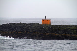
| Streiti (Streittishvarf)
latitude 64° 43' 47.7" N longitude 13° 59' 9.1" W
Located just off highway 1 on a prominent cape about 8 south of Breiðdalsvik. Accessible from the coastal highway. (L4749.2) ARLHS # ICE-089
Photo courtesy Ronald Wöhrn [List of Lights] |
Southern Austerland
(Southeast Coast)
| IC 1522 |
Karlstaðatangi (Ædarsteinstangi)
latitude 64° 41' 16.4" N longitude 14° 13' 41.5" W
Located on the north side of the entrance to the Berufjörður, opposite Djúpivogur. Accessible from the coastal highway. (L4750) ARLHS # ICE-060
Photo courtesy Ronald Wöhrn [List of Lights] |
|
| IC 1524 |
| Æðarsteinn
latitude 64° 40' 5.8" N longitude 14° 17' 37.1" W
July 2, 2018
In the port of Djupivogur (L4754) ARLHS # ICE-115 |
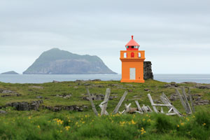
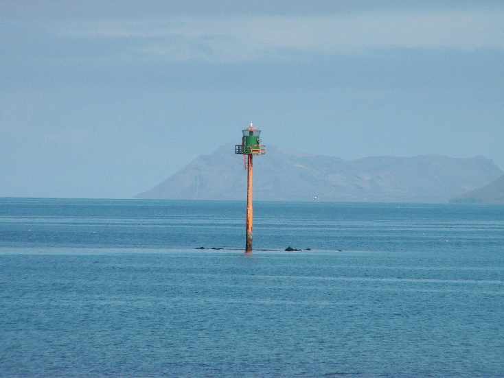
IC 1525
[190] |
Ketilbodafles (Ketilsfles)
latitude 64° 36' 57.3" N longitude 14° 14' 50.4" W |
(L4760) ARLHS # ICE-061
Photo courtesy Ingvarh Reinsson © [Flickr] |
IC 1527
[200] |
Papey
latitude 64° 35' 27.9" N longitude 14° 10' 28.3" W |
(L4762) ARLHS # ICE-017
Photo courtesy © Sonia [Flickr] |
IC 1528
[210] |
Hvalnes
latitude 64° 24' 8.4" N longitude 14° 32' 23.2" W
July 2, 2018 access: car
This important lighthouse marks a prominent cape, the Austerhorn, one of two capes that mark the southeastern corner of Iceland. Accessible from the coastal highway IS-1 (L4764) ARLHS # ICE-055
Photo courtesy © Mifl68 [Flickr] |
|
IC 1529
[220] |
| Stokksnes (L4766) ARLHS # ICE-085
Photo courtesy Ronald Wöhrn [List of Lights] |
IC 1530
[230] |
Hellir
latitude 64° 14' 29.4" N longitude 15° 11' 8.9" W
place: Hornafjörður (L4768.4)
Photo courtesy Ronald Wöhrn [List of Lights] |
|
IC 1531
[240] |
| Höfn Harbour (Hvanney)
place: Hornafjörður (L4768) ARLHS # ICE-056
Photo courtesy Ronald Wöhrn [List of Lights] |
IC 1533
[250] |
Hrollaugseyjar |
Hrollaugseyjar is one of a group of small, rocky islands about 5 km offshore and 25 km southwest of Höfn. Accessible only by boat. (L4770) ARLHS # ICE-010 |
IC 1534
[251] |
Hornafjordur |
Literally - Fjord of Horns ARLHS # ICE-105 |
Southeastern Suðurland
(Central South Coast)
IC 1537
[260] |
Inggolfshöfdi
latitude 63° 48' 5.7" N longitude 16° 38' 13" W |
The Lighthouse of a small Island called Ingolfshöfdi in Iceland. ARLHS # ICE-057
Photo courtesy © Josche [Flickr] |
IC 1538
[270] |
Skaftárós
latitude 63° 38' 57.3" N longitude 17° 49' 45.7" W |
(L4774) ARLHS # ICE-081
Photo courtesy © Jón Kornelíus Gíslason [Flickr] |
IC 1539
[280] |
Skardsfjara (Skarðsfjara)
latitude 63° 31' 4.6" N longitude 17° 58' 42.1" W |
Located at a bend in the coastline about 30 km east of Myrar. This is a remote area and there may not be any land access. (L4775) ARLHS # ICE-084
Photo courtesy © Gunnlaugur Hólm [Flickr] |
IC 1541
[300] |
Alvidruhamar (Alviðruhamrar)
latitude 63° 27' 18.9" N longitude 18° 18' 31.1" W |
Located on the west side of the Küðafljot, a glacial melt river, about 15 km south of Myrar. There may not be any public land access. (L4776) ARLHS # ICE-027
Photo courtesy © ingvar Hreinsson [Flickr] |
IC 1542
[305] |
Dyrhólaey
latitude 63° 24' 9.2" N longitude 19° 7' 52.4" W (L4780) ARLHS # ICE-034
Photo courtesy Matito [Flickr] |
|
Vestmannaeyjar
(Westman Islands)
IC 1544
[310] |
| Storhöfdi /Heimaey/Vestmannæyjar
latitude 63° 23' 58.1" N longitude 20° 17' 18.2" W
July 3, 2018 access: Car
Located at the top of “the Broad Cape” (L4784) ARLHS # ICE-086 |
IC 1545
[320] |
Urðir /Heimaey/Vestmannæyhar
latitude 63° 26' 11.5" N longitude 20° 13' 38.7" W
July 3, 2018 access: Boat
Located on the headland approaching the Heimaey Harbor. ARLHS # ICE-093 |
|
IC 1546
[330] |
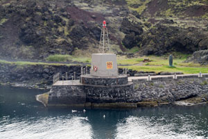
| Heimaey Höfn
latitude 63° 26' 42.7" N longitude 20° 15' 41.4" W
July 3, 2018
Located on south pier on entry to the harbor. (L4790) |
IC 1547
[440] |
Faxasher /Vestmannæyjar
latitude 63° 27' 38.1" N longitude 20° 14' 21.8" W
July 3, 2018 access: boat
Located on a small island in the Vestmannaeyjar, about 2 km north of Heimaey. Accessible only by boat. (L4782) ARLHS # ICE-036 |
|
IC 1548
[350] |
Þrídrangar (Thridrangur) |
Trídrangaviti near Vestmannaeyjar at Iceland. (L4802) ARLHS # ICE-019
Photo courtesy © Ingvar Hreinsson [Flickr] |
Western Suðurland
(Southwest Coast)
IC 1552
[380] |
Hafnarvik (Þorlákshöfn,Thorlákshöfn)
latitude 63° 51' 4.3" N longitude 21° 21' 39.5" W
Place: Thorlákshöfn (Thorlaks harbor) (L4820) ARLHS # 2
Photo courtesy Ronald Wöhrn [List of Lights] |
|
IC 1553
[390] |
| Selvogur
latitude 63° 49' 16.6" N longitude 21° 39' 6.8" W ARLHS # ICE-079
Photo courtesy © Brynja Hrafnkelsdóttir (with permission) [Flickr] |
South Coast Lighthouses
| IC 2022 |
Reykjanes I |
ARLHS # ICE-074 |
| IC 2024 |
Reykjanes II |
ARLHS # ICE-075 |
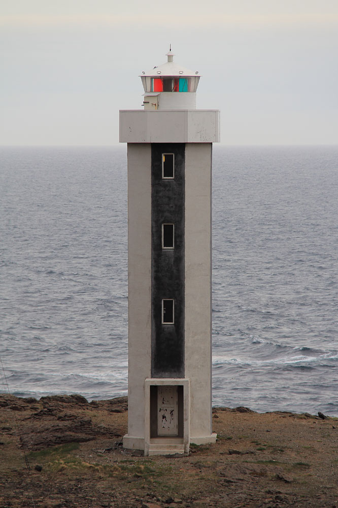
| IC 2030 |
Reykjanes III
latitude 63° 48' 55.7" N longitude 22° 42' 16.7" W
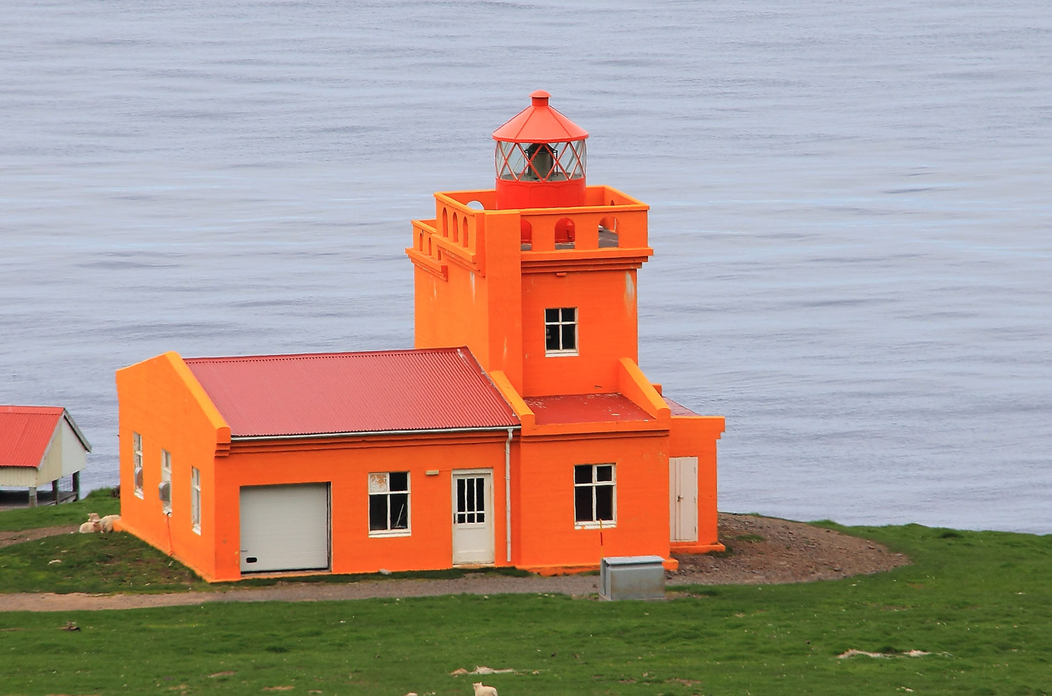
Located atop a hill (an inactive volcanic cone) near the southwestern point of the Reykjanes peninsula, about 16 km west of Grindavík and 20 km southwest of Keflavík. (L4466) ARLHS # ICE-020
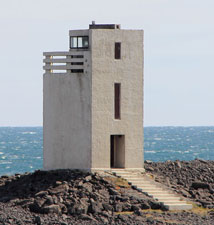
Photo courtesy Christian Bickel [wikimedia] |
|
| IC 2040 |
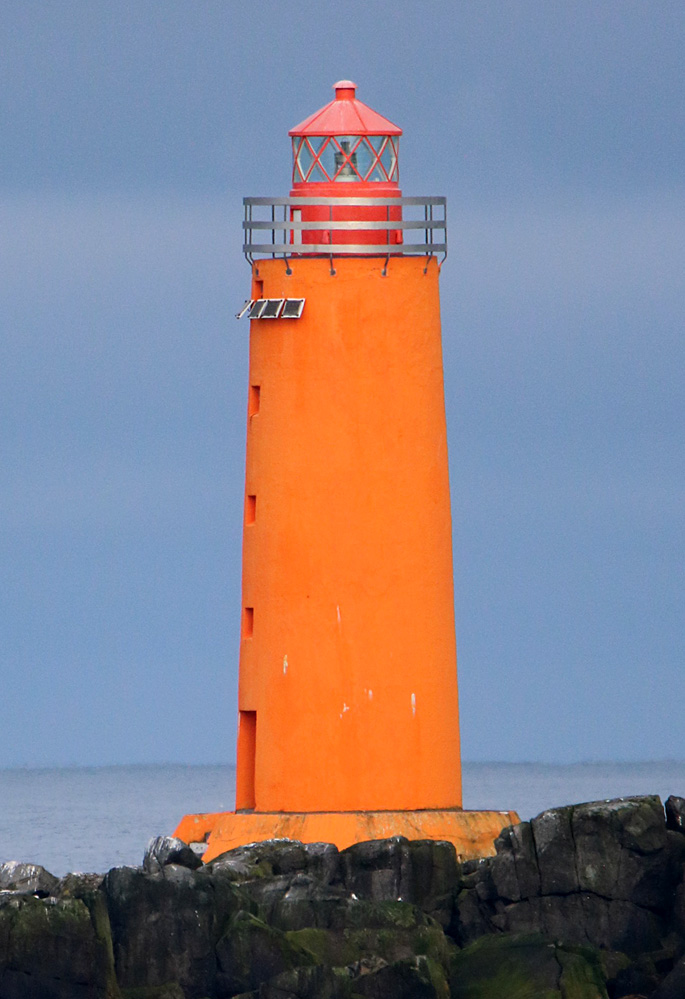
Reykjanestá (Reykjanes aukaviti)
latitude 63° 48' 1.2" N longitude 22° 41' 52.5" W |
Located on the extreme tip of the Reykjanes peninsula, 1.7 km southwest of the Reykjanes lighthouse. (L4468)
Photo courtesy (c) Ingvar Hreinsson [Flickr] |
Keflavic Area
| IC 2050 |
Stafnes Stafnesviti
latitude 63° 58' 15.1" N longitude 22° 45' 8.8" W
Located at the west point of the Reykjanes peninsula, about 5 km south of Sandgerði. (L4472) ARLHS # ICE-025
Photo courtesy Larry Myhre [Flickr] |
|
| IC 2060 |
| Sandgerdhi Sandgerdôi
latitude 64° 4' 57.4" N longitude 22° 41' 30" W
built into the end of a warehouse building in Sanderdi (L4476) ARLHS # ICE-021
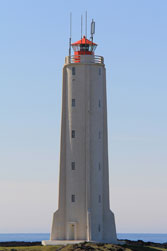
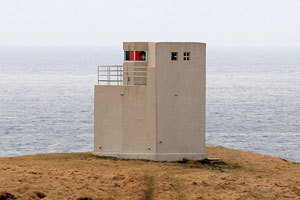
Photo courtesy Larry Myhre [Flickr] |
| IC 2070 |
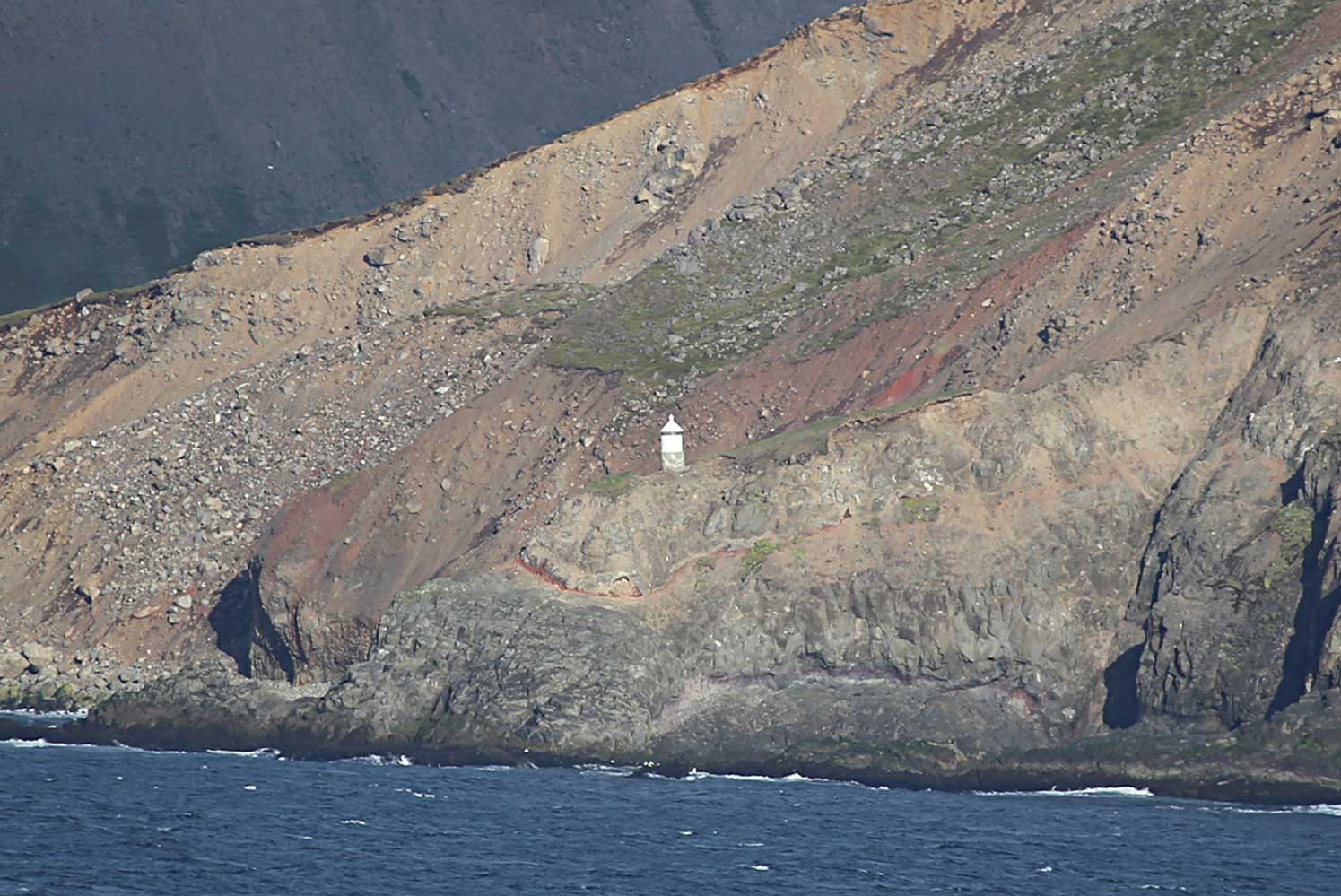
Garðskagi (Old)
latitude 64° 4' 58.5" N longitude 22° 41' 37.1" W
access: car
Located on Garðskagi (Cape Garð), the northwestern tip of the Reykjanes peninsula, about 8 km northwest of Keflavík. ARLHS # ICE-016 |
|
| IC 2080 |
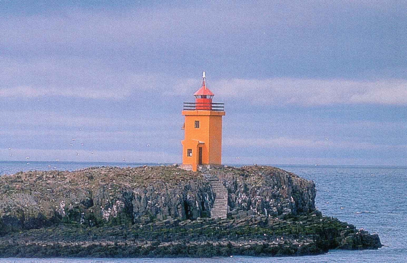
| Gardskagi (New)
latitude 64° 4' 58.5" N longitude 22° 41' 37.1" W
Located about 200 m southeast of the original lighthouse on Garðskagi (Cape Garð). (L4480) ARLHS # ICE-015
Photo courtesy Bromr [wikimedia] |
| IC 2090 |
Holmsberg
Located on a promontory about 2.5 km northwest of Keflavík. (L4483) ARLHS # ICE-047
Photo courtesy Larry Myhre [Flickr] |
|
| IC 2100 |
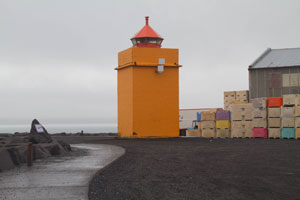
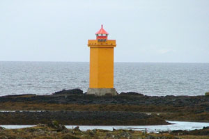
| Vatnsnes /Keflavik
latitude 64° 7.4" N longitude 22° 32' 35" W
June 22, 2018
Located in a warehouse area at the tip of the Vatnsnes peninsula, on the northwest side of Keflavík harbor. (L4488) ARLHS # ICE-094 |
| IC 2110 |
Geirfuglasker (Gerðistangi)
latitude 64° 44.4" N longitude 22° 21' 7.2" W
Located on a point of land near Vogar, about 12 km east of Keflavík. (L4494) ARLHS # ICE-038
Photo courtesy Larry Myhre [Flickr] |
|
Höfuðborgarsæði Region
(Reykjavík Metropolitan Area)
Reykjavík Approach
| IC 2120 |
| Straumsvík Range Rear
latitude 64° 2' 35.6" N longitude 22° 2' 20.1" W
Located on the waterfront of an industrial harbor at Straumsvík. (L4495.1)
Photo courtesy Peter Mosselberger [List of Lights] |
| IC 2130 |
Hafnarfjörður (Straumesvík Directional Light)
latitude 64° 4' 15.5" N longitude 21° 57' 58.1" W
Located on the waterfront on the north side of Hafnarfjörður harbor, a fishing port on the southwest side of Reykjavík. (L4498.5)
Photo courtesy Peter Mosselberger [List of Lights] |
|
| IC 2140 |
| Hafnarfjördur (Range Rear)
Located on a hill off Vitastígur street in Hafnarfjörður. ARLHS # ICE-112
Photo courtesy Klaus Huelse [Leuchtturm Welt] |
|


![[Ólafsvík]](http://listoflights.org/images/leuchtfeuer/gross/L4542.jpg)