|
This page shows the documentation of the Lighthouses of Southeastern Norway. You can always click on the photo of the light to go to a specific (larger resolution) copy. Each lighthouse name is linked to (in our editorial opinion) the best reference site for that light. I would like to include directions on how to get to these lights. If you know such data, could you eMail me and I'll post it here (with your choice of attribution.) mailme There has been significant usage of the Lighthouse Directory prepared by Russ Rowlett (UNC). lhDirectory Lighthouse coordinates are via via Norsk Fyr, orange italic numbers are their reference numbers). My thanks to them for providing this basis for understanding. p6 |
|
Østfold County
Map is SE1
NO 1
[NO 20i] |
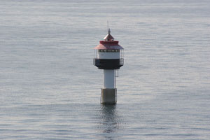
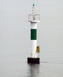
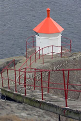
Ildjernsflu
latitude 58° 51' 20.7" N longitude 10° 37' 51.4" E
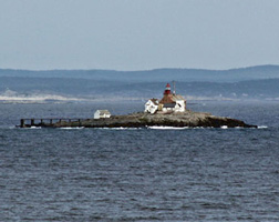
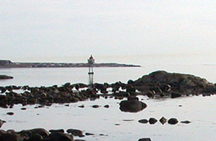
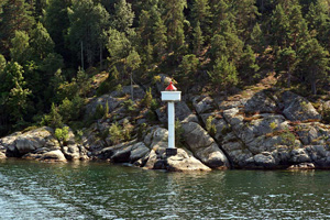
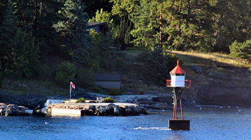
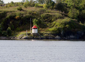
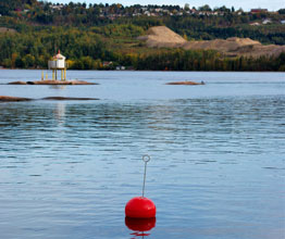
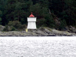
Located on the east side of the Oslofjord about 1 km offshore west of Nesodden (B 2402) [021300]
Photo courtesy Mike Boucher [ListOfLights] |
|
NO 2
[NO 0] |
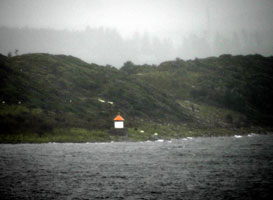
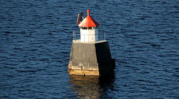
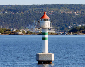
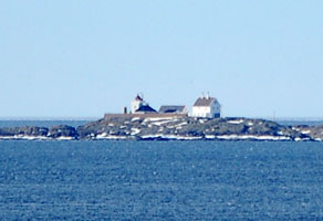
| Torbjørnskjaer
latitude 58° 59' 46.8" N longitude 10° 46' 54" E
The lighthouse marks the entrance to Oslofjorden from the Skagerrak. Located on a small skerry (skjaer) about 8 km southwest of Utgard, Vesterøy. Accessible only by boat, and landing is usually difficult; the lighthouse is now maintained by helicopter. (B 2219) [000200]
Photo courtesy Ronald Wöhrn [ListOfLights] |
NO 5
[NO 0F] |
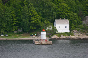
Reiertangen
latitude 59° 1' 1.8" N longitude 11° 6' 38" E |
This light faces Sweden across a channel about 800 m wide. Located at the eastern point of the island of Søndre Sandøy about 4 km east of Skjaerhollen. (B 2195) [000700] ARLHS # NOR-388 |
NO 6
[NO 2] |
Kuskjær |
Søndre Sandøy north. (B 2226) [006000] |
NO 8
[NO 2M] |
Børholmen |
North point of Holmens near Lauersvaeljen. (B 2224) [005600] |
NO 8R
[NO 2S] |
Sauholmen (Børhomen rear range) |
Holmens west shore. (B 2224.1) [005700] |
NO 9
[NO 3] |
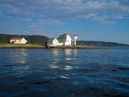
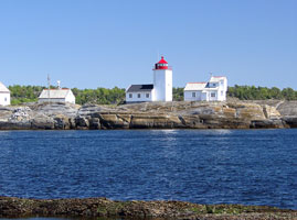
Homlungen
The lighthouse was altered in 1915, apparently by installation of a new lantern. Located at the southernmost point of Kirkøy, 1 km southwest of Skjaerhollen. Accessible by road. (B 2222) [005500]
Photo courtesy Vega photo [Flickr] |
|
NO 10
[NO 4] |
Fugletangskjær |
Located on a skerry off the southeastern tip of Asmaløy, marking the channel between that island and Kirkøy. (B 2230) [006200] |
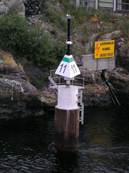
NO 11
[NO 4U] |
Asmalsund (Brattestø, Pigstens, Pikesten)
Located at the southwestern tip of Asmaløy, marking the entrance to the Asmalsund, the passage between Asmaløy and Spjærøy. (B 2258) [011500]
Photo courtesy Mariusz Korzeniewski [panoramio] |
|
NO 14
[NO 4V] |
Skjelsbusund |
Skjelholmen east beach (B 2260) [011600] |
NO 15
[NO 5] |
Papperhavn (Lyngholmen) |
Located at the western point of Vesterøy, about 2 km west of Hauge. (B 2266) [011900] |
NO 16
[NO 3L] |
Lubbegrunnen |
By Lubbegrunnen in the middle of the Løperen. (B 2233.8) [007300] ARLHS # NOR-371 |
NO 20
[NO 4L] |
Løperungen (front range) |
Øyas north side (B 2240) [007900] |
NO 20R
[NO 4G] |
Bratholmen (Løperungen rear range) |
Øyas west side (B 2240.1) [007800] |
NO 21
[NO 1T] |
Terneskjæra
latitude 59° 5' 11.1" N longitude 11° 5' 51.3" E |
Near Kirkøy on the North Side. (B 2216) [004700] |
NO 22
[NO 1S] |
Singløy (rear range)
latitude 59° 6' 25.7" N longitude 11° 7' 6.2" E |
On the island of Singløya in the Singlefjord. (B 2214.1) [003700] |
NO 23
[NO 1L] |
Lauskjær
latitude 59° 6' 32.1" N longitude 11° 6' 26.8" E |
On a little skerry west of the island of Singløya in the Singlefjord. (B 2214) [003800] |
NO 24
[NO 1H] |
Haslauflu
latitude 59° 6' 27.5" N longitude 11° 10' 10.7" E |
On the right side of Haslau. (B 2211) [003500] |
NO 25
[NO 1 ] |
Hykkelen (Haslauflu Range Rear)
latitude 59° 7' 30.6" N longitude 11° 10' 46.2" E |
Located on a skerry on the north side of the Singlefjorden about 4 km northwest of Sponvika. Accessible only by boat. (B 2211.1) [003600] |
NO 26
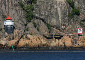
[NO 0G] |
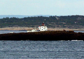
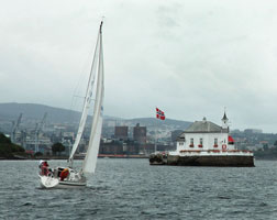
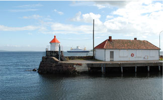
Sponvikskansen
Located at the base of a vertical cliff on the north side of the entrance to Sponvika from the Svinesund. Accessible only by boat. (B 2198) [001500]
Photo courtesy Ronald Wöhrn [ListOfLights] |
|
NO 27
[NO 0K] |
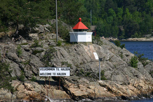
| Knivsøyholmen
latitude 59° 6' 40.1" N longitude 11° 19' 36.4" E
Located on the south side of the Svinesund about 5 km east of Sponvika and 4 km west of Halden. (B 2205) [002200]
Photo courtesy Ronald Wöhrn [ListOfLights] |
NO 28
[NO 0S] |
Skysskafferen
latitude 59° 5' 58.1" N longitude 11° 22' 29.6" E |
South of Halden. This light has 3 different colors on 6 different sectors. (B 2207) [002400] |
NO 29
[NO 0L] |
Flöberget |
East side of the Iddefjorden. (B 2209) [003100] |
NO 30
[NO 4M] |
Tjeldholmgrunnen |
Northwest of Tjeldholmen (B 2241) [008300] |
NO 31
[NO 4N] |
Vestre Fugleskjærgrunnen |
Located on a skerry off the southeastern tip of Asmaløy, marking the channel between that island and Kirkøy. Accessible only by boat. (B 2241.5) [008400] |
NO 32
[NO 4R] |
Ramsøy west side
latitude 59° 7' 7.7" N longitude 11° 44.7" E |
West of Ramsøy (B 2218) [008800] |
NO 34
[NO 4S] |
Flyndregrunnen |
West of Rognholmen (B 2245) [009600] |
NO 36
[NO 6] |
Tenneskjær |
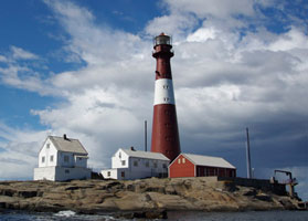
Located on a small skerry about 2.5 km northeast of Hauge. While accessible only by boat, there should be view from the highway 108 bridge between Trolldalen and Vesterøy. (B 2268) [012500] ARLHS # NOR-391 |
NO 37
[NO 8] |
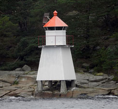
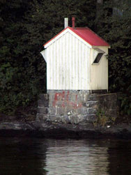
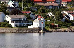
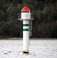
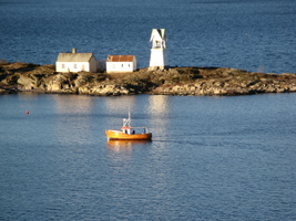
Struten (1907)
latitude 59° 7' 4.8" N longitude 10° 44' 26.4" E |
The lighthouse is located on a small island on the east side of the channel in Oslofjorden, about 8 km northwest of Torbjørnskjaer. German troops fortified the island during World War II, but the fortifications saw no fighting.
This is the house in the photo below [012500] |
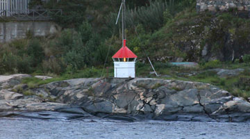
NO 38
[NO 9] |
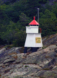
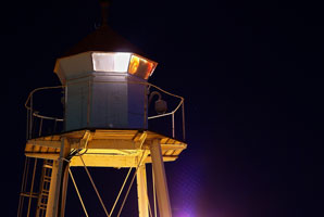
Struten (1985)
latitude 59° 7' 4.8" N longitude 10° 44' 26.4" E
Located between the original lighthouse and the sea. (B 2284) [013900]
Photo courtesy Ronald Wöhrn [ListofLights] |
|
NO 39
[NO 10] |
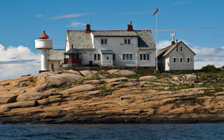
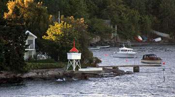
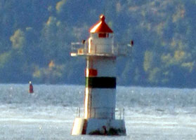
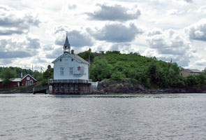
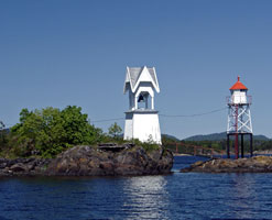
| Strømtangen (1859) (Torgauten)
latitude 59° 9' 4.2" N longitude 10° 49' 45.8" E
Available for overnight accommodations (reservations should be made at least a year in advance). Located on a small island off the end of a rocky peninsula about 2 km southwest of Øyenkilen. Don't confuse this pair with the light in the South. NO 178 [013900] ARLHS # NOR-323
Photo courtesy Asbjorn Floden [Flickr] |
NO 40
[NO 11] |
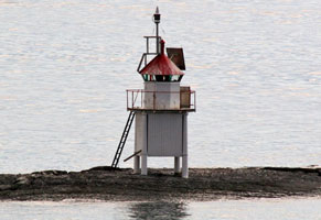
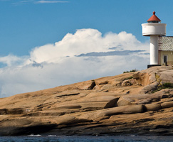
Strømtangen (1986) (Torgauten)
latitude 59° 9' 3.8" N longitude 10° 49' 45.7" E
Located between the original lighthouse and the sea. (B 2288) [014100] ARLHS # NOR-041
Photo courtesy Asbjorn Floden [Flickr] |
|
NO 41
[NO 11H] |
Gåsungene |
Western Entrance to Frederikstad (B 2396) [021100] |
NO 42
[NO 12S] |
Slevik
latitude 59° 10' 54" N longitude 10° 47' 51.3" E |
Steinshoms west side. (B 2318) [017100] |
|
|
NO 43
[NO 12] |
Garnholmen
latitude 59° 11' 27.7" N longitude 10° 45' 51.7" E |
Located on a small island at the southern entrance to the Hankesund from the Oslofjord, about 2 km southwest of Vikene. (B 2320) [017000] ARLHS # NOR-379 |
NO 44
[NO 12V] |
Veslekalv
latitude 59° 15' 13.9" N longitude 10° 42' 13.9" E |
Rauøy north side. (B 2326) [017300] |
NO 45
[NO 12X] |
Larkollen
latitude 59° 19' 23.2" N longitude 10° 40' 5.1" E
Located on the south side of the entrance to Larkollen. Accessible only by boat. (B 2330) [017500]
Photo courtesy Ole Reidar Johansen [Flickr] |
|
NO 46
[NO 13] |
| Revlingen
latitude 59° 23' 56.8" N longitude 10° 37' 54.6" E
Located on a small island in the Oslofjord about 2.5 km southwest of the Moss waterfront. (B 2334) [017600] ARLHS # NOR-389
Photo courtesy Mike Boucher [ListofLights] |
NO 47
[NO 13V] |
Verlebukta
latitude 59° 25' 41.1" N longitude 10° 39' 19.1" E
At the end of a pier in Moss. (B 2336) [017700]
Photo courtesy Mike Boucher [ListofLights] |
|
NO 48
[NO 14] |
| Guldholmen (1894) (Gullholmen)
latitude 59° 26' 6.7" N longitude 10° 34' 37.4" E
The house is available for overnight stays. The light marks a constriction in the Oslofjord near the town of Moss. Located on a small island on the east side of Oslofjordens about 5 km west of Moss. [017700] ARLHS # NOR-104
Photo courtesy Rainer Arndt [ListOfLights] |
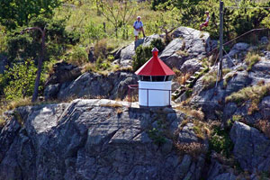
NO 49
[NO 15] |
Guldholmen (1984) (Gullholmen)
latitude 59° 26' 6.8" N longitude 10° 34' 36.3" E |
The small light in front of the old light in the photo above. (B 2346) [018100] ARLHS # NOR-310 |
NO 50
[NO 16] |
Kippenes
latitude 59° 29' 11.5" N longitude 10° 40' 31.4" E |
Located on the east side of Jeløy, marking a narrow passage in the Mossesund, about 3 km north of Moss. (B 2350) [018500] ARLHS # NOR-381 |
NO 52
[NO 16F] |
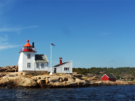
Filtvet (1840)
latitude 59° 34' 15.6" N longitude 10° 37' 4.8" E
Located on the west side of Oslofjorden near Tofte, about 12 km southeast of Hurum. There is a new light (1985) in front of an older light. (B 2354) [018700] ARLHS # NOR-079
Photo courtesy Mike Boucher [ListOfLights] |
|
Eastern Akershus County
NO 53
[NO 16T] |
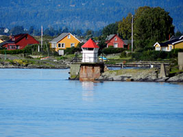
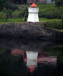
| Elle
latitude 59° 38' 25.8" N longitude 10° 38' 13.2" E
South of Drøbak (B 2358) [018700]
Photo courtesy Rainer Arndt [ListofLights] |
NO 54
[NO 17] |
Drøbak Mole
latitude 59° 39' 45.7" N longitude 10° 37' 30.2" E
Located at the end of the short mole on the north side of the harbor at Frogn. (B 2425) [019100]
Photo courtesy Alex Trabas [ListOfLights] |
|
NO 55
[NO 17K] |
| Kaholmen
latitude 59° 40' 43" N longitude 10° 36' 31.5" E
Located at the east end of Kaholmen, an island in the Oslofjord about 1 km northwest of Frogn. Accessible only by boat. (B 2364) [019500]
Photo courtesy Rainer Arndt [ListOfLights] |
NO 56
[NO 17M] |
Tronstadodden
latitude 59° 41' 31.1" N longitude 10° 35' 26.8" E
Located just off the east coast of Håøy, an island in the Oslofjord about 2 km northwest of Frogn. Accessible only by boat. (B 2378) [019660]
Photo courtesy Ronald Wöhrn [ListOfLights] |
|
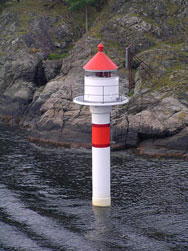
NO 57
[NO 17S] |
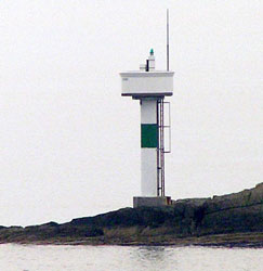
| Storegrunnen
latitude 59° 42' 33.3" N longitude 10° 35' 20.8" E
Located on a shoal in the Oslofjord about 4 km northwest of Frogn. Accessible only by boat. Anke and Jens photo (B 2376) [019900]
Photo courtesy Rainer Arndt [ListofLights] |
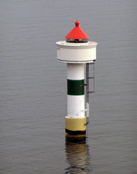
NO 58
[NO 18] |
Digerudgrunnen (Digerud)
latitude 59° 43' 10.3" N longitude 10° 35' 9.7" E
Located on the east side of Oslofjorden near the end of the Digerudgbakken road, about 1.5 km southwest of Fagerstrand. (B 2378) [020000] ARLHS # NOR-067
Photo courtesy Ronald Wöhrn [ListOfLights] |
|
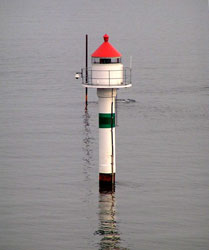
NO 61
[NO 19] |
| Steilene
latitude 59° 48' 59.7" N longitude 10° 35' 41" E
The house is now available for overnight stays (for guests in good condition as transportation to the island is by rowboat). Located on the southwest end of a small island on the east side of Oslofjorden about 2 km northwest of Fjellstrand. overnight [020900] ARLHS # NOR-229
Photo courtesy Asbjorn Afloden [Flickr] |
NO 62
[NO 20] |
Steilene Northeast (Fyrsteilene)
latitude 59° 49' 3.5" N longitude 10° 35' 51.7" E |
Located at the northeast point of the island, only a short distance from the Steilene lighthouse. (B 2394) [021000] ARLHS # NOR-320 |
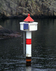
NO 64
[NO 28G] |
| Gåsøy
latitude 59° 51' 4.8" N longitude 10° 35' 19.3" E
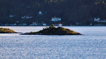
Gåsøy is an inhabited island in the northern Oslofjord, accessible by a series of ferries and bridges. Located just off the south coast of Gåsøy. (B 2398) [021200]
Photo courtesy Rainer Arndt [ListOfLights] |
NO 65
[NO 21] |
Nesodden (Nesoddtangen)
latitude 59° 52' 15.9" N longitude 10° 39' 21.9" E
Located on a point of land in Nesodden, on the south side of the entrance to Oslo harbor. (B 2404.3) [021800]
Photo courtesy elysea [webshots] |
|
NO 66
[NO 22] |
| Nordre Langøy
latitude 59° 52' 28.5" N longitude 10° 43' 12.3" E
Located at the northeastern tip of the island of Langøy in the inner Oslofjorden. The island is accessible by ferry. (B 2406) [022500] ARLHS # NOR-301
Photo courtesy Alex Trabas [ListOfLights] |
Oslo County
NO 69
[NO 23] |
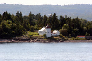
Heggholmen (Gressholmen)
latitude 59° 53' 6.9" N longitude 10° 42' 49.9" E
Located on a short jetty on the north point of an island in the "inner" Oslofjorden, marking a secondary channel approaching the city. There is a village on the island, and ferry transportation from the city is available. (B 2412) [023100] ARLHS # NOR-112
Photo courtesy Graniers [Flickr] |
|
NO 71
[NO 25] |
Bleikøy
latitude 59° 53' 28.5" N longitude 10° 44' 35.2" E
Bleikøya is a forested island only a few hundred meters off the waterfront of downtown Oslo. The island is accessible by ferry. Located at the northeastern point of the island. (B 2416) [023400] ARLHS # NOR-376
Photo courtesy Mike Boucher [ListOfLights] |
|
NO 72
[NO 26] |
| Dyna (Oslofjord)
latitude 59° 53' 41.5" N longitude 10° 41' 18.1" E
Surrounded by a stone seawall, this remarkable little lighthouse looks like a ship sailing down the Oslofjord. Located on a rock about 200 m off the coast of Bygdøy about 3 km west of downtown Oslo. Accessible only by boat. Private dining is available dining (B 2422) [024200] ARLHS # NOR-308
Photo courtesy M M Mnemonic [Flickr] |
NO 73
[NO 27] |
Koppernaglen
latitude 59° 53' 34.4" N longitude 10° 41' 22.4" E
This light is directly across the channel from the Dyna lighthouse. Accessible only by boat. (B 2424) [024300] ARLHS # NOR-382
Photo courtesy Rainer Arndt [ListOfLights] |
|
NO 74
[NO 28] |
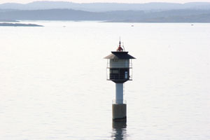
| Kavringen
latitude 59° 53' 59.2" N longitude 10° 43' 19.5" E
October 19, 2010
Located in the inner harbor of Oslo, between Hovedøya and the Filipstad container terminal.
B 2428.2 is in the foreground (B 2428) [024800] ARLHS # NOR-069 |
Buskerud/Vestfold County
Map is SE
NO 78
[NO 31T] |
Risgarden Mole
latitude 59° 43' 57.4" N longitude 10° 14' 16.8" E |
At mole end. (B 2472) [028700] |
NO 79
[NO 31S] |
Steinsbråtan
latitude 59° 41' 0.1" N longitude 10° 21' 46.2" E |
Dramsfjordens west side (B 2464) [028500] |
NO 80
[NO 31R] |
Blindeskjær
latitude 59° 37' 24.4" N longitude 10° 24' 46.7" E
Located on a tiny skerry just off a public park in southeast Oslo. Accessible only by boat. (B 2460) [027900] ARLHS # NOR-377
Photo courtesy Inge Petersen [Flickr] |
|
NO 81
[NO 31Q] |
Svelvik
latitude 59° 36' 44.7" N longitude 10° 24' 33.5" E |
Drammensfjorden [027600] |
NO 82
[NO 31N] |
Tømmerås Nedre (front range)
latitude 59° 36' 28.8" N longitude 10° 24' 38.1" E |
Located at the northern tip of Batteriøya, a small island at the south end of Svelvik harbor (B 2456) [027200] |
NO 83
[NO 31P] |
Batteriøy
latitude 59° 36' 28.9" N longitude 10° 24' 37.8" E
This lighthouse stands at Batteriøya in Svelvik, and is part of the navigational aids that help ships pass through Norway's second most powerful maelestrom. [027300]
Photo courtesy Inge Pettersen [Flickr] |
|
NO 84
[NO 31K] |
| Svelvikrenna Nordre
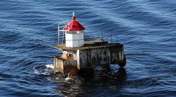
Svelvikstrømmen. This light is actually the NE light. There is also a NW light (B2450.6 which is a twin with red stripes instead of the green.) (B 2450.65) [027100]
Photo courtesy Mike Boucher [ListOfLights] |
NO 85
[NO 31E] |
Svelvikrenna Søndre
latitude 59° 35' 50.8" N longitude 10° 25' 15.3" E |
Southwest side at west fartsløp photo (B 2449.95) [027000] |
NO 86
[NO 31C] |
Bjørneskjær (front range)
latitude 59° 35' 3.1" N longitude 10° 26' 1.1" E |
Drammensfjordens east side (B 2449) [026900] |
|
|
NO 87
[NO 31B] |
Kroksberget
latitude 59° 33' 47.6" N longitude 10° 24' 30.9" E |
Drammensfjordens west side (B 2446) [026300] |
NO 88
[NO 31] |
Rødtangen
latitude 59° 31' 46.1" N longitude 10° 24' 55" E
Located on a point of land at the junction of the Oslofjord and Dramsfjord, about 3 km south of Holmsbu. (B 2440) [026200] ARLHS # NOR-195
Photo courtesy Tore Flaterud [panoramio] |
|
NO 89
[NO 30o] |
Østnestangen |
Located at the tip of a sharp promontory about 3 km southwest of Tofte. Probably accessible by a hiking trail. (B 2436) [025900] |
NO 90
[NO 30H] |
Ramvikholmen
latitude 59° 31' 13" N longitude 10° 32' 6.3" E
Located on the north point of a small island about 2.5 km southwest of Tofte. (B 2434) [025800] ARLHS # NOR-388
Photo courtesy Mike Boucher [ListOfLights] |
|
NO 91
[NO 32] |
Mulodden
latitude 59° 28' 52" N longitude 10° 20' 58.2" E |
Mulodden is a public park on a peninsula at the southern entrance to the Sandebukta from the Oslofjord just east of Holmestrand. Located at the tip of the peninsula. (B 2474) [030400] ARLHS # NOR-386 |
NO 92
[NO 32F] |
Fyllingen (Horten)
On a point north of Horten. It is the North end Canal Mole. (B 2478) [030700]
Photo courtesy B. Rehoff Larsen [panoramio] |
|
NO 93
[NO 33] |
| Bastøy
The house appears to be in use as a private residence. Located on an island on the west side of Oslofjordens about 4 km southeast of Horten. Accessible only by boat. (B 2480) [031200] ARLHS # NOR-307
Photo courtesy Alex Trabas [ListOfLights] |
NO 95
[NO 35] |
Mefjordbåen
Located in the lower Oslofjorden about 3 km off the west coast, northeast of Tønsberg. Accessible only by boat. (B 2482.5) [31600] ARLHS # NOR-302
Photo courtesy Alex Trabas [ListOfLights] |
|
Tønsberg Area
NO 96
[NO 36] |
| Torgersøy
Located on a small island on the west side of Oslofjorden off Tønsberg. Accessible only by boat. (B 2486) [032000] ARLHS # NOR-250
Photo courtesy M. Prinke [Flickr] |
NO 99
[NO 36K] |
Kalvetangen |
Føynlandets north point (B 2492) [032600] |
NO 100
[NO 37] |
Kalnes (Range Rear)
latitude 59° 15' 49.1" N longitude 10° 24' 18.7" E
This range guides vessels westbound into Tønsberg; the front light is on the Nøtterøy bridge. Located on the south side of the Tønsbergfjord, which is quite narrow at this point, about 800 m west of the Nøtterøy bridge. (B 2554.1) [039500]
Photo courtesy Are Karlsen [Flickr] |
|
NO 102
[NO 38] |
Nordbyen (Range Front)
latitude 59° 16' 13.4" N longitude 10° 24' 0.3" E |
This range guides vessels eastward through the north end of the Tønsbergfjord to Tønsberg. Located on the waterfront on the western side of Tønsberg, off the street called Nordbyen. A short mole leads to within a few feet of the lighthouse. (B 2562) [039600] |
NO 102R
[NO 39] |
Slottsfjellet (Nordbyen Range Rear) |
Located near the end of a street called Storgaten in the Slotsfjell neighborhhood on the western side of Tønsberg. (B 2564) [039800] |
NO 109
[NO 40] |
Fulehuk
latitude 59° 10' 32.3" N longitude 10° 35' 57.4" E
Located on a small island in the Oslofjord about 15 km southeast of Tønsberg. Accessible only by boat. (B 2496) [033600] ARLHS # NOR-015
Photo courtesy Jørgen R. Bjerkøe [Bjerkøe Genealogy] |
|
NO 111
[NO 45L] |
Vassholmen |
Located on a skerry in the Oslofjord about 2 km east of Arøysund. (B 2520) [036000] |
NO 113
[NO 42P] |
Tuten
latitude 59° 10' 25.4" N longitude 10° 23' 47.5" E |
Vrengens north side (B 2504) [034500] |
NO 114
[NO 42] |
Leistein |
Located on a skerry in the Oslofjord about 4 km southeast of Arøysund. (B 2500) [034100] ARLHS # NOR-383 |
NO 116
[NO 45S] |
Saltbu
latitude 59° 9' 23" N longitude 10° 22' 30" E |
Tjømekjæla east side (B 2534) [037500] |
NO 118
[NO 45o] |
Barkevik Øvre |
Near Barkevik landing. (B 2528.1) [036800] |
NO 119
[NO 45P] |
Barkevik Nedre
latitude 59° 6' 8.6" N longitude 10° 22' 44.6" E |
West side of Barkevic (B 2528) [036900] |
NO 120
[NO 46] |
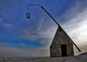
Verdens Ende (replica)
This tower is a replica of a vippefyr, a small stone fire beacon of a type common on the Norwegian coast before the advent of regular lighthouses. "Verdens Ende" means "End of the World" in Norwegian. Located on the southernmost tip of Tjøme, an island on the west side of the entrance to Oslofjorden, with a superb view of the Skagerrak and the Lille Faerder lighthouse. [038300]
Photo courtesy propagandalf [Flickr] |
|
NO 122
[NO 45B] |
Kongsholmen |
Northeast of Froungen at the holmens east side. (B 2518) [035600] |
NO 124
[NO 43] |
Store Færder |
The original fire tower was replaced in 1802 by a coal-fired stone tower. Today only the stone foundation ruins of the 1802 station remain. Located at the northern end of Store Færder, an island in the southwestern entrance to Oslofjorden about 8 km east of Tjøme. (B 2509.5) [035100] ARLHS # NOR-305 |
NO 125
[NO 44] |
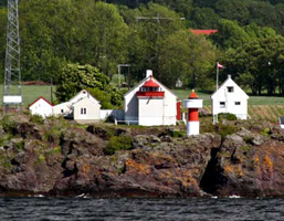
Lille Færder (Tristein)
This magnificent lighthouse is the landfall light for Oslo. With all its buildings intact and well preserved, Færder is one of the most historically authentic stations in northern Europe. The iron for the light tower was cast in Norway by Bærums Verk. Located on a small island off the southwestern entrance to Oslofjorden, 5 km south of the Store Færder station it replaced. (B 2506) [000100] ARLHS # NOR-254
Photo courtesy Geir Rosset [Flickr] |
|
NO 126
[NO 45K] |
Krukepynten |
West side of the Sandøysundet (B 2514) [035500] |
NO 126R
[NO 45] |
Sandvikberget (Krukepynten Range Rear) |
Located on the northeast side of Hvasser, a large island on the west side of the entrance to the Oslofjord; apparently accessible by a short walk. (B 2516) [035600] ARLHS # NOR-390 |
NO 127
[NO 46B] |
Truberodden
Navigational light on the island of Trubberodden just off the beach Trubberstranda, on the tip of Østerøya in Sandefjord. Park in the car park 10 km from Sandefjord, than about a 10 minute walk to this light. [040500]
Photo courtesy Geir Rosset [Flickr] |
|
NO 128
[NO 46E] |
Tønsberg Tønne |
Navigational light on the tip of Østerøya on the western side of the entrance to the Tønsberg fjord. Access by foot path from Trubberstranda, a beach on the tip of Østerøya in Sandefjord.
A beacon just behind the light can be seen just barely at the top of the hill on the left above. flickr (B 2566) [040600] ARLHS # NOR-258 |
NO 131
[NO 47] |
Svenner
Located on a small island about 3 km offshore and 7 km southeast of Stavern. *
Boat transportation is available from Stavern. (B 2578) [041700] ARLHS # NOR-044
Photo courtesy Astrid Westvang [Flickr] |
|
NO 133
[NO 49L] |
Larvik Havn |
On the quay at the southwest point. (B 2588) [042800] |
NO 135
[NO 49] |
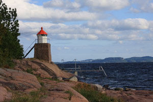
Stavernsodden (1874)
Located at the southernmost point of Stavernsøy, the island protecting the harbor of Stavern, on the west side of the entrance to Larviksfjorden. (B 2582) [042000] ARLHS # NOR-225
Photo courtesy Geir Røsset [Flickr] |
|
NO 136
[NO 49B] |
| Vadholmen
Located on a sharp promontory marking the mainland side of the south entrance to Stavern harbor. Accessible by stairs and a short bridge. (B 2584) [042300]
Photo courtesy Tor Kristensen [istavern] |
NO 137
[NO 50] |
Tvistein (Skagerrak Sea)
Located on a small island in the Skagerrak about 5 km southeast of Nevlunghavn. Accessible only by boat, but tours seem to be available. (B 2592) [043500] ARLHS # NOR-294
Photo courtesy Arnstein Rønning [wikipedia] |
|
Langesund Area
NO 139
[NO 51] |
Åmlirogna |
Located on a small island in the entrance to the Langangsfjord about 2 km northwest of Nevlunghavn. The island is accessible by bridge. (B 2595) [045100] |
Telmark County
NO 147
[NO 52] |
Langøytangen
East side of Langesundsfjord (B 2598) [044900] ARLHS # NOR-152
Photo courtesy Ronald Wöhrn [ListOfLights] |
|
NO 149
[NO 53B] |
Langsund Øvre |
At brygge west of Halen (on the Quay) (B 2620.1) [046300] |
NO 150
[NO 53] |
Figgeskjæret
The station is preserved as a historic monument. Located on a point of land on the west side of the Langangsfjorden about 1 km north of Langesund. (B 2616) [046000] ARLHS # NOR-078
Photo courtesy Ronald Wöhrn [ListOfLights] |
|
NO 152
[NO 51B] |
Brattholmen Vestre (west) |
Southern beach at holmen (B 2595.8) [045500] |
NO 155
[NO 53H] |
Strømtangen
latitude 59° 3' 0.9" N longitude 9° 41' 30.2" E
In Langesundsbukta on Brevikfjorden (B 2636.05) ARLHS # NOR-291
Photo courtesy Captain Theo [ListofLights] |
|
| NO 156 |
| Gjermesholmen
Gjermesholmen (or Croftholmen) is an island on the south side of the Brevikfjord at Stathelle. Located on the northern point of the island, which is accessible by a short bridge from the mainland. (B 2632) [046400]
Photo courtesy Trond [stathelle] |
|
|
 Southwest Norway