|
This page shows a portion of Lighthouses of Spain. Some of the photos are on Flickr or other places, you can click on the light to go to it's specific (larger resolution) copy. Each lighthouse is linked to (in our editorial opinion) the best reference site for that light. |
|
Balearic Islands
Formentera
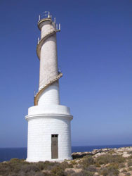
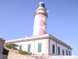
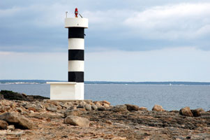
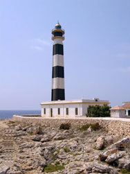
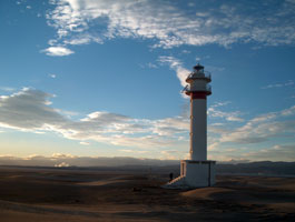
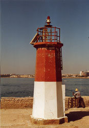
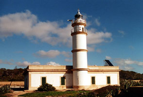
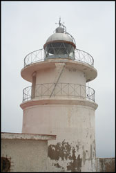
| SP 158 |
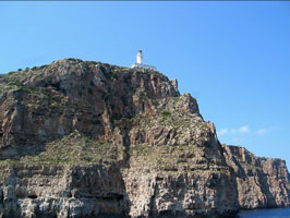
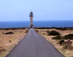
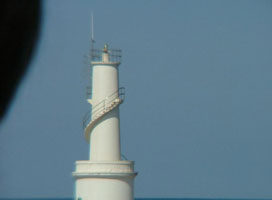
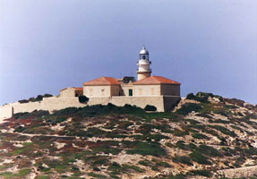
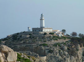
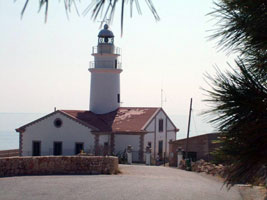
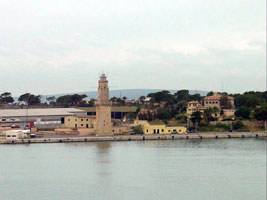
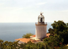
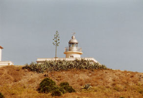
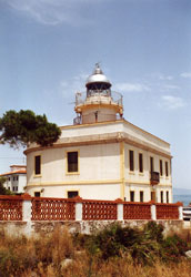
Formentera (Sa Mola, La Mola)
latitude 38° 39' 48.7" N longitude 1° 35' 1.7" E
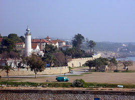
This lighthouse stands at the eastern tip of the island and is an important guide for ships passing to the south of the islands; it has a listed range of 23 nautical miles. 'Sa Mola' is a roughly circular plateau that forms the eastern portion of Formentera and is connected to the main part of the island by a sandy isthmus. Located about 15 km east of the town of Formentera, accessible by road. (E 0250) ARLHS # BAL-047
Photo courtesy Nuska [Flickr] |
|
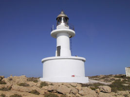
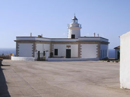
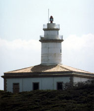
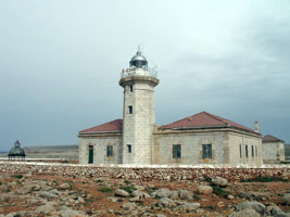
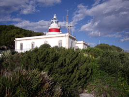
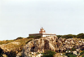
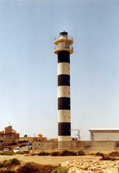
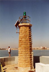
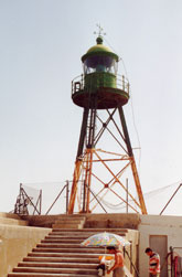
| SP 159 |
| Cap Barbaria (Cabo Berberia)
latitude 38° 38' 28.3" N longitude 1° 23' 22.2" E
Located at the southwestern tip of the island, about 10 km southwest of the town of Formentera; accessible by road. (E 0251) ARLHS # BAL-013
Photo courtesy mpico63 [webshots] |
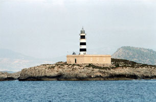
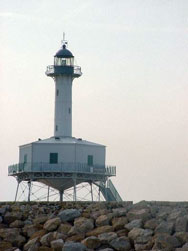
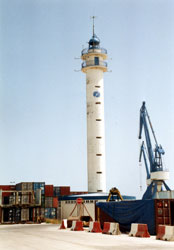
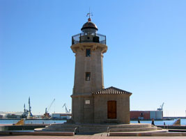
| SP 160 |
La Savina (Cala Sabina)
latitude 38° 44' 7.7" N longitude 1° 24' 57.1" E
Entrance to harbor at La Savina, north side of island of Formentera. (E 0252)
Photo courtesy getxo [Webshots] |
|
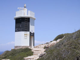
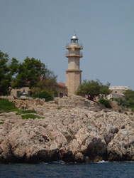
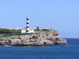
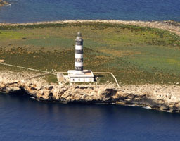
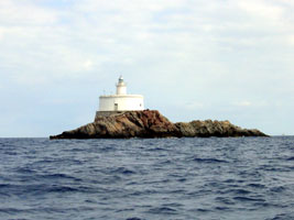
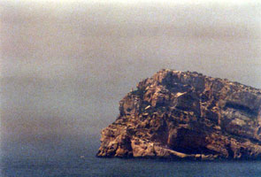
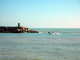
| SP 161 |
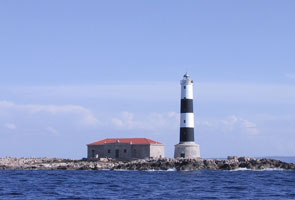
| Islote d'en Pou (Isla de los Puercos)
latitude 38° 47' 56.4" N longitude 1° 25' 19.6" E
Located on an islet off the northernmost point of Formentera. Accessible only by boat; there are excellent views from ferries between the two islands. (E 0254)
Photo courtesy Roberto Miotto [panoramio] |
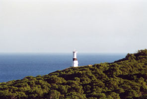
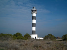
| SP 162 |
Isla Espardell
latitude 38° 48' 15.2" N longitude 1° 28' 43.7" E
Located on an islet about 5 km northeast of the northernmost point of Formentera. Accessible only by boat, and the island is a protected nature reserve. (E 0256)
Photo courtesy Roberto Miotto [panoramio] |
|
Ibiza
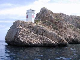
| SP 163 |
| Islote de's Penjats (Islote Ahorcados, Los Freus, Freu Grande)
latitude 38° 48' 52.3" N longitude 1° 24' 43.9" E
This lighthouse and the Far d'en Pou guide ships on the difficult passage between Formentera and Ibiza; the two island are joined by a barely-submerged ridge that emerges in several islets. Located on an islet about 1.8 km south of the southernmost point of Ibiza. SP 161 (E 0260)
Photo courtesy Alex Trabas [ListOfLights] |
| SP 163B |
Bleda Plana
latitude 38° 58' 48.1" N longitude 1° 9' 33.7" E
Located on a small island off the westernmost point of Ibiza, about 5 km west southwest of the Cunillera lighthouse. (E 0276) ARLHS # BAL-007
Photo courtesy Roberto Miotto [panoramio] |
|
| SP 164 |
| Isla Cunillera (Isla Conejera)
The Isla Conejara (Rabbit Island) lies off the westernmost point of Ibiza, so this lighthouse acts as the landfall light for ships arriving from mainland Spain. Located atop a high cliff near the northern point of the island. (E 0274) ARLHS # BAL-030
Photo courtesy Roberto Miotto [panoramio] |
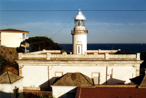
| SP 165 |
Covas Blancas (Sant Antoni de Portmany)
latitude 38° 58' 45.7" N longitude 1° 17' 53.9" E
Located on Carrer des Far in Sant Antoni de Portmany, on the west coast of Ibiza. Nearest Town or City: Sant Antoni de Portmany, Spain ARLHS # BAL-096
Photo courtesy Rafael Garcia [panoramio] |
|
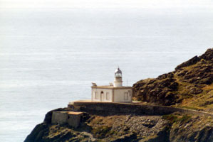
| SP 166 |
| Punta Moscarter (Moscarté)
latitude 39° 7' 3.5" N longitude 1° 31' 59.2" E
Northernmost point of Ibiza. The lighthouse is within about 1200 m of Cala de Portinatx, but there does not appear to be any public land access. (E 0270) ARLHS # BAL-068
Photo courtesy Captain Theo [ListOfLights] |
| SP 168 |
| Botafoc (Islote Botafoch)
latitude 38° 54' 14.9" N longitude 1° 27' 14.2" E
Located just right of the beach as you head to Talamanca. Once you have gone past the hotel area, you will arrive at the Calle de Botafoc, which will take you straight to the lighthouse. (E 0264)
Photo courtesy getxo [Webshots] |
| SP 169 |
Ibiza Dique de Abrigo
latitude 38° 54' 39" N longitude 1° 26' 34.1" E
End of breakwater in harbor at Eivissa (Ibiza) (E 0265) ARLHS # BAL-058
Photo courtesy Pedro Ramón Calafat [Flickr] |
|
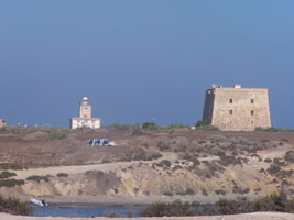
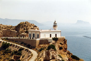
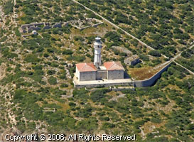
Cabrera
| SP 170 |
| N'Ensiola (Punta Anciola)
Located at the southern tip of the Illa de Cabrera. The park service offers guided tours of the area including a visit to the station. another photo
Photo courtesy Roberto Miotto [panoramio] |
| SP 171 |
Cap Llebeig (Cabo Lebeche)
Located on a steep promontory at the northwest corner of the Illa de Cabrera, marking the entrance to the island's natural harbor. (Don't confuse with the Cap Lleibig below.) SP 183
Photo courtesy Roberto Miotto [panoramio] |
|
| SP 171C |
| Sa Creueta
Just across the channel from Cap Llebeig is this matching light.
Photo courtesy Roberto Miotto [panoramio] |
| SP 172 |
Na Foradada (Isla de Horadada)
latitude 39° 12' 25.6" N longitude 2° 58' 41.7" E
Located on the northernmost islet of the Cabrera Archipelago, about 10 km southwest of the southern tip of Majorca. a distant photo (E 0340) |
|
Majorca South Coast
| SP 174 |
S'Estanyol (El Estañol, Punta Plana)
latitude 39° 21' 9.9" N longitude 2° 54' 47.3" E
This modern lighthouse marks the entrance to the harbor of S'Estanyol, a resort town on the south coast of Majorca. Located on a promontory about 1.5 km southwest of the S'Estanyol waterfront. (E 0315)
Photo courtesy Alex Trabas [ListOfLights] |
|
| SP 175 |
| Cap Blanc
latitude 39° 21' 49" N longitude 2° 47' 15.1" E
Located atop a steep promontory off the coastal road about 15 km south of S'Arenal. ARLHS # BAL-014
Photo courtesy marc vm1 [Webshots] |
| SP 178 |
Porto Pi (Palma de Majorca)
latitude 39° 32' 54.9" N longitude 2° 37' 24.6" E
The lighthouse sits today on a busy, industrial waterfront on the east side of the harbor of Palma de Majorca. Located off the Passaig Maritim about 3 km southwest of the downtown waterfront of Palma de Majorca. (E 0318.8) ARLHS # BAL-056
Photo courtesy Arno Siering [ListOfLights] |
|
| SP 179 |
| Palma Dique Ouest
latitude 39° 33' 8.6" N longitude 2° 38' 19.9" E
End of west breakwater in harbor at Palma de Majorca (E 0318) ARLHS # BAL-098
Photo courtesy Arno Siering [ListOfLights] |
| SP 179A |
Palma Digue Ouest Elbow
www.trabas.de/enindex.html (E 0318.3)
Photo courtesy Alex Trabas [ListOfLights] |
|
| SP 180 |
| Cala Figuera
latitude 39° 27' 26.7" N longitude 2° 31' 20" E
West side of entrance to Badia de Palma (E 0312.6) ARLHS # BAL-018
Photo courtesy Guillermo Ribot [Flickr] |
| SP 181 |
Cap de sa Mola (Cabo de la Mola)
latitude 39° 31' 56.7" N longitude 2° 21' 50.7" E
SW tip of Majorca
Photo courtesy Miguel Peces [Flickr] |
|
| SP 182 |
| Port d'Andratx
latitude 39° 32' 34.4" N longitude 2° 22' 44" E
On west mole at Port d'Andratx
Photo courtesy Juan Francisco Lladó Sabater [Flickr] |
Dragonera
| SP 183 |
Cap Llebeig (Cabo Llebeitx)
latitude 39° 34' 26.9" N longitude 2° 18' 14.8" E
SW end of Illa sa Dragonera (Don't confuse with the Cap Llebeig above.) SP 171 (E 0282) ARLHS # BAL-008
Photo courtesy Hans-Albert Liebetrau [ListOfLights] |
|
| SP 184 |
Dragonera
latitude 39° 35' 10.7" N longitude 2° 19' 1.6" E |
Abandoned for a century, it is probably in poor condition. Located on the summit of Pico Single de Ginavera, the highest point of the island. Apparently accessible by hiking trails. ARLHS # BAL-097 |
| SP 185 |
Cap de Tramuntana (Cabo Tramontana)
latitude 39° 35' 53.1" N longitude 2° 20' 16.5" E
NE end of Illa sa Dragonera. (E 0284)
Photo courtesy Doug Keagle [webshots] |
|
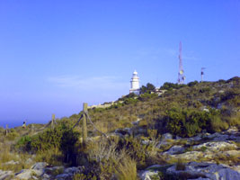
Majorca North Coast
| SP 186 |
| Cap Gros
latitude 39° 47' 49.7" N longitude 2° 40' 53.2" E
Located on a promontory on the west side of the harbor entrance at Port de Sóller on the central northwestern coast of Majorca. Accessible by road. (E 0289)
Photo courtesy Klaus Kern [ListOfLights] |
|
|
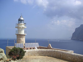
| SP 187 |
Sa Creu (1864)
latitude 39° 47' 48.1" N longitude 2° 41' 21.3" E
Both lights (this and the one below) are shown in this photo. ARLHS # BAL-101 |
|
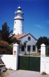
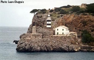
| SP 188 |
Sa Creu (1945)
latitude 39° 47' 49.3" N longitude 2° 41' 21.9" E |
Located on a promontory on the east side of the harbor entrance at Port de Sóller. If not accessible by road, this station should be accessible by a short hike from town. (E 0288) ARLHS # BAL-064
Photo courtesy Laure Chappuis [phares] |
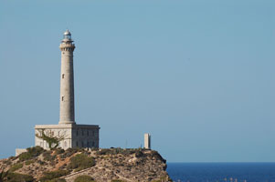
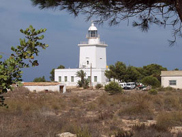
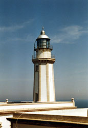
| SP 189 |
Cap Formentor
latitude 39° 57' 40" N longitude 3° 12' 41.9" E
This lighthouse marks the northernmost tip of Majorca and the entrance to the Badia de Pollença; it is accessible at the end of a very crooked road about 25 km northeast of Port de Pollença. Driving to the lighthouse seems to be a popular challenge. (E 0296)
Photo courtesy Cindy1508 [webshots] |
|
| SP 190 |
| L'Avençada (Punta de la Avanzada)
latitude 39° 53' 59.2" N longitude 3° 6' 37.7" E
Located on a promontory on the north side of the Badia de Pollença, about 5 km east of Port de Pollença. There doesn't seem to be any road access to this station.
Photo courtesy "guruAnt" [Flickr] |
| SP 190S |
Punta Sabate
latitude 39° 53' 33.7" N longitude 3° 11' 38.8" E
Located at the northern tip of a rugged peninsula on the east side of the Badia de Pollença. Accessible by an unpaved road (E 0303.7)
Photo courtesy Alexander Trabas [ListOfLights] |
|
| SP 191 |
| Illa Aucunada
latitude 39° 50' 7.6" N longitude 3° 10' 15.6" E
Located on an island just off the north shore of the Badia d'Alcúdia about 5 km east of Port d'Alcúdia. (E 0304) ARLHS # BAL-006
Photo courtesy Klaus Kern [ListOfLights] |
Majorca East Coast
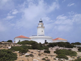
| SP 192 |
Capdepera (Cabo de Pera)
latitude 39° 42' 56.3" N longitude 3° 28' 38.4" E
This very handsome lighthouse has a beautiful location on the northeastern tip of Majorca, a short distance from Cala Ratjada; in fine weather it is probably possible to see Cap d'Artrutx, Menorca, to the northeast.
Photo courtesy cindy1508 [webshots] |
|
| SP 193 |
| Porto Colom (Punta de Ses Crestes, Punta de sa Farola)
latitude 39° 24' 56.9" N longitude 3° 16' 15.9" E
East coast of Majorca. (E 0310) ARLHS # BAL-055
Photo courtesy luckystewart [Webshots] |
| SP 194 |
Porto Petro
Located on the south side of the harbor entrance at Porto Petro; accessible by road. (E 0311.8) ARLHS # BAL-073
Photo courtesy Alex Trabas [ListOfLights] |
|
| SP 195 |
| Torre d'en Bou (Cala Figuera de Santanyí)
North side of entrance to harbor at Cala Figuera de Santanyí, east coast of Majorca. There is road access to a point close to the lighthouse. (E 0312.6) ARLHS # BAL-073
Photo courtesy Arno Siering [ListOfLights] |
Menorca
| SP 196 |
Cap d'Artrutx
latitude 39° 55' 21.5" N longitude 3° 49' 26.3" E
Cap d'Artrutx is the southwesternmost point of Menorca, and unlike most points of land in the Balearics it is quite low. Located at the end of Plaça Far in the town of Cap d'Artrutx. (E 0342) ARLHS # BAL-015
Photo courtesy Ian Dempster [Webshots] |
|
| SP 197 |
Ciutadela (Punta de Sa Farola)
latitude 39° 59' 46.9" N longitude 3° 49' 21.2" E |
Located on on the Cami Farola, on the west side of the harbor entrance in Ciutadela de Menorca, on the west end of the island. photo ARLHS # BAL-078 |
| SP 198 |
Punta Nati (Cabo Nati)
This lighthouse, on the relatively wild northeast coast of Menorca, is not often visited. Located at the end of secondary road CF-5 about 6 km north of Ciutadela de Menorca. ARLHS # BAL-026
Photo courtesy tredelijkheid [webshots] |
|
| SP 199 |
| Cap de Cavalleria (Cabo Caballeria)
latitude 40° 5' 20.4" N longitude 4° 5' 31.6" E
The Cap de Cavalleria is a narrow, rocky spine that projects from the north coast of Menorca, forming a very dangerous obstacle for ships. Located at the end of secondary road CF-3 about 6 km northwest of Platges de Fornells by sea, but more like 25 km by road. (E 0350)
Photo courtesy Antoniao Louro [webshots] |
| SP 200 |
Cap Favaritx
latitude 39° 59' 49.7" N longitude 4° 16' 1.1" E
Cap Favoritx is a sharp promontory projecting from the northeastern coast of Menorca. Located at the end of secondary road CF-1 about 12 km off the main road ME-7.
Photo courtesy fatbarman [Webshots] |
|
| SP 201 |
| Punta de San Carlos (Port de Maó, Puerto de Mahon)
Port de Maó is the principal town and harbor of Menorca; its English name Mahon is a reminder that Britain occupied Menorca for most of the 18th century after capturing it in 1708. Located on a promontory on the south side of the harbor entrance. ARLHS # BAL-066
Photo courtesy sparijs [Webshots] |
| SP 202 |
Illa de S'Aire (Isla del Aire)
latitude 39° 47' 58.1" N longitude 4° 17' 34.3" E
The Illa de S'Aire is a low, rather flat island, about 1.2 km long, located off the southeastern tip of Menorca. Located near the eastern tip of the island. ARLHS # BAL-002
Photo courtesy marinas.com [marinas.com] |
|
Northeast Spain
Tarragona
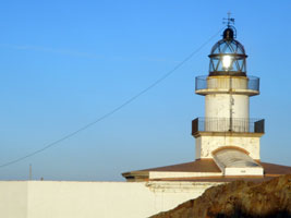
| SP 247 |
| La Banya (Punta de la Baña)
latitude 40° 33' 37.5" N longitude 39' 41.5" E
Punta de la Baña is on a broad sandy spit that has evolved from the south side of the Río Ebro delta. The area is now included in a national park; it is usually accessible by 4WD vehicles and parking is provided. Boat transportation is also available from Sant Carles de la Ràpita. The original lighthouse has been relocated to Tarragona. SP 252
Located about from the base of the spit, east of Sant Carles de la Ràpita.
Photo courtesy MASTerry [photo] |
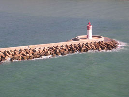
| SP 248 |
Cap Tortosa |
Offshore about 3 miles east of Cap Tortosa, Catalonia. This light replaced the Buda Lighthouse near the mouth of the Ebro River, which was destroyed in a storm in 1961. (E 0377) |
| SP 248E |
Río Ebro
Located on the north side of the entrance to the Río Ebro in Ríumar. (E 0376)
Photo courtesy Alex Trabas [ListOfLights] |
|
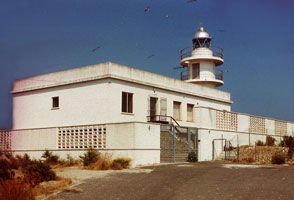
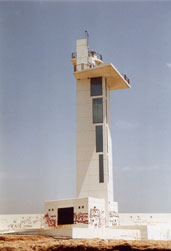
| SP 249 |
| El Fangar
latitude 40° 47' 25.6" N longitude 46' 6.2" E
East side of Port del Fangar, Catalonia. The lighthouse is in the Parc Natural del Delta de l'Ebro, accessible by four-wheel drive vehicle.
Photo courtesy Mas Terry [Flickr] |
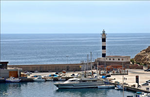
| SP 250 |
Cap de Salou
latitude 41° 3' 20.9" N longitude 1° 10' 18.7" E
Located on a promontory at Cap de Salou, about 10 km southwest of Tarragona (E 0386)
Photo courtesy Mas Terry [Flickr] |
|
| SP 251 |
Tarragona Muelle de Aragón
latitude 41° 5' 59.3" N longitude 1° 14' 7.3" E |
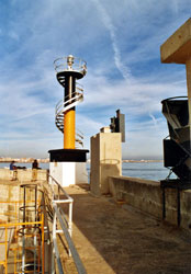
This light is no longer an aid to navigation, but has a blinking light in it for visitors. Located near the last elbow of the Tarragona main breakwater. photo (E 0388.4) |
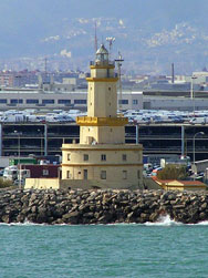
| SP 252 |
Tarragona Dique de Levante (La Banya)
latitude 41° 5' 15.1" N longitude 1° 13' 33.3" E
This lighthouse was built in 1864 and originally served as the Punta de la Baña Light. It was relocated in 1984. It housed a restaurant from 1992 to 1996. In 2003, the lighthouse was restored and opened as a museum. lighthouseDepot
Photo courtesy getxo [Flickr] |
|
| SP 253 |
| Torredembarra
latitude 41° 7' 55.2" N longitude 1° 23' 41.8" E
Located on Punta de la Galera, at the end of the Avenguda de la Galera in Torredembarra, a residential community about 13 km east of Tarragona. (E 0393.7)
Photo courtesy Mas Terry [Flickr] |
Barcelona
| SP 254 |
Vilanova i la Geltrú (Sant Cristòfor)
latitude 41° 13' 1.1" N longitude 1° 44' 14.5" E
Located behind the beach on Punta Sant Cristòfol (San Cristobol) in Vilanova i la Geltrú, a seaside town about halfway between Tarragona and Barcelona.
Photo courtesy Moisès [Flickr] |
|
| SP 255 |
| Llobregat
latitude 41° 19' 30.3" N longitude 2° 9' 8" E
This historic lighthouse, Catalonia's oldest, is now surrounded by industrial development on the south side of Barcelona's harbor. Located on the north side of the mouth of the Río Llobregat. A distant view can be obtained from unrestricted areas in the industrial town of Prat de Llobregat about 4 km to the west. (E 0398)
Photo courtesy Captain Theo [ListOfLights] |
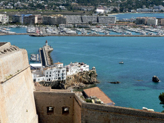
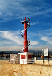
| SP 256 |
Barcelona (Torre del Reloj)
latitude 41° 22' 29.6" N longitude 2° 11' 8.8" E |
On the Barcelona waterfront, this lighthouse was converted to a clock tower in 1911. |
| SP 257 |
Monjuïc
latitude 41° 21' 39.1" N longitude 2° 9' 57.9" E
Monjuïc is a mountain that rises steeply above the harbor of Barcelona, crowned by the historic Castillo de Montjuïc. The lighthouse is built partway up the mountain, an area that is not open to the public. One can look down on the lighthouse from the area in front of the Castillo, and drivers on the Ronda del Litoral expressway at the foot of the mountain can glance up and see it. (E 0400)
Photo courtesy Captain Theo [ListOfLights] |
|
|
|
| SP 257NE |
| Barcelona North Harbor East Breakwater
latitude 41° 21' 28.8" N longitude 2° 11' 6.6" E
Photo courtesy Rich Schoeller [eMail] |
| SP 258 |
Calella
latitude 41° 36' 29.3" N longitude 2° 38' 47.1" E
Located on a bluff behind the beach on the west side of Calella, about 40 miles NE of Barcelona. (E 0448)
Photo courtesy nadia spb [webshots] |
|
Girona
| SP 259 |
| Tossa de Mar (Cabo Tossa)
latitude 41° 42' 56.2" N longitude 2° 56' 2.5" E
Located at the top of the walled town, with a sweeping view of the Mediterranean. About 50 miles NE of Barcelona. (E 0453)
Photo courtesy getxo [webshots] |
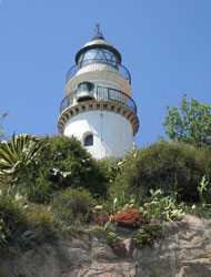
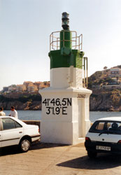
| SP 260A |
Sant Feliu de Guíxols
latitude 41° 46' 37.1" N longitude 3° 1' 59.2" E
Located on the breakwater mole at Sant Feliu de Guíxols. (E 0456)
Photo courtesy Rainer Arndt [ListOfLights] |
|
| SP 260 |
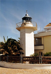
| Palamós (Punta del Molí, Punta del Molino)
latitude 41° 50' 29.5" N longitude 3° 7' 44.3" E
Located on a sharp promontory east of the harbor of Palamós. (E 0462)
Photo courtesy Arno Siering [ListOfLights] |
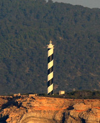
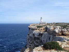
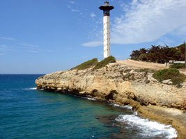
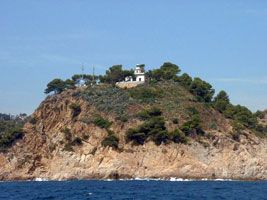
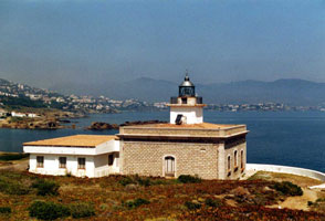
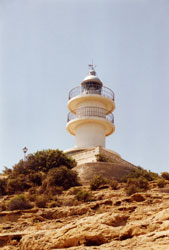
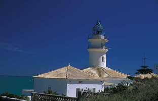
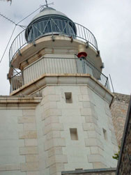
| SP 261 |
Cap Sant Sebastià (Cabo de San Sebastian)
latitude 41° 53' 45.7" N longitude 3° 12' 8" E
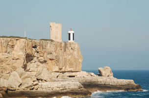
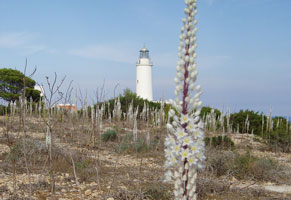
One of the most important and most famous lighthouses of Spain's Mediterranean coast. The cape is a bulge in the coastline that marks the southeastern end of the Pyrenees and the southwestern corner of the Golfo de Léon. Located high on the cape on the east side of Llafranc and about 4 km southeast of Palafrugell. (E 0470) ARLHS # SPA-045
Photo courtesy Arno Siering [ListOfLights] |
|
| SP 262 |
| Islas Medas
latitude 42° 2' 52.2" N longitude 3° 13' 17.4" E
On small island (Meda Grande) about 1 mile E of L'Estartit. (E 0472)
Photo courtesy Alex Trabas [ListOfLights] |
| SP 263 |
Roses (Punta de la Batería, Punta Blancals)
latitude 42° 14' 44.2" N longitude 3° 10' 58.8" E
This lighthouse is built on the ruins of the Castillo de la Trinidad, overlooking the north shore of the Golf de Roses on the south side of the Cap de Creus massif. Located on a promontory about 3 km southeast of Roses. (E 0476)
Photo courtesy Arno Siering [ListOfLights] |
|
| SP 264 |
| Cala Nans (Cadaqéus)
latitude 42° 16' 15" N longitude 3° 17' 11" E
The light station is located in a large national park. Located on a steep promontory on the south side of harbor entrance at Cadaqués. Probably accessible by hiking the access road. (E 0484)
Photo courtesy Alex Trabas [ListOfLights] |
| SP 265 |
Cap de Creus (Cabo Creus)
latitude 42° 19' 8" N longitude 3° 18' 57" E
The lighthouse building serves as the visitor center in the Parc Natural del Cap de Creus. (E 0486)
Photo courtesy Julianna [Flickr] |
|
| SP 266 |
| Punta s'Arnella (Port de la Selva)
latitude 42° 21' 5" N longitude 3° 11' 13.1" E
West side of harbor at Port de la Selva. (E 0488)
Photo courtesy Heike + Friedrich Klatt [ListOfLights] |
Murcia
| SP 273 |
Águilas (Punta Negra)
West entrance to harbor at Ãguilas. (E 0114)
Photo courtesy Ginés Sánchez [Flickr] |
|
| SP 274 |
| Mazarrón
latitude 37° 33' 38.1" N longitude 1° 15' 17" W
Located on a steep headland south of the harbor of Mazarrón. (E 0120)
Photo courtesy Alex Trabas [ListOfLights] |
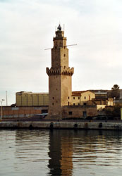
| SP 276 |
| Cartagena
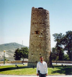
Located on the Cerro Molinete, a hill in Cartagena. This light dates from the 1st Century AD.
Photo courtesy berb102100 [Webshots] |
| SP 277 |
Navidad (Cartagena Dique de Navidad)
latitude 37° 35' 4.1" N longitude 59' 3" W
End of breakwater on west side of entrance to harbor. (E 0128)
Photo courtesy Juan Ramón Martínez Inglés [Flickr] |
|
| SP 278 |
| Cartagena Dique de la Curra
latitude 37° 35' 20.7" N longitude 58' 59.9" W
At end of main breakwater in harbor at Cartagena. ARLHS # SAP 087
Photo courtesy Juan Ramón Martínez Inglés [Flickr] |
| SP 279 |
Escombreras (Islote de Escombreras)
latitude 37° 33' 33.4" N longitude 58' 8.1" W
On an island just off (but not connected to) the land near the Escombreras harbor. (E 0126)
Photo courtesy Alex Trabas [ListOfLights] |
|
| SP 280 |
| Portman (Punta de la Chapa)
latitude 37° 34' 45.4" N longitude 50' 31.2" W
Located on a promontory about 3 km southeast of Portman and 10 km east of Cartagena. (E 0134)
Photo courtesy Alexander Trabas [ListOfLights] |
| SP 281 |
Cabo de Palos
latitude 37° 38' 5.1" N longitude 41' 24.8" W
The Cabo de Palos is the central cape of the three great capes of southeastern Spain, the others being Cabo de Gata in Almería and Cabo de la Nao in Alicante. Located on the point of the cape, a narrow peninsula extending about 1.5 km eastward into the Mediterranean at the town of Cabo de Palos. (E 0136.8)
Photo courtesy Roghliff [Flickr] |
|
| SP 282 |
| Las Hormigas (Hormiga Grande)
latitude 37° 39' 19.5" N longitude 38' 57.5" W
Located on a small rocky islet about 4 km northeast of Cabo de Palos; easily visible from the Faro de Palos. (E 0138)
Photo courtesy albunes [afotos] |
| SP 283 |
El Estacio
North of Cabo de Palos a sandy barrier beach surrounds the Mar Menor, a lagoon about 20 km longitude The lighthouse is located midway along this barrier at the Punta del Estacio, just north of an inlet that gives access to the Mar Menor. (E 0140)
Photo courtesy Alex Trabas [ListOfLights] |
|
Alicante
| SP 284A |
| Torrevieja Muelle de la Sal
latitude 38° 10' 3.4" N longitude 28' 42.8" W (E 0146)
Photo courtesy Alex Trabas [ListOfLights] |
| SP 284B |
Torrevieja Dique de Levante
latitude 38° 9' 59.8" N longitude 28' 42.5" W (E 0146.2)
Photo courtesy Alex Trabas [ListOfLights] |
|
| SP 284 |
| Isla de Tabarca (Isla Plana)
latitude 38° 9' 50.8" N longitude 28' 15.3" W
On island about 6 miles SE of Santa Pola. (E 0148)
Photo courtesy Frank Blacknoir [Flickr] |
| SP 285 |
Santa Pola (Torre Talayola)
latitude 38° 12' 34" N longitude 30' 49.2" W
The lighthouse is built atop a spectacular vertical cliff, which is famous among geologists for its exposure of Miocene fossils. Located about 4 km east of the town of Santa Pola. (E 0152)
Photo courtesy Susi Aldesnudo [Flickr] |
|
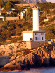
| SP 287 |
Las Huertas (Cabo Huertas, Cabo de la Huerta)
latitude 38° 21' 10.9" N longitude 24' 18.7" W
The lighthouse is located in a city park called Lomas del Faro. Located on the point of Cabo de la Huerta in Albufereta, about 7 km east of the Alicante waterfront. (E 0166)
Photo courtesy Alex Trabas [ListOfLights] |
|
| SP 289 |
Albir (Punta del Albir, Punta Bombarda)
latitude 38° 33' 48.1" N longitude 2' 59.2" W
Between Benidorm and Albir, the Costa Blanca is interrupted by a steep-sided mountain, the Sierra de Finestrat. The lighthouse stands on the eastern tip of this massif with a sweeping view of the Mediterranean. Accessible by a hiking trail (2 hr round trip) from Albir. trail (E 0173.6)
Photo courtesy Alex Trabas [ListOfLights] |
|
| SP 290 |
| Cabo de la Nao
Cabo de la Nao is very prominent cape, the nose of a ridge that continues underwater and reappears to the east as the Balearic Islands. Located on the tip of the cape, at the top of a steep cliff, in the town of Cabo de la Nao. (E 0176)
Photo courtesy Alex Trabas [ListOfLights] |
| SP 291 |
Cabo de San Antonio
latitude 38° 48' 5.8" N longitude 11' 43.7" E
East of Aduanas. The lighthouse can be viewed from the end of the Camino del Faro (E 0180)
Photo courtesy popsique [Flickr] |
|
Valencia
| SP 292 |
| Cabo Cullera
latitude 39° 11' 11.4" N longitude 13' 1" W
Located on the Calle Farola, on a promontory to the east of the town of Cullera, about 32 km south of Valencia. (E 0198)
Photo courtesy Antonio [Flickr] |
| SP 293 |
Valencia (Dique del Norte)
latitude 39° 26' 57" N longitude 18' 8.8" W
This was built as a cast-iron tower in 1909; an octagonal stone outer shell was added at the same time the light was relocated to the end of the newly extended main breakwater in 1930. (E 0200.4)
Photo courtesy Alexander Trabas [ListOfLights] |
|
| SP 294 |
Cabañal (Cabanyal) |
Light on church tower at Iglesia de Nuestra Seãtora de los Angeles ARLHS # SPA 347 |
| SP 295 |
Cabo Canet
latitude 39° 40' 22.6" N longitude 12' 4.5" W
Nearest Town or City: Canet D'En Berenguer (E 0216)
Photo courtesy Susana Prades [Flickr] |
|
Castellón
| SP 296 |
| Nules
Playa de Nules. (E 0218) ARLHS # SPA-134
Photo courtesy Ken Wood [Flickr] |
| SP 297 |
Burriana |
This is currently a building at a girl's school. The tower was a lantern on top a dwelling, the lantern has been removed ARLHS # SPA-348 |
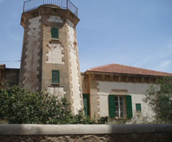
| SP 300 |
Islas Columbretes (Monte Colibrí) |
On Columbrete Grande, island about 20 miles offshore, thus accessible by boat only |
| SP 301 |
Cabo Oropesa
latitude 40° 4' 60" N longitude 8' 48" E
The lighthouse is dwarfed today by high-rise beach resorts. Located on a promontory at Oropesa del Mar, about 20 km northeast of Castellón de la Plana. (E 0230) ARLHS # SPA-035
Photo courtesy Alexander Trabas [ListOfLights] |
|
| SP 302 |
| Cabo de Irta
latitude 40° 15' 37.9" N longitude 18' 14.4" E
Located on the beach about 3 km north of Alcossebre. (A 0231.6) ARLHS # SPA-351
Photo courtesy Alexander Trabas [ListOfLights] |
| SP 303 |
Peñíscola (Castillo del Papa Luna)
Papa Luna is Pedro de Luna, a powerful Catholic cardinal who ruled as antipope at Avignon, France, from 1394 to 1417, when there were competing popes at Avignon and Rome. His castle is built on a walled promontory extending from the village of Peñíscola; the lighthouse stands below the castle shining its light over the wall. (E 0232) ARLHS # SPA-067
Photo courtesy getxo [Webshots] |
|
|
|
 Southern France

