|
This page shows the documentation of the Lighthouses of Croatia. Most of the photos below are available on the web (and are reproduced with permission) and you can almost always click on the light to go to its specific (larger resolution) copy. Each lighthouse name is linked to (in our editorial opinion) the best reference site for that light. I would like to include directions on how to get to these lights. If you know such data, could you eMail me and I will post it here (with your choice of attribution.) mailto There has been significant usage of the Lighthouse Directory prepared by Russ Rowlett (UNC). My thanks to him for providing this basis for understanding. LHdirectory Lighthouse addresses are often from the Amateur Radio Lighthouse Society. w8 |
|
| HR 1 |
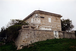
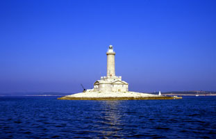
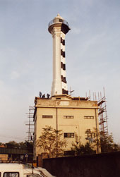
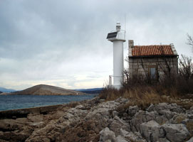
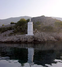
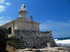
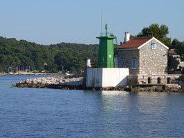
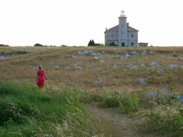
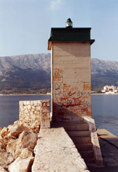
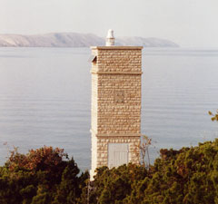
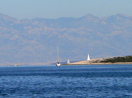
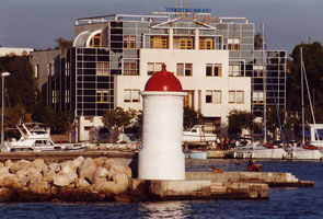
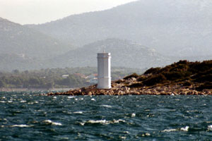
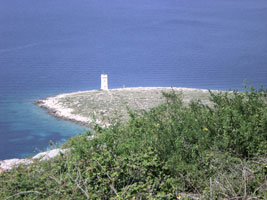
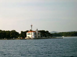
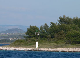
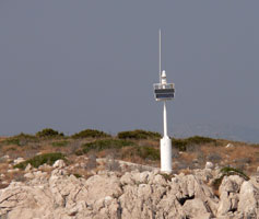
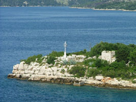
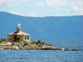
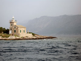
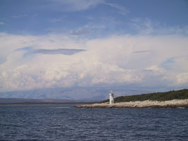
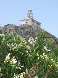
Stara Savudrija Breakwater
latitude 45° 30' 3.6" N longitude 13° 30' 4.7" E
Located at the end of the breakwater of Stara (Old) Savudrija.
Photo courtesy Ann Adriel [Flickr] |
|
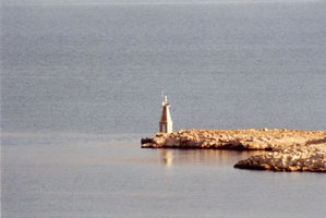
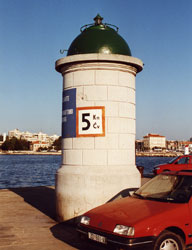
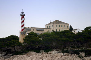
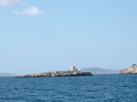
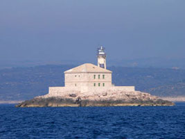
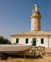
| HR 2 |
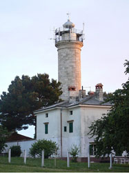
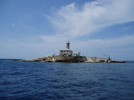
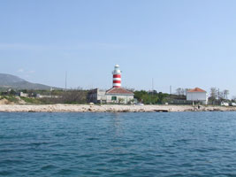
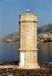
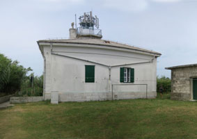
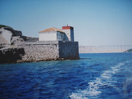
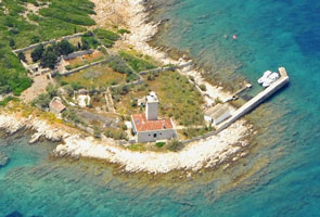
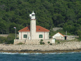
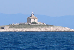
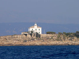
| Punta Salvore (Savudrija)
latitude 45° 29' 23.4" N longitude 13° 29' 28" E
The light marks the southern entrance to the Gulf of Trieste. Before World War II the lighthouse was usually known by its Italian name, Punta Salvore. The 2-story principal keepers house has two large apartments available for vacation rental. The lighthouse stands on the westernmost point of Croatia, near the village of Savudrija and within 5 km of the Slovenian border. ARLHS # CRO-134
Photo courtesy Ann Abulf [Flickr] |
| HR 3 |
Luka Umag Inner Mole Head |
ARLHS # CRO-215 |
| HR 4 |
Luka Umag Mole Head
latitude 45° 26' 9.4" N longitude 13° 30' 46.9" E |
ARLHS # CRO-216 |
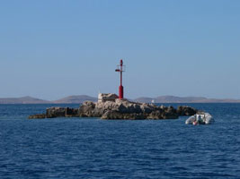
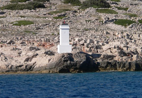
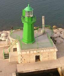
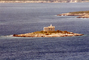
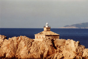
| HR 5 |
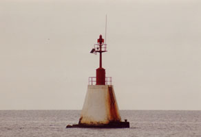
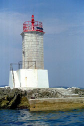
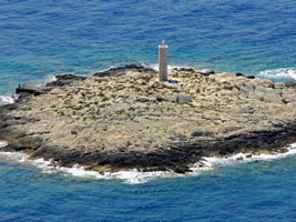
Pličina Paklena {Secca Pegolotta}
Located on a shoal off the entrance to Umag harbor. (E 2644)
Photo courtesy Arno Siering [ListOfLights] |
|
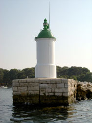
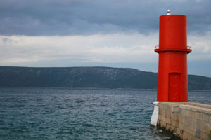
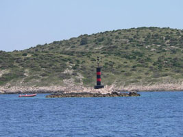
| HR 6 |
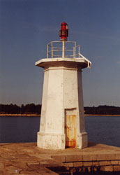
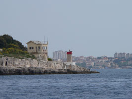
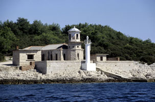
| Umag (Novigrad Breakwater)
latitude 45° 19' 3.2" N longitude 13° 33' 20.7" E
Novigrad is a small port now used almost entirely by pleasure craft. Located at the end of the breakwater. (E 2654) ARLHS # CRO-213
Photo courtesy Arno Siering [ListOfLights] |
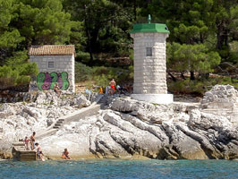
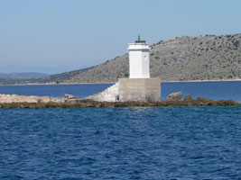
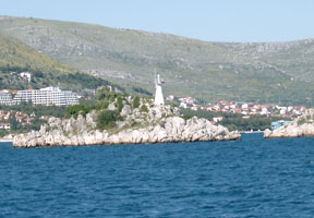
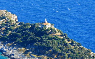
| HR 7 |
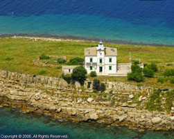
Zub {Porto Quieto}
latitude 45° 17' 53.9" N longitude 13° 34' 8.5" E
Rt Zub (Cape Tooth) shelters the south side of the bay of Novigrad. The house is available for vacation rental. Located at the tip of the Lanterna (lighthouse) peninsula, about 13 km north of Poreč. (E 2658) ARLHS # CRO-157
Photo courtesy Arno Siering [ListOfLights] |
|
| HR 8 |
Hrid Barbaran |
ARLHS # CRO-207 |
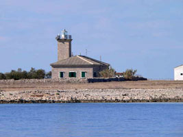
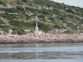
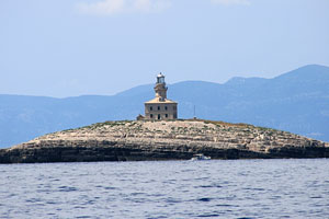
| HR 9 |
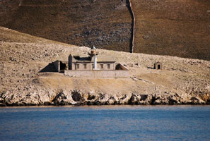
Poreć (Otok Sveti Nikola)
latitude 45° 13' 41" N longitude 13° 35' 5.1" E
Located at the end of a mole extending from the northern tip of Otok Sv. Nikola (St. Nicholas Island), sheltering the harbor of Poreć. (E 2663)
Photo courtesy Uli Knapp [ListOfLights] |
|
| HR 10 |
| Sveti Nikola (near Porec)
latitude 45° 13' 29.8" N longitude 13° 34' 58.7" E
Located at the western tip of Otok Sv. Nikola (St. Nicholas Island), sheltering the harbor of Poreč. ARLHS # CRO-164
Photo courtesy Janko Eđidio [panoramio] |
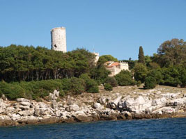
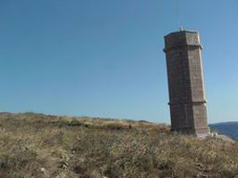
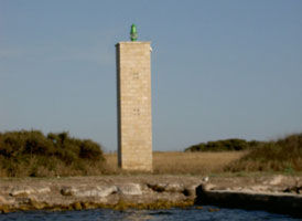
| HR 11 |
Altijez |
Located southwest of Poreč (Parenzo). photo ARLHS # CRO-021 |
| HR 12 |
Sveta Eufemija (Rovinj)
latitude 45° 5' 2.4" N longitude 13° 37' 46.1" E
Located at the tip of Rt Sveta Eufemija, a sharp-pointed peninsula sheltering the harbor of Rovinj. ARLHS # CRO-155
Photo courtesy Lenkolaf [Flickr] |
|
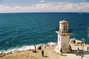
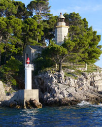
| HR 13 |
| Sveti Ivan Na Pucini
latitude 45° 2' 34.6" N longitude 13° 36' 51.5" E
This lighthouse marks the end of a dangerous reef extending southwestward from Rovinj. Located on a rocky islet about 2.5 km offshore and about 4 km southwest of Rovinj. It is available for vacation rental -- which is unusual for such an exposed light station. Plovput provides boat transportation for guests from Rovinj, but only in the morning. ARLHS # CRO-017
Photo courtesy Ivana [Wikimedia] |
| HR 14 |
Sveti Jerolim (near Veli Brijun) |
ARLHS # CRO-160 |
| HR 15 |
Prostina
This light is situated on a small headland on the north shore of the entrance of the Pula bay, just a few miles from Pula city. There is a half submerged breakwater on the southern site of the entrance - so all ships pass very close to this mark. ARLHS # CRO-123
Photo courtesy Viktor Sebesteny [panoramio] |
|
| HR 16 |
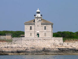
| Pola (Punta Peneda)
latitude 44° 53' 16.8" N longitude 13° 45' 11.5" E
Brijuni (Brioni in Italian) is a popular resort island off the southwest tip of Istria; most of the island is set aside as a national park. Brijuni is readily accessible by ferry from Fazana. Located at the southern tip of the island, about 7 km west of Pula. ARLHS # CRO-210
Photo courtesy Viktor Sebesteny [panoramio] |
| HR 18 |
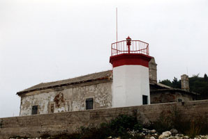
Verudica {Verudella}
latitude 44° 49' 59.1" N longitude 13° 50' 1.8" E
Located at the tip of a peninsula at Verudica, about 4 km south of Pula. (E 2734) ARLHS # CRO-187
Photo courtesy Arno Siering [ListOfLights] |
|
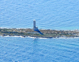
| HR 19 |
| Porer (Islet of Pora)
latitude 44° 45' 28.6" N longitude 13° 53' 28.1" E
This lighthouse marks the southern tip of the Istrian Peninsula. Located on an islet about 2.5 km southwest of Rt Kamenjak, the tip of the peninsula, and about 10 km south of Pula. Although it is located on a tiny scrap of land, it has two apartments available for vacation rental. Plovput provides boat transportation for guests from Pula, but only in the morning. ARLHS # CRO-014
Photo courtesy M. Prinkle [Flickr] |
| HR 20 |
Pličina Albanež
Located on an isolated reef in the Adriatic about 2.8 km southwest of the Porer lighthouse (E 2742) ARLHS # CRO-208
Photo courtesy Hans de Graaf [ListOfLights] |
|
| HR 21 |
Marlera
latitude 44° 48' 12.4" N longitude 14° 6.5" E |
Located on Rt Marlera, an east-pointing promontory about 5 km by sea northeast of Rt Kamenjak and 13 km east southeast of Pula. photo ARLHS # CRO-094 |
| HR 22 |
Punta Crna
latitude 44° 57' 25.3" N longitude 14° 8' 44.2" E
'Crna Punta' means Black Point. Located on a prominent cape about 12 km south of Labin. This is another example of the new light being placed immediately in front of the old light. ARLHS # CRO-035
Photo courtesy Vitezslav Blažek [panoramio] |
|
| HR 23 |
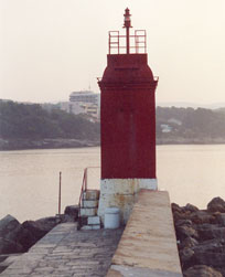
Volosko Pier |
At the head of the Marina Opatija breakwater there is a lighthouse (Fl R 3s 7m 3M), which can be used as a way point (45°18,9' N 14°17,8' E). ARLHS # CRO-214 |
| HR 24 |
Gen. Petra Drapsina Breakwater {Maria Theresa Breakwater}
latitude 45° 19' 37.4" N longitude 14° 25' 8.9" E
Located at the end of the main breakwater of Rijeka. (E 2824)
Photo courtesy Hans de Graaf [ListOfLights] |
|
| HR 25 |
| Mlaka (Luka Rijeka)
latitude 45° 20' 1.2" N longitude 14° 25' 12.7" E
The building has apartments leased to retired Plovput employees. In 1898, the 1884 breakwater lighthouse was relocated onshore to replace the 1878 light. Located on the Milutina Barača near the west end of the waterfront of Rijeka. (E 2822) ARLHS # CRO-206
Photo courtesy Alex Trabas [ListOfLights] |
| HR 26 |
Oštro (Kraljevica)
latitude 45° 16' 23" N longitude 14° 33' 37.4" E
Located on the east side of the entrance to Kraljevica, about 10 km southeast of Rijeka. ARLHS # CRO-111
Photo courtesy Boris Jerkin [panoramio] |
|
| HR 27 |
| Sveti Marko
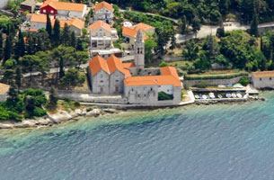
I can find no reference to a "lighthouse" in this location, but there is a church near the edge of the island that could have been used for navigation. ARLHS # CRO-162
Photo courtesy marinas.com [marinas.com] |
| HR 28 |
Krk Mole (Porto Veglia)
latitude 45° 1' 26.1" N longitude 14° 34' 33.4" E
Krk is the best harbor and largest town on the island of the same name; it is located midway on the south coast. Located at the end of the west mole at Krk. Accessible by walking the mole. (E 2874)
Photo courtesy Arno Siering [ListOfLights] |
|
| HR 29 |
| Ertak (Punta Ertak)
latitude 45° 13' 10" N longitude 14° 36' 36.8" E
Located on a promontory on the mainland side of the Velebitski Channel, about 2.5 km southeast of the highway 102 bridge to Otok Krk. (E 2896) ARLHS # CRO-042
Photo courtesy Hans de Graaf [ListOfLights] |
| HR 30 |
Tokal
latitude 45° 8' 17.9" N longitude 14° 44' 24.7" E |
Located on a promontory about 5 km southeast of Selce. photo ARLHS # CRO-175 |
| HR 31 |
Sveti Anton |
ARLHS # CRO-158 |
| HR 32 |
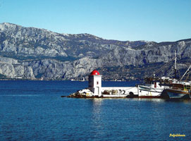
Senj Marija Art Breakwater {Segna}
latitude 44° 59' 24" N longitude 14° 53' 48.8" E
Located at the end of a breakwater on the southwest side of the bay of Senj. (E 2922)
Photo courtesy Alex Trabas [ListOfLights] |
|
| HR 33 |
| Senj Mole Sv. Ambrož
latitude 44° 59' 31.4" N longitude 14° 53' 54.9" E
Senj is a small port about 50 km southeast of Rijeka. Located on the end of the north mole at Senj. (E 2923)
Photo courtesy Arno Siering [ListOfLights] |
| HR 34 |
Štokić (Jablanac)
latitude 44° 42' 31.1" N longitude 14° 53' 30.9" E
This light guides vessels in a narrow passage between the mainland and Otok Rab. Located on a very steep bluff about 1 km northwest of Jablanac harbor. (E 2938)
Photo courtesy Arno Siering [ListOfLights] |
|
| HR 35 |
| Jurišnica (Pag Island)
This light guides vessels in the narrow Velebitski Channel between the mainland and Otok Pag. Located on a headland about 15 km northwest of Karlobag. (E 2944) ARLHS # CRO-059
Photo courtesy Uli Knapp [ListOfLights] |
| HR 36 |
Konj (near Karlobag) |
ARLHS # CRO-070 |
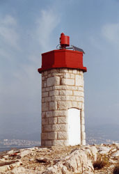
| HR 37 |
Prestenice (Cres Island)
latitude 45° 7' 12" N longitude 14° 16' 21.5" E |
This lighthouse marks the narrowest section of the passage between Istria and Cres, known as the Vela Vrata (Vela Strait). Located on a promontory about 1.5 km south of Porozina. photo ARLHS # CRO-120 |
| HR 38 |
Kovačine
latitude 44° 57' 35" N longitude 14° 23' 26.7" E
The lighthouse marks the entrance to the harbor of Cres. The point of land, Rt Kovačine, is the site of a popular campground. Located on the north side of the entrance, about 1.5 km west of the Cres waterfront.
Photo courtesy Nick Bartlett 2007 [Flickr] |
|
| HR 39 |
Zaglav (near Cres)
latitude 44° 55' 16.5" N longitude 14° 17' 18.3" E |
Located on a small island off the west coast of Cres near Pernat. photo ARLHS # CRO-020 |
| HR 40 |
Visoki ARLHS # CRO-189
Photo courtesy Karmen Krivicic Spajic [island-cres] |
|
| HR 41 |
Suha (Cres Island) |
ARLHS # CRO-152 |
| HR 42 |
Veli Pin (Plavnik Island)
latitude 44° 58' 53.7" N longitude 14° 29' 7.8" E |
Plavnik is an island off the east coast of Cres. A narrow channel separating the islands, the Kanal Krusija, is the shortest route from the Adriatic through the islands to Rijeka. Located at the northwestern point of Plavnik, marking the east side of the narrowest opening of the channel. ARLHS # CRO-182 |
| HR 43 |
Zeca |
ARLHS # CRO-201 |
| HR 44 |
Galijola
Located on an isolated islet in the Kvarner Gulf about 12 km west of Cres and 8 km northwest of Unije. ARLHS # CRO-046
Photo courtesy marinas.com [marinas.com] |
|
| HR 45 |
Lakunji (Unije Island) |
ARLHS # CRO-081 |
| HR 46 |
Vnetak (Unije Island)
latitude 44° 37' 9.3" N longitude 14° 14' 8" E
Unije is an island lying off the southwest coast of Cres at the entrance to the west channel of the Kvarner from the Adriatic Sea. There is ferry transportation from Mali Lošinj. The lighthouse is located on the southwestern tip of the island. ARLHS # CRO-190
Photo courtesy Darko Višek [Flickr] |
|
| HR 47 |
| Garba (Susak Island)
latitude 44° 30' 51.6" N longitude 14° 18' 4.8" E
Susak is a high island south of Unije and about 7 km south of the channel separating Cres from Lošinj. Boat transportation from Mali Lošinj is available. Located on the highest point of the island; accessible by a stiff hike from the village of Susak. ARLHS # CRO-050
Photo courtesy Nikola Derežic [Picasa] |
| HR 48 |
Kurila (Losinj Island)
latitude 44° 33' 44.2" N longitude 14° 22' 7.4" E |
Located on a prominent cape near the southern point of the island of Cres, about 4 km southwest of Cunski. photo ARLHS # CRO-080 |
| HR 49 |
Zabodaski |
ARLHS # CRO-197 |
| HR 50 |
Hrid Šilo (near Male Srakane)
latitude 44° 33' 30" N longitude 14° 20' 37.8" E
The Srakane islands are a chain of rocks and islets, the tops of an underwater ridge connecting Unije to the the south end of Cres. Located on the islet closest to Cres. Theres a good view from the ferries between Mali Lošinj and Unije. ARLHS # CRO-139
Photo courtesy Nikola Derežic [panoramio] |
|
| HR 51 |
| Murtar
latitude 44° 33' 0.2" N longitude 14° 25' 16.1" E
Located on the small island of Murtar in the southern entrance to the channel separating Cres and Lošinj, marking the approach to the ferry port of Mali Lošinj. Theres a good view from ferries from Mali Lošinj to Susak or Unije. Note the old light behind the new active one. (E 3022) ARLHS # CRO-104
Photo courtesy Uli Knapp [ListOfLights] |
| HR 52 |
Kriz (Kolundarac Island)
latitude 44° 33' 27.9" N longitude 14° 25' 47.7" E
Located on an island, marking the south side of the entrance to the harbor of Mali Lošinj. There's a good view from ferries from Mali Lošinj to Susak or Unije. ARLHS # CRO-077
Photo courtesy Viktor Sebesteny [panoramio] |
|
| HR 53 |
| Madona
latitude 44° 31' 33.5" N longitude 14° 26' 55.2" E
Located on a promontory on the west side of Otok Lošinj, about 3 km west of Mali Lošinj. (E 3019) ARLHS # CRO-090
Photo courtesy Uli Knapp [ListOfLights] |
| HR 54 |
Sveti Petar (near Loinj) |
ARLHS # CRO-167 |
| HR 55 |
Grujica
latitude 44° 24' 34.3" N longitude 14° 34' 8.3" E
Located on a small island in the channel between Ilovik and Premuda, about 12 km southeast of Veli Lošinj. ARLHS # CRO-005
Photo courtesy Viktor Sebesteny [panoramio] |
|
| HR 56 |
| Morovnik
Located on a small island about 3 km northwest of Olib. (E 3064) ARLHS # CRO-098
Photo courtesy Uli Knapp [ListOfLights] |
| HR 57 |
Otočić Trstenik
latitude 44° 40' 7.2" N longitude 14° 34' 41" E
Located on an island off the east side of Cres, about 5 km northeast of Punta Kriza. ARLHS # CRO-019
Photo courtesy SL-Ziga [wikipedia] |
|
| HR 58 |
Manganel (Krk Island) |
ARLHS # CRO-093 |
| HR 59 |
Sveti Mikula (Krk Island) |
ARLHS # CRO-163 |
| HR 60 |
Vošćica (Krk Island)
latitude 45° 14' 19.7" N longitude 14° 35' 26.9" E
Located on a promontory at the northern point of Krk, about 1.5 km east of the bridge joining the island and the mainland. (E 2894) ARLHS # CRO-193
Photo courtesy Hans de Graaf [ListOfLights] |
|
| HR 61 |
Negrit (Krk Island)
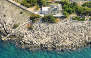
latitude 44° 58' 46.6" N longitude 14° 37' 2.6" E |
The house is abandoned and in poor condition. Located on a promontory about 7 km southeast of Krk town. photo ARLHS # CRO-106 |
|
|
| HR 62 |
Galun |
ARLHS # CRO-049 |
| HR 63 |
Stražica (Prvic Island)
latitude 44° 56' 0.8" N longitude 14° 46' 7.6" E
Located on Rt Stražica, the northwestern point of Otok Prvi?, marking the narrow channel between that island and the southeastern tip of Otok Krk. Note that this photo shows 2 generations of the light at this location. ARLHS # CRO-147
Photo courtesy Monika Fahrnberger [Flickr] |
|
| HR 64 |
| Rt Šilo (Dobrinj)
latitude 44° 58' 5.1" N longitude 14° 45' 36.9" E
Rt Šilo is a long, very narrow promontory at the southeastern corner of Otok Krk. Located at the tip of the promontory. (E 2901)
Photo courtesy Alex Trabas [ListOfLights] |
| HR 65 |
Baška Mole
latitude 44° 58' 5.1" N longitude 14° 45' 36.9" E
Baška is a picturesque village at the southeastern end of Krk. Located at the end of the breakwater mole. (E 2904)
Photo courtesy Arno Siering [ListOfLights] |
|
| HR 66 |
Hrid Šilo (Krk Island) |
Stipanja bay is well protected from eastern and southern winds by a narrow and low peninsula at the end of which cape Punta Šilo is located. At the end of this cape there is a lighthouse which emits a light beam: B BI 3s, whose maximum range is 7 nautical miles. wiki ARLHS # CRO-138 |
| HR 67 |
Soline (Rt. Glavati)
latitude 45° 9' 41.6" N longitude 14° 38' 3.5" E
The light marks the south side of the narrow entrance to the bay of Soline, on the northeast side of Otok Krk about 3 km east northeast of the town of Soline. (E 2898)
Photo courtesy Alex Trabas [ListOfLights] |
|
| HR 68 |
Sajalo (Goli Island) |
ARLHS # CRO-133 |
| HR 69 |
Sorinj (Rab Island)
Located on the northwestern tip of Otok Rab. (E 2976) ARLHS # CRO-144
Photo courtesy Uli Knapp [ListOfLights] |
|
| HR 70 |
Frkanj |
ARLHS # CRO-043 |
| HR 71 |
Sveti Juraj (Otočić Tunera, Rab)
latitude 44° 45' 6.8" N longitude 14° 45' 56.3" E
Located at the northeast end of Otočić Tunera, an island in the entrance to the harbor of Rab, on the south side of Otok Rab. (E 2994) ARLHS # CRO-018
Photo courtesy Uli Knapp [ListOfLights] |
|
| HR 72 |
Donji RT (Dolin Island) |
RAB (440 45'N; 140 46'E), town and harbour (pop. 592 in 1991) on the island of the same name.
Approach. Landmarks: the white tower with a column and gallery (white light) on Donji point (the islet of Dolin). ARLHS # CRO-038 |
| HR 73 |
Pohlib (near Rab Island) |
ARLHS # CRO-117 |
| HR 74 |
Stara Novalja (Pag Island)
Located on a headland on the north coast of Otok Pag, just west of the town of Stara Novalja. Ferries between Stara Novalja and Gradina on the mainland probably provide a good view. (E 2995.6) ARLHS # CRO-145
Photo courtesy Alex Trabas [ListOfLights] |
|
| HR 75 |
Zigljen |
There is a ferry line running from Prizna to Zigljen. ARLHS # CRO-055 |
| HR 76 |
Krištofor (Pag Island) |
This light marks the entrance to a crooked channel leading to the town of Pag. Located on a prominent cape on the north side of Otok Pag, about 8 km south of Karlobag photo ARLHS # CRO-076 |
| HR 77 |
Zaglav (Pag Island) |
ARLHS # CRO-198 |
| HR 78 |
Mandre (Pag Island) |
ARLHS # CRO-092 |
| HR 79 |
Škrda
latitude 44° 29' 8.8" N longitude 14° 50' 47.6" E |
Located on an island off the southwest coast of the large island of Pag. photo ARLHS # CRO-142 |
| HR 80 |
Pohlib (Pohlipski Canal)
latitude 44° 23' 42.9" N longitude 14° 53' 35.8" E |
A tiny island between Planik island and Maun. ARLHS # CRO-118 |
| HR 82 |
Silba Island |
ARLHS # CRO-137 |
| HR 83 |
Kamenjak (near Premuda Island) |
ARLHS # CRO-062 |
| HR 84 |
Greben |
ARLHS # CRO-053 |
| HR 85 |
Tanka Nožica
Located on a promontory of the mainland marking the northern entrance to the narrow channel between the mainland and the island of Pag, about 2 km northwest of Miletici. (E 2961)
Photo courtesy Arno Siering [ListOfLights] |
|
| HR 86 |
Otrljak |
ARLHS # CRO-110 |
| HR 87 |
Razanac Veli |
ARLHS # CRO-128 |
| HR 88 |
Otočić Mišjak
Located off the northwestern tip of Otočić Mišjak, marking a sharp turn in the zigzagging channel between the mainland and Otok Pag. (E 3086)
Photo courtesy Hans de Graaf [ListOfLights] |
|
| HR 89 |
| Otok Vir
Located on the southwest side of the island of Vir, about 5 km west of the town of Vir. The island is accessible by bridge. (E 3081) ARLHS # CRO-188
Photo courtesy Arno Siering [ListOfLights] |
| HR 90 |
Sikavac Mali |
ARLHS # CRO-136 |
| HR 91 |
Uvala Široka (Ist Island) |
ARLHS # CRO-181 |
| HR 92 |
Vranac (Molat Island)
This lighthouse marks the eastern entrance of the Prolaz Zapuntel (Zapuntel Channel) - a narrow passage between Ist and Molat islands. ARLHS # CRO-195
Photo courtesy Viktor Sebesteny [panoramio] |
|
| HR 93 |
Bonaster (Molat Island) |
ARLHS # CRO-033 |
| HR 94 |
Trata |
ARLHS # CRO-176 |
| HR 95 |
Vrtlac |
ARLHS # CRO-196 |
| HR 96 |
Golac |
A small island in the Adriatic Sea ARLHS # CRO-052 |
| HR 97 |
Tun Mali |
ARLHS # CRO-179 |
| HR 98 |
Tun Veli |
ARLHS # CRO-180 |
| HR 99 |
Zecevo |
ARLHS # CRO-202 |
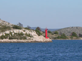
| HR 100 |
Zanavin (Tri Sestrica), {Tre Sorelle}
latitude 44° 10' 19.7" N longitude 15° 42.9" E
Located on the small island of Mala Sestrica off the northwest tip of Otok Rivanj, about 16 km northwest of Zadar. ARLHS # CRO-199
Photo courtesy marinas.com [marinas.com] |
|
| HR 101 |
Otočić Tri Sestrice |
Physically this is close to, but probably not a duplicate of the light listed above. ARLHS # CRO-177 |
| HR 102 |
Veli Rat (Dugi Island)
The lighthouse marks the northwestern end of Dugi Otok (Long Island), which extends for 45 km along the Adriatic coast of Zadarska County. The island is accessible by ferry from Zadar. Located about 3 km west of the village of Veli Rat. ARLHS # CRO-183
Photo courtesy Filippo Giunchedi [Flickr] |
|
| HR 103 |
Sveti Nedjelja (Dugi Island) |
ARLHS # CRO-154 |
| HR 104 |
Trska (Sestrunj Island) |
ARLHS # CRO-178 |
| HR 105 |
Oštri Rat
latitude 44° 7' 47.9" N longitude 15° 12' 15.6" E
Located on a promontory about 1.5 km northwest of the harbor of Zadar. (E 3142) ARLHS # CRO-109
Photo courtesy Arno Siering [ListOfLights] |
|
| HR 106 |
| Zadar Breakwater
latitude 44° 7' 8.1" N longitude 15° 13' 28.2" E
Located at the end of the breakwater enclosing Zadar's inner harbor. (E 3144)
Photo courtesy Arno Siering [ListOfLights] |
| HR 107 |
Istarske Obala
latitude 44° 7' 8" N longitude 15° 13' 19.4" E
This lighthouse is identical to the Zadar Breakwater light. Located at the end of the peninsula sheltering Zadar's inner harbor, marking the west side of the entrance. (E 3148)
Photo courtesy Alex Trabas [ListOfLights] |
|
| HR 108 |
Garmina (Rava Island) |
ARLHS # CRO-051 |
| HR 109 |
Maslinovac
latitude 44° 6.6" N longitude 15° 5' 26.4" E |
A small island south of Rava. ARLHS # CRO-096 |
| HR 110 |
Mrtovnjak (near Iz Island) |
Don't confuse this light with the identically named light somewhat south of here. HR140 ARLHS # CRO-100 |
| HR 111 |
Karantunic |
ARLHS # CRO-065 |
| HR 113 |
Babac
latitude 43° 57' 24.2" N longitude 15° 23' 41.4" E
Located on the west point of Babac island, marking a narrow passage in the Pašmanski Channel. ARLHS # CRO-024
Photo courtesy Viktor Sebesteny [panoramio] |
|
| HR 114 |
Lavdara Island |
The is a relatively large island, and we have no data if the light is north, south, or marks some middle channel. ARLHS # CRO-083 |
| HR 115 |
Balabra Mala
latitude 43° 56' 48.1" N longitude 15° 16' 46.9" E |
A little island west of Otok Pasman. ARLHS # CRO-026 |
| HR 116 |
Rt. Bluda (Dugi Island) |
ARLHS # CRO-132 |
| HR 118 |
Sveta Katarina
The lighthouse is located on the south-western shore of Sveta Katarina island. This is the southernmost island in the Pasmanski Kanal (Pasmanki Channel), just in front of Biograd. ARLHS # CRO-156
Photo courtesy Viktor Sebesteny [panoramio] |
|
| HR 119 |
Lavdara Mala |
A small island south of Lavdara island. HR119 ARLHS # CRO-084 |
| HR 120 |
Proversa (Dugi Island)
The lighthouse is situated on the southern tip of Dugi Otok island on a small headland. It marks the western entrance of Mala Proversa - the small, narrow channel between Dugi Otok and Katina islands. A must see place for yachties. ARLHS # CRO-003
Photo courtesy Viktor Sebesteny [panoramio] |
|
| HR 121 |
Cuska (Dugi Island) |
ARLHS # CRO-036 |
|
|
| HR 122 |
Hrid Galigolica |
ARLHS # CRO-217 |
| HR 123 |
Košara
The light is located on Kosara, a small island at the southern tip of Pasman Island. ARLHS # CRO-071
Photo courtesy Viktor Sebesteny [panoramio] |
|
| HR 124 |
Galijolica
latitude 43° 52' 37.8" N longitude 15° 22' 13" E |
Located on a reef about 3 km south of Otok Pašman and a similar distance east of Otok Šćine. photo ARLHS # CRO-047 |
| HR 125 |
Artica Vela |
ARLHS # CRO-023 |
| HR 126 |
Sestrica Vela (Kornati)
latitude 43° 51' 11" N longitude 15° 12' 19.1" E
Located on a small island off the southeastern end of Dugi Otok, marking the start of the twisting channel around the end of the island. ARLHS # CRO-015
Photo courtesy Elvira Skelin [panoramio] |
|
| HR 127 |
Tajerske Sestrice |
ARLHS # CRO-212 |
| HR 129 |
Prišnjak
latitude 43° 49' 32.2" N longitude 15° 33' 31.5" E
Located on a small island off the northwest end of the much larger island of Murter. (E 3202) ARLHS # CRO-121
Photo courtesy Alex Trabas [ListOfLights] |
|
| HR 130 |
| Rat (Murter Channel)
This light marks the northern entrance to the Murterski Channel. Located on a promontory of the mainland opposite the northwestern corner of Otok Murter, about 4 km northwest of Tisno. (E 3212) ARLHS # CRO-125
Photo courtesy Alex Trabas [ListOfLights] |
| HR 131 |
Miine
latitude 43° 48' 43.9" N longitude 15° 33' 53" E ARLHS # CRO-097
Photo courtesy Viktor Sebesteny [panoramio] |
|
| HR 132 |
Maslinjak
latitude 43° 46' 4.5" N longitude 15° 40' 45.2" E |
Located on the southwestern side of Maslinjak, an island about 2.5 km east of the southeastern tip of Otok Murter. ARLHS # CRO-095 |
| HR 133 |
Murteric (Murter Island) |
ARLHS # CRO-105 |
| HR 134 |
Hrid Kukuljar |
ARLHS # CRO-079 |
| HR 135 |
Otočić Kukuljari
This area is very popular with scuba divers. Located on a tiny islet off the southern coast of Murter. ARLHS # CRO-218
Photo courtesy Viktor Sebesteny [panoramio] |
|
| HR 136 |
| Smokvica Vela
Located on a small island near the southwestern end of the Kornati archipelago, about 15 km southwest of Otok Murter. ARLHS # CRO-143
Photo courtesy Thomas Mikula [panoramio] |
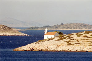
| HR 137 |
Jadrija (Luka Šibenik)
latitude 43° 43' 17.9" N longitude 15° 51' 0.8" E
This lighthouse marks the entrance to the Kanal Sv. Ante, a narrow channel leading to the port of Šibenik; the mast next to the building carries red and green traffic control lights. Located on the north side of the entrance at Jadrija, about 4 km southeast of Srima. ARLHS # CRO-058
Photo courtesy Viktor Sebesteny [panoramio] |
|
| HR 138 |
Konj (Lupac) |
ARLHS # CRO-069 |
| HR 139 |
Sveti Nikola (Šibenik) |
ARLHS # CRO-166 |
| HR 140 |
Mrtovnjak (Kornati) |
Don't confuse this light with the identical named light somewhat north of here. HR110 ARLHS # CRO-101 |
| HR 141 |
Tijacica (Tijat Island) |
ARLHS # CRO-174 |
| HR 142 |
Sir (Zmajan Island)
The light is located on a headland on the southern end of the Zmajan island. This area is like a maze: dozen of similar looking small islands - big fun to sail there in the darkness without GPS :)
ARLHS # CRO-140
Photo courtesy Viktor Sebesteny [panoramio] |
|
| HR 143 |
Obonjan Island |
ARLHS # CRO-107 |
| HR 144 |
Muna (Zirje Island)
Isolated danger mark - a small rock between Zirje and Kakan islands. ARLHS # CRO-103
Photo courtesy Viktor Sebesteny [panoramio] |
|
| HR 145 |
Kakan Island |
A small light on the southern end of Kakan island. It marks the southern entrance of a very narrow passage between Kakan and Kaprije Islands. ARLHS # CRO-061 |
| HR 146 |
Leme (Kaprije Island) ARLHS # CRO-085
Photo courtesy Viktor Sebesteny [panoramio] |
|
| HR 147 |
| Drvenik
This light is situated on the northern side of Drvenik Island, in the Sibenik region. It marks the northern entrance of the passage between Zlarin and Drvenik and Dvainka Islands. ARLHS # CRO-040
Photo courtesy Viktor Sebesteny [panoramio] |
| HR 148 |
Ravan |
A bone shaped island SE of Kaprije. Google makes it look like the light is just north of the center of the bone. ARLHS # CRO-127 |
| HR 149 |
Komorica |
ARLHS # CRO-068 |
| HR 150 |
Rat (Zlarin Island) |
ARLHS # CRO-126 |
| HR 151 |
Dvainka |
This lighthouse is located on the western shore of Dvainka Island, it marks the southern entrance of the passage between Zlarin and Drvenik and Dvainka Islands. ARLHS # CRO-041 |
| HR 152 |
Krbela Vela |
ARLHS # CRO-073 |
| HR 153 |
Hrbonjak |
ARLHS # CRO-057 |
| HR 154 |
Otočić Blitvenica |
This is one of several very isolated Croatian light stations in the Adriatic Sea; landing on the island is very difficult except in the best weather. Located on a tiny island about 7 km southwest of the larger island of Žirje and about 30 km southwest of Šibenik. photo ARLHS # CRO-002 |
| HR 155 |
Kremik |
Located at the tip of a headland on the south side of the entrance to the bay of Primošten. photo ARLHS # CRO-075 |
| HR 157 |
Hrid Mulo
latitude 43° 30' 50.7" N longitude 15° 55' 8.3" E
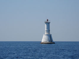
This lighthouse helps guide ships around a substantial bulge in the coastline of the mainland. Located on a tiny island about 5 km southwest of Rogoznica. ARLHS # CRO-006
Photo courtesy Viktor Sebesteny [panoramio] |
|
| HR 158 |
| Split Breakwater
latitude 43° 30' 3.8" N longitude 16° 26' 9.3" E
The keepers house was demolished when the breakwater was reconstructed in 1999. Located at the end of the main breakwater protecting the harbor of Split.
Photo courtesy Larry Myhre [Flickr] |
| HR 159 |
Pomorac
latitude 43° 30' 2.7" N longitude 16° 26' 35" E |
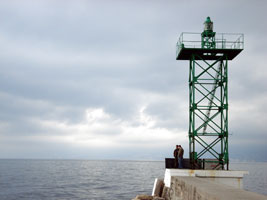
Located on the Split waterfront near the base of the breakwater photo |
| HR 160 |
Celice
This lighthouse is situated on a small rock in the middle of the Trogirski Zaljev (Trogir bay), about a mile west from Trogir city. ARLHS # CRO-034
Photo courtesy Viktor Sebesteny [panoramio] |
|
| HR 161 |
| Muljica
The light is located on Muljica, a small island in the north-western entrance of the Drvenicki Cannal (Drvenik Channel) - the western approach of Trogir and Split. ARLHS # CRO-102
Photo courtesy Viktor Sebesteny [panoramio] |
| HR 162 |
Artatur |
ARLHS # CRO-022 |
| HR 165 |
Zaporinovac |
ARLHS # CRO-200 |
| HR 166 |
Murvica (Velika Murvica)
latitude 43° 27' 60" N longitude 16° 3' 23.9" E
Located on a small island in the Drvenički Kanal, the channel between the island of Drvenik Mali and the mainland; this channel is the beginning of the approach to the port of Split from the west. ARLHS # CRO-007
Photo courtesy Viktor Sebesteny [panoramio] |
|
| HR 167 |
Pasika (Drvenik Mali Island)
latitude 43° 27' 19.5" N longitude 16° 4' 19.5" E |
Located on Rt Pasika, a promontory on the north side of the island of Drvenik Mali, marking the south side of the passage through the Drvenicki Kanal. photo ARLHS # CRO-112 |
| HR 168 |
Postira
latitude 43° 22' 41.1" N longitude 16° 37' 38.2" E
Located at the end of the breakwater mole at Postira, on the central north coast of Otok Brač.
Photo courtesy Polježičanin [Flickr] |
|
| HR 169 |
| Sveti Nikola (Pučišća)
Located on Rt Sv. Nikola, marking the west side of a narrow bay leading to Pučišća, a town on the north side of Otok Brač. The lighthouse appears to be accessible by road from the town. ARLHS # CRO-209
Photo courtesy marinas.com [marinas.com] |
| HR 170 |
Školijic |
ARLHS # CRO-141 |
| HR 171 |
Sveti Nikila (Brac Island) |
ARLHS # CRO-165 |
| HR 172 |
Mrduja
Ruins surrounding the light appear to be those of a former lighthouse, but are actually ruins of a 19th century fort. Located on a small island about 2 km north of Rt Ražanj. ARLHS # CRO-099
Photo courtesy Larry Myhre [Flickr] |
|
| HR 173 |
| Bijaka (Milna)
Located on Rt Bijaca, a promontory on the north side of the entrance to Milna, at the west end of Otok Brač. ARLHS # CRO-031
Photo courtesy Viktor Sebesteny [panoramio] |
| HR 174 |
Ražanj (Brac Island)
Located on Rt Ražanj, the southwestern tip of Otok Brač, guarding the narrow passage between the islands of Brač and Solta about 3 km west of Milna. ARLHS # CRO-129
Photo courtesy Larry Myhre [Flickr] |
|
| HR 175 |
Livka (Solta Island) |
ARLHS # CRO-087 |
| HR 176 |
Lašćatna (Rašćatna)
latitude 43° 18' 50.6" N longitude 16° 53' 57.3" E
Located at the eastern tip of Otok Brač. ARLHS # CRO-082
Photo courtesy Tomas Gelien [Flickr] |
|
| HR 177 |
Makarska |
ARLHS # CRO-205 |
| HR 178 |
Sveti Petar (near Makarska)
latitude 43° 17' 41.2" N longitude 17° 30.6" E
Makarska is a very popular resort town on the mainland coast opposite Sumartin, Otok Brač. The lighthouse is located on the tip of a forested peninsula within walking distance of the town waterfront. ARLHS # CRO-168
Photo courtesy Frosted Peppercorn [Flickr] |
|
| HR 179 |
| Sumartin (Port St. Martin)
Located on the east side of the entrance to the harbor of Sumartin, which faces the Hvarski Kanal on the southeast side of Otok Brač. ARLHS # CRO-153
Photo courtesy Nataša Štambuk a.k.a. tashenka [Flickr] |
| HR 180 |
Bol
latitude 43° 15' 39.3" N longitude 16° 39' 26.3" E |
Located at the end of the main pier at Bol, a port on the central south coast of Otok Brač. photo |
| HR 181 |
Kabal (Hvar Island) |
ARLHS # CRO-060 |
| HR 182 |
Pelegrin (Hvar Island)
latitude 43° 11' 45.2" N longitude 16° 22' 1.9" E |
Located on Rt Pelegrin, the western tip of Hvar, about 3 km west of Vira. photo ARLHS # CRO-113 |
| HR 183 |
Vodnjak Veli |
ARLHS # CRO-191 |
| HR 184 |
Kriz (Hvar Island) |
ARLHS # CRO-078 |
| HR 185 |
Gališnik
latitude 43° 9' 57.3" N longitude 16° 26' 13.6" E
Located on Otočić Gališnik, a small island lying to the south of the harbor of the town of Hvar, on the southwest coast of the island. photo ARLHS # CRO-048
Photo courtesy Viktor Sebesteny [panoramio] |
|
| HR 186 |
Jelsa North Mole
latitude 43° 9' 46.9" N longitude 16° 41' 46.2" E |
Located at the end of the breakwater mole at the entrance to Jelsa, a port on the north side of Hvar; theres a good view from ferries arriving from Split or from Bol or Milna on Otok Brač. photo |
| HR 187 |
Pokonji Dol (Hvar)
latitude 43° 9' 23.3" N longitude 16° 27' 9.8" E
Located on a tiny island about 4 km southeast of Hvar harbor; ships arriving in Hvar from the Adriatic must pass close to the island. ARLHS # CRO-119
Photo courtesy Viktor Sebesteny [panoramio] |
|
| HR 188 |
Sveti Jerolim (near Hvar) |
ARLHS # CRO-161 |
| HR 189 |
Otočić Pokonji Dolfin |
ARLHS # CRO-009 |
| HR 190 |
Sućuraj (Hvar Island)
latitude 43° 7' 30.6" N longitude 17° 11' 44.7" E
Located on Rt Sućuraj at the easternmost tip of Hvar; theres a good view from ferries sailing between Sućuraj and Drvenik on the mainland. ARLHS # CRO-151
Photo courtesy Robert A [Flickr] |
|
| HR 191 |
Volici |
There are 2 islands named Volici. Looking at the ferry routes, I'm guessing Mali Volici has the light on it. ARLHS # CRO-192 |
| HR 192 |
Lukavci (Korculanski Canal) ARLHS # CRO-089
Photo courtesy Viktor Sebesteny |
|
| HR 193 |
Scedro (Korculanski Canal) |
ARLHS # CRO-135 |
| HR 194 |
Host (Viska Luka)
latitude 43° 4' 31.7" N longitude 16° 12' 6.7" E |
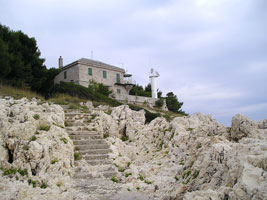
Located on the small island of Host in the entrance to the harbor of Vis, on the north side of the island. The lighthouse has been renovated for vacation accommodations. photo ARLHS # CRO-056 |
| HR 195 |
Stončica (Vis Island) |
This lighthouse functions as a landfall light for the Split region. Located on Rt Stončica, the eastern tip of Vis. There are boat tours that visit the lighthouse. photo ARLHS # CRO-146 |
| HR 196 |
Podšćedro |
Located near the western tip of Otok Šćedro, an island about 8 km long off the south coast of Otok Hvar. photo |
| HR 198 |
Barjak Mali
Located on Mali Barjak, a rocky islet off the northwestern tip of Otok Vis. ARLHS # CRO-028
Photo courtesy marinas.com [marinas.com] |
|
| HR 199 |
Lovišće
latitude 43° 2' 50.1" N longitude 17° 3.2" E |
Located at the extreme tip of Rt Lovište. photo ARLHS # CRO-088 |
| HR 200 |
Otočić Plocica (Korčula Canal)
Pločica is a small, teardrop-shaped island in the Hvarski Kanal about 6 km north of Prigradica, Korčula. Located on the highest point of the island. The house is available for vacation accommodations. ARLHS # CRO-013
Photo courtesy marinas.com [marinas.com] |
|
| HR 201 |
| Osičac
latitude 43° 36.9" N longitude 17° 17.3" E
Located on Rt Osicac, marking the north side of the western entrance to the Pelješki Kanal separating the Pelješac Peninsula from the island of Korčula. There does not appear to be any road access to the site. ARLHS # CRO-108
Photo courtesy Isabella Carchia [Flickr] |
| HR 202 |
Stupišće (Vis Island) |
Located on the southwestern tip of Otok Vis. ARLHS # CRO-150 |
| HR 203 |
Kobila (Bievo Island) |
ARLHS # CRO-067 |
| HR 204 |
Kneza Vela (Peljeki Canal) |
ARLHS # CRO-066 |
| HR 205 |
Sveti Ivan |
ARLHS # CRO-159 |
| HR 206 |
Mali kojic |
ARLHS # CRO-091 |
| HR 207 |
Proizd Island |
Located at the eastern end of Otočić Proizd, a small island off the northeastern tip of Korčula. photo ARLHS # CRO-122 |
| HR 208 |
Kamenjak (near Vela Luka) |
ARLHS # CRO-063 |
| HR 209 |
Otok Sestrice Vela (Peljeski Canal)
This is probably the least well known of three Croatian lighthouses called Sestrice Vela (big sister). Located on one of several small islands in the eastern entrance to the Pelješki Kanal (Pelješki Channel) about 2.5 km southwest of Podstub. (E 3482) ARLHS # CRO-016
Photo courtesy Douglas Cameron [ListOfLights] |
|
| HR 210 |
Vranac (Korcula Island) |
ARLHS # CRO-194 |
| HR 211 |
Badija Island |
The island provides the weather block for Domice, thus ferries need to jog around the island. The light is probably on the NW corner ARLHS # CRO-025 |
| HR 212 |
Stupe Vele |
ARLHS # CRO-149 |
| HR 213 |
Velo Dance (Korcula Island) |
Located on the southwestern tip of Kor?ula, about 7 km southwest of Vela Luka. photo ARLHS # CRO-186 |
| HR 214 |
Blaca
latitude 42° 55' 30" N longitude 17° 31' 6.8" E |
Located on Rt Blaca, a promontory on the north side of the peninsula, about 3 km northwest of Brijesta. ARLHS # CRO-032 |
| HR 215 |
Ražnjić Korcula |
Located on Rt Ražnjic, the easternmost point of Korčula. There does not appear to be any road access to the site. photo ARLHS # CRO-130 |
| HR 216 |
Veli Zaglav (Korcula Island) |
ARLHS # CRO-184 |
| HR 217 |
Lirica (Mljetski Canal)
latitude 42° 52' 26.3" N longitude 17° 25' 35.1" E |
Located on a small island off a promontory about 5 km southeast of Trstenik, on the south coast of the peninsula. photo ARLHS # CRO-086 |
| HR 218 |
Tajan Velji (Lastovski Canal)
latitude 42° 48' 57.1" N longitude 16° 59' 28.2" E |
Located on an islet about 8 km northeast of Lastovo. photo ARLHS # CRO-171 |
| HR 218D |
Donji RT (near Slano) |
This light marks the entrance to the protected bay of Slano. Located on a promontory of the mainland about 50 km northwest of Dubrovnik. ARLHS # CRO-039 |
| HR 219 |
Pod Mrcaru |
ARLHS # CRO-116 |
| HR 220 |
Glavat
latitude 42° 45' 56.4" N longitude 17° 8' 45.1" E
This important but rather poorly-known lighthouse is located on a small island midway between Lastovo and Mljet, marking the end of a dangerous reef. ARLHS # CRO-004
Photo courtesy Brian Domander [Flickr] |
|
| HR 221 |
Olipa
latitude 42° 45' 29.5" N longitude 17° 46' 36.1" E |
Olipa is the westernmost of the Elaphiti islands, an archipelago of small islands stretching along the mainland coast between the base of the Pelješac Peninsula and Dubrovnik. The lighthouse guards the entrance to the Kolocepski Kanal, the protected passage between the islands and the mainland. Located on the southeastern point of Otočić Olipa. photo ARLHS # CRO-008 |
| HR 222 |
Kanula (Susac Island) |
ARLHS # CRO-064 |
| HR 223 |
Kremene (Prezba Island) |
ARLHS # CRO-074 |
| HR 225 |
Tiha (Sipan Island) |
ARLHS # CRO-173 |
| HR 226 |
Otok Sušac {Isola Cazza}
latitude 42° 44' 59.3" N longitude 16° 29' 27" E
Sušac (formerly called Cazza) is a rugged, uninhabited island about 20 km west of Lastovo and a similar distance southwest of Korčula. Located on heights at the southwestern end of the island. The lighthouse has been renovated for vacation accommodations, with two apartments; transportation is provided from Split. ARLHS # CRO-011
Photo courtesy marinas.com [marinas.com] |
|
| HR 227 |
Otok Milet (Sobra)
latitude 42° 44' 41.6" N longitude 17° 36' 38.4" E |
Located on the tip of the peninsula sheltering the harbor of Sobra, on the north coast of Mljet. There must be good views from ferries arriving from Korčula or Dubrovnik. photo ARLHS # CRO-211 |
| HR 228 |
Pusti (Mljet Island) |
ARLHS # CRO-124 |
| HR 229 |
Struga (Lastovo Island)
This lighthouse is on Lastovo, an inhabited island about 10 km south of Korčula. Located on Rt Struga, a sharp cape on the south side of the island; accessible by a gravel road. ARLHS # CRO-148
Photo courtesy Stefan Schulze [Flickr] |
|
| HR 231 |
Daksa
latitude 42° 40' 13.4" N longitude 18° 3' 20.6" E
Located at the northern tip of Otočić Daksa, an island protecting the entrance to Dubrovnik harbor. It looks like both the "old" and the "new" light are both in this photo. ARLHS # CRO-037
Photo courtesy Karen Rustad [Flickr] |
|
| HR 232 |
| Grebeni {Pettini}
latitude 42° 39' 5.6" N longitude 18° 2' 52.4" E
Located on Hrid Grebeni, a small island about 1/2 mile offshore on the west side of Dubrovnik. Accessible only by boat, but clearly there are fine views from the mainland. (E 3598) ARLHS # CRO-054
Photo courtesy Alex Trabas [ListOfLights] |
| HR 233 |
Bezdanj (Kolocep Island) |
ARLHS # CRO-030 |
| HR 234 |
Sveti Andrija
The lighthouse has been renovated for vacation accommodations. This is a landfall light for Dubrovnik. Located on Otočić? Sv. Andrija, a small island about 13 km west of Dubrovnik. ARLHS # CRO-001
Photo courtesy marinas.com [marinas.com] |
|
| HR 235 |
Dubrovnik |
ARLHS # CRO-203 |
| HR 236 |
Sveti Roko |
ARLHS # CRO-169 |
| HR 237 |
Veliki kolj |
ARLHS # CRO-185 |
| HR 238 |
Oštra (Prevlaka) |
Located on a bluff at the end of a sharp promontory at Prevlaka, about 35 km southeast of Dubrovnik (this is the southernmost point of Croatia). Mumula is on the other side of the strait. ME8 ARLHS # CRO-111 |
| HR 239 |
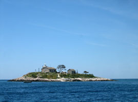
Otočić Palagruza
An infamous hazard to navigation in the Adriatic, Palagruža is an isolated island in the middle of the Adriatic, 48 km south of Lastovo. The island is a sharp ridge of rock 7/8 mile long and about 330 yd wide. Construction of the lighthouse at the highest point of this isolated island was a considerable engineering triumph. Two apartments in the large building are available for vacation accommodations, with boat transportation provided from Korčula. ARLHS # CRO-012
Photo courtesy Cecilia Balint [Flickr] |
|
|
|
 Slovenia


