|
This page shows pictures of that portion of Lake Erie that you can access by car and portions of Lake St. Clair. There are semi-entries to describe the lights I haven't personally visited. The lights in Lake Erie are numbered starting at Detroit and then going counter-clockwise, thus across the Southern shore, up through Niagara Falls and across the North. Copies of my pictures are stored on the Web if you want to download them. If you click on the pictures below, they will take you directly to Flickr for that particular photo (well, or maybe a similar photo of the same light). webshots Orange numbers in parenthesis are references to the Shanklin List of all US lights. p2 Index numbers are from Great Lakes Lighthouses American & Canadian p1 |
|
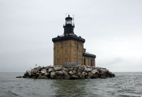
| 0.5 |
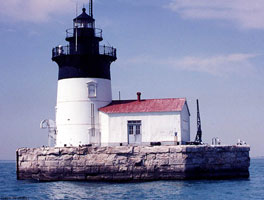
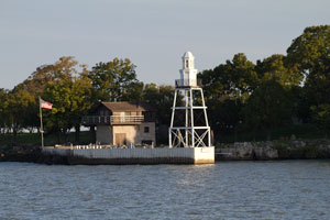
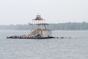
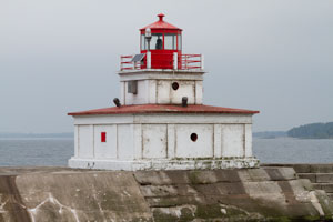
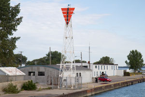
Detroit River (Bar Point Shoal) (MI 111)
latitude 42° 2.9" N longitude 83° 8' 28.7" W
access: boat
Located south of the entrance to the Detroit River from Lake Erie. The station is an active aid to navigation and is only visible from a boat. ARLHS # USA-227
Photo courtesy Dave Wobser [boatnerd] |
|
| 1 |
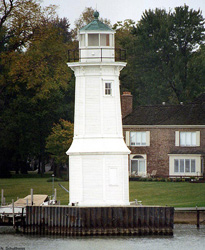
| Grosse Ile N. Channel Front Range (MI 110)
latitude 42° 10' 5.3" N longitude 83° 8' 23.5" W
access: boat
Since it is on private land, visitors must be escorted to the light by members of the Grosse Isle Historical Society. ARLHS # USA-357
Photo courtesy Dave Wobser [boatnerd] |
| 1.1 |
Harsens Island Range St. Clair Flats Front Range (MI 105H) |
The front range light is on a 26 ft cylindrical steel tower 525 ft south. Located on the St. Clair River just upstream from Lake St. Clair. Accessible only by boat, visible from the end of South Channel Drive (extension of MI 154) south of Clay's Landing |
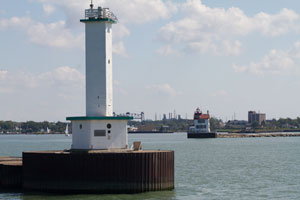
| 2.1 |
St. Clair Flats Old Channel (MI 106) |
Located southwest of Harsens Island marking a channel from Lake St. Clair into the St. Clair River (but not the channel now used). Accessible only by boat, visible from the end of South Channel Drive (extension of MI 154) south of Clay's Landing. ARLHS # USA-790 |
| 2.3 |
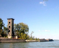
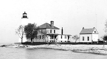
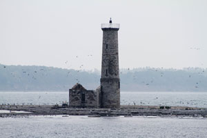
| Peche Island (MI 105)
latitude 42° 42' 58.9" N longitude 82° 29' 29.8" W
June 15, 2007 access: car
Once physically on Lake St. Claire, this light house has been moved to Marine City. ARLHS # USA-586 |
| 3 |
Lake St. Clair (MI 107)
access: boat
Located in the middle of Lake St. Clair. Accessible only by boat. ARLHS # USA-426
Photo courtesy Dave Wobser [boatnerd] |
|
| 4 |
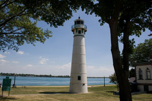
| Windmill Point (MI 108)
latitude 42° 21' 27.4" N longitude 82° 55' 47.5" W
June 15, 2007 access: car
Located in Mariner's Park, at the end of Alter Road in Grosse Pointe, this is at the Detroit River entrance from Lake St. Clair, a little over a mile east of Belle Isle. ARLHS # USA-896 |
| 5 |
Livingston Memorial (MI 109)
latitude 42° 20' 49.2" N longitude 82° 57' 15.1" W
June 15, 2007 access: car
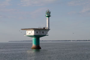
Located at the eastern end of Belle Isle Park on Belle Isle in the Detroit River. park ARLHS # USA-978 |
|
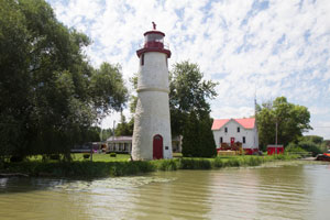
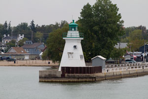
| 5.1 |
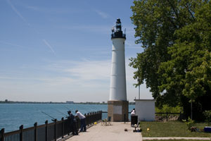
| Palmer Park (faux) (MI 111A)
latitude 42° 25' 20" N longitude 83° 6' 42.7" W
September 3, 2010 access: car
Alone on an island in Lake Frances, it is unlikely that any boat will need illumination from this lighthouse.
1880 photo
Exit I-75 at McClintock and travel west past Woodward. Navigate behind the Palmer Park apartments and park at the Civil Defense offices. Walk to the Northwest corner of the lake. |
| 5.5 |
Mariners Memorial light (faux) (MI 111M)
latitude 42° 16' 15" N longitude 83° 6' 40.2" W
August 3, 2015 access: car
The most recent light in Michigan, this was activated in 2004.
Exit I-75 south at exit 43A, follow the ramp to Coolidge. Go 2.3 miles then left on W Jefferson. Go 0.4 miles and right on Marion, then another 0.7 miles to a right turn. In 0.4 miles, turn left onto Bellanger Park dr, then 0.5 miles. |

|
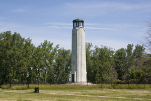
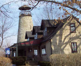
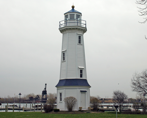
| 6 |
| Detroit Lighthouse Depot (MI 109A)
latitude 42° 20' 27.9" N longitude 83° 32.1" W
June 15, 2007 access: car
Located at the foot of Mt. Elliott St. Follow Jefferson North from the Ren Center, turn right just before the Belle Isle Bridge.
This has never been an aid to navigation, but has strongly influenced all the Michigan Lights built after 1871. |
| 6.5 |
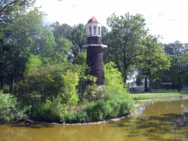
Tawas Point Replica (MI 109T)
latitude 42° 19' 56" N longitude 83° 1' 29.8" W |
Located right on Detroit's waterfront in the William G. Miliken State Park. The park can be accessed on Atwater Drive at the foot of St.Aubin Road. |
| 7 |
Thames River Rear Range (ON 84)
latitude 42° 19' 8.6" N longitude 82° 27' 13.7" W
August 3, 2015 access: car
In Ontario, at the mouth of the Thames River near Tilbury. This light was built as a result of the war of 1812 making it the second oldest light in Ontario. The lighthouse is on private property, but can be seen from the north side near the boat launch.
Exit off highway 2 in the center of town and follow the signs to Lighthouse Cove. If the bridge is closed, go west 2 right turns past hwy 401, then ditto. ARLHS # CAN-594 |
|
Lake Erie proper
| 3 |
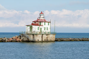
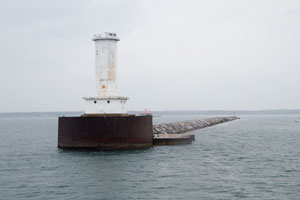
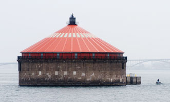
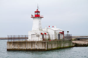
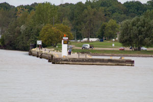
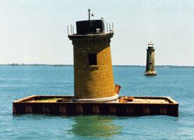
| Toledo Harbor (OH 1)
latitude 41° 45' 42.5" N longitude 83° 19' 44.4" W
August 19, 2007 access: boat
Being 8.4 miles from the mouth of the river, this is a boat trip or nothing. We decided a one day trip on my birthday would be fun. The weather didn't cooperate (too much, but then you'll notice it's not raining as I took this picture.) ARLHS # USA-853 |
| 4 |
Turtle Island (OH 2)
latitude 41° 45' 9" N longitude 83° 23' 27.6" W
access: boat
The light is still privately owned. Physically it is in both Michigan and Ohio, so development is an issue. The island now offers vacation rentals for visitors wishing to stay overnight on the island. rentals ARLHS # USA-859
Photo courtesy dscn0220 [Webshots] |
|
| 4.2 |
| Toledo Front Manhattan Range (OH 3)
June 15, 2007 access: boat
The current rear light is on the sewage disposal plant and can be seen from Summit Street. From I-280, take the the Summit Street exit north for 1.3 miles. The Front Light is actually in the river. ARLHS # USA-1089 |
| 4.3 |
Toledo Rear Manhattan Range (OH 3R) |
ARLHS # USA-927 |
| 4.5 |
Toledo Front (original) Manhattan Range (OH 3Fo)
latitude 41° 40' 37.4" N longitude 83° 29' 53.9" W |
Established in 1913 to replace an earlier structure, the Manhattan range lights served to guide mariners on their final entry into the Maumee River. Obsoleted in the 1980’s, the front range tower was given to local manufacturer Hansen Industries, who relocated it to their parking lot at 2824 N. Summit Street in Toledo. You can photograph this light from the sidewalk in front of the factory gates. |
| 4.7 |
Toledo Rear (original) Manhattan Range (OH 3Ro)
latitude 41° 37' 7.7" N longitude 83° 34' 36.7" W |
The rear range tower of the 1913 Manhattan range lights was given to a Toledo restaurant after the lights were eliminated in the 1980’s. The light was transported across town and re-erected in the restaurant parking alongside the Maumee River. While the restaurant had gone out of business the last time we visited, the tower is still standing in the parking lot at 2605 Broadway Street. |
| 5 |
West Sister Island (OH 4)
access: boat
Located on West Sister Island, roughly midway between Toledo and Put-In-Bay and eight miles from shore. ARLHS # USA-882
Photo courtesy US Coast Guard [wikipedia] |
|
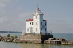
| 6 |
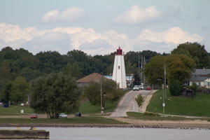
| Old Port Clinton (OH 5)
latitude 41° 30' 57.3" N longitude 82° 56' 12.1" W
September 25, 2011 access: car
This is actually only the top portion of the lighthouse that once stood at the west river entrance. (There was also an east lighthouse in the 1800s.)
Moved in 2016 to a public park. ARLHS # CAN-914 |
| 7 |
South Bass Island (OH 6)
latitude 41° 37' 44.5" N longitude 82° 50' 20.2" W
September 21, 2011 access: ferry + cart ride
First lit in 1892, it was in operation until 1962. The skeletal tower behind the original building is the modern optic.
take the ferry from Catawba or Port Clinton, then rent a golf cart and drive to the south edge of the island. ARLHS # USA-769 |
|
|
|
| 7.2 |
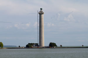
| Perry Memorial Monument (OH 7)
latitude 41° 39' 15.1" N longitude 82° 48' 43.2" W
September 21, 2011 access: ferry
This structure isn't a lighthouse at all, but it is one of the most widely recognized structures on Lake Erie from the water. The light is 2.3 miles from the ferry landing you would take to the South Bass Island. ARLHS # USA-1317 |
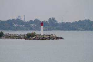
| 7.5 |
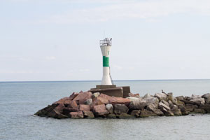
Rattlesnake Island (OH 7R)
latitude 41° 40' 49.8" N longitude 82° 51' 18.3" W
September 22, 2011 access: boat
Now a residence for threatened species and a private club. The light indicates the entrance to the harbor. |
|
| 8 |
| Marblehead (OH 8)
latitude 41° 32' 11.1" N longitude 82° 42' 42.4" W
March 29, 2001 access: car
This lighthouse is on the peninsula just north of Sandusky and is in a beautiful location. ARLHS # CAN-472 |
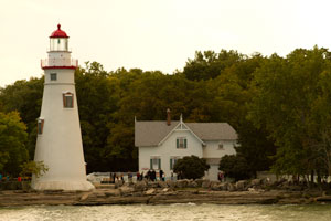
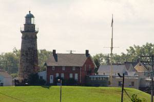
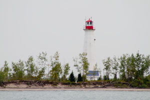
| 9 |
Cedar Point (restored) (OH 9)
latitude 41° 29' 17.6" N longitude 82° 41' 36.3" W
July 27, 2009 access: car
Located in Lighthouse Point a collection of lakeside cottages, RV park, camping spots, at the northern end of Cedar Point (thus, within the parking area of the amusement park), a peninsula near Sandusky. Cedar Point ARLHS # USA-926 |
|
| 9.3 |
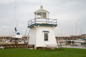
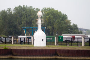
| Cedar Point Chausee (faux) (OH 9C)
latitude 41° 25' 52.1" N longitude 82° 37' 5.5" W
September 25, 2011 access: boat
It looks like this light marks the harbor for the condos at the east end of Cedar Point. It is not an official aid to navigation. |
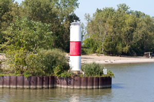
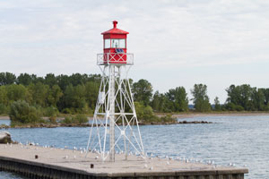
| 10 |
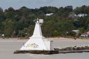
Huron Harbor (OH 10)
latitude 41° 24' 17" N longitude 82° 32' 37.9" W
August 17, 2008 access: car
Located at the end of the pier on the west side of the entrance to the Huron River near Huron.
From Ohio route 6, turn north on Tiffin Avenue to Nickle Plate Beach. ARLHS # USA-393 |
|
| 11 |
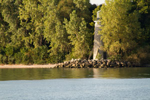
| Vermilion (replica) (OH 11)
March 29, 2001 access: car
Adjacent to the old home for Inland Seas Maritime Museum, this is replica built in the 1990s. The original light was dismantled and sent to Ontario (see the East Charity Shoals light). The museum looks like it is worth the visit, so stop by and check it out. The word is they are moving to the lakefront in Lorain. NY22 ARLHS # USA-868 |
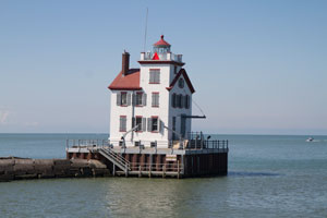
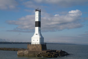
| 12 |
Lorain W. Breakwater (OH 12)
latitude 41° 28' 39.7" N longitude 82° 11' 25.4" W
September 25, 2011 access: car
The best view is from the city pier (off US 6 on the east side of the river) or from Lakeview park (about a mile west of the river on US6. Or, you can sit at your table in the Jackalope Lakeside (near the pier) Jackalope ARLHS # USA-1037 |
|
| 13 |
| Lorain E. Breakwater (OH 12B)
latitude 41° 28' 42.1" N longitude 82° 11' 17.6" W
September 25, 2011 access: car
I'm not sure this is any more than a daymark as there is no visible light from where we stood. ARLHS # USA-453 |
| 14 |
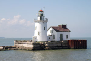
Cleveland W. Pierhead (OH 13)
latitude 41° 30' 32.3" N longitude 81° 43' 3.7" W
September 25, 2011 access: boat or car
The best way to view this light is from the Goodtime III, which offers cruises of the Cleveland Harbor and Cuyahoga River. Distant views of the light are from VoinovichPark at the East Ninth Street Pier, right behind the Rock and Roll Hall of Fame. The lighthouse can likely also be viewed while enjoying lunch or dinner aboard the Nautica Queen. We took this photo at the base of the Brown's stadium. goodtime ARLHS # USA-178 |
|
| 15 |
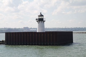
| Cleveland E. Pierhead (OH 14)
latitude 41° 30' 36.7" N longitude 81° 42' 55.4" W
September 25, 2011 access: car
see thoughts above. We took this photo as we drove west over the river. ARLHS # USA-177 |
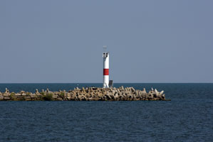
| 15.1 |
Cleveland E. Entrance (OH 15)
latitude 41° 32' 35.1" N longitude 81° 39' 4.3" W
September 25, 2011 access: car
From Interstate 90/Highway 2, take the East 55th Street)Exit, and go northeast to Cleveland Lakefront State Park, where you will see the light at the end of the offshore breakwater. park ARLHS # USA-176 |
|
| 15.8 |
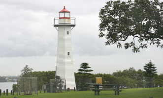
| Point Cleveland (OH 15A)
access: none
The lighthouse is easily accessible in a public reserve at Cleveland Point a short distance from Cleveland, Queensland.
Unfortunately, this lighthouse is in Cleveland, Queensland (Australia) so nearly 13,000 miles away. I'm going to leave the photo here until I get the Australia pages working, but it's not in Cleveland OH.
Photo courtesy cindytoo [Flickr] |
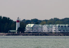
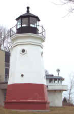
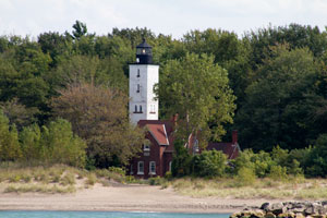
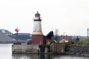
| 16 |
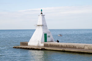
Fairport W. Breakwater (OH 16)
latitude 41° 46' 4.4" N longitude 81° 16' 52.3" W
September 25, 2011 access: boat
At the end of a breakwater accessed only through a Coast Guard Station, this is best seen from a boat. We took this picture from the Harbor beach park. ARLHS # USA-280 |
|
| 16 |
| Fairport Harbor (OH 16H)
latitude 41° 46' 4.4" N longitude 81° 16' 52.3" W
September 25, 2011 access: boat
On the East side of the harbor as you work your way in from the Fairport Breakwater light. This is a simple pole light and many would not classify it as a "lighthouse". |
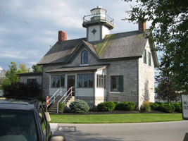
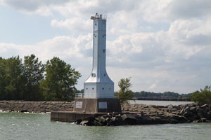
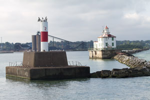
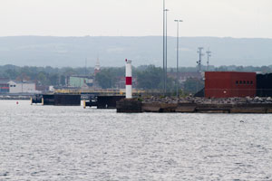
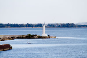
| 17 |
Fairport Main (Grand River) (OH 17)
latitude 41° 45' 25.2" N longitude 81° 16' 38.3" W
March 28, 2001 access: car
Built in 1871, this light is now part of a Maritime Museum.
It's right in downtown Fairport, near the river and the beach park. ARLHS # USA-279 |
|
| 17.1 |
| Conneaut W. Breakwater (OH 19)
September 25, 2011 access: car + walk
Located at the end of the breakwater west of the entrance to Conneaut Harbor. Accessible by walking the pier, there's also a good view from Lakeview City Park. ARLHS # USA-190 |
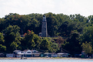
| 18 |
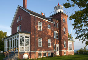
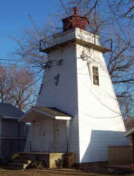
Ashtabula (OH 18)
latitude 41° 55' 6.6" N longitude 80° 47' 45.2" W
September 25, 2011 access: boat
This light was automated in 1973, allegedly the last staffed lighthouse on the great lakes. lhsociety ARLHS # USA-020 |
|
| 18.3 |
| Ashtabula East (OH 18E)
latitude 41° 55' 11.8" N longitude 80° 47' 32.7" W
September 25, 2011 access: boat
A simple pole light marking the east side of the entrance to the Ashtabula harbor. |
| 18.6 |
Ashtabula Outer (OH 18O)
latitude 41° 55' 11.8" N longitude 80° 47' 41.4" W
September 25, 2011 access: boat
When the breakwater was extended, the old light was no longer effective and a simple pole lamp was built to define the new west entrance. |
|
| 18.6 |
| Grand Lake St. Mary (OH 20)
access: car
Located south of State Route 703 on the northern shore of Grand Lake St. Marys east of Celina in Jefferson Township, Mercer County, Ohio, United States. Built in 1923, it is listed on the National Register of Historic Places. ARLHS # USA-928
Photo courtesy Nyttend [wikipedia] |
|
|
| 18.8 |
Green Island (ruins) (OH 21) |
Green Island is a small island of the U.S. state of Ohio, in Lake Erie. It is located approximately three miles southwest of Put-in-Bay. ARLHS # USA-353 |
| 19 |
Erie Pierhead (PA 2)
latitude 42° 9' 22.4" N longitude 80° 4' 15.3" W
September 22, 2011 access: car + walk
Built in 1927, this light is a long way from Erie, and not very impressive. ARLHS # USA-274 |
|
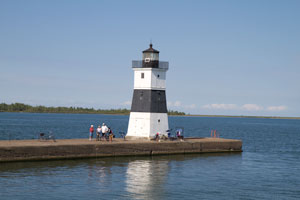
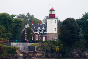
| 20 |
| Presque Isle (PA 1)
September 25, 2011 access: car
In the Presque Isle park of Erie PA, this is a very neat lighthouse. It is the residence of the park manager, but visible from the lake side. ARLHS # USA-666 |
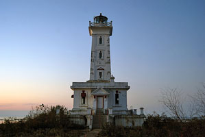
| 21 |
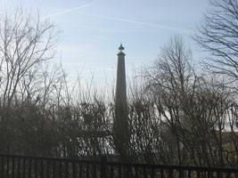
Erie Land (PA 3)
latitude 42° 8' 38.2" N longitude 80° 3' 43.9" W
September 22, 2011 access: car
Built in 1867, this and Buffalo Main are said to be the oldest lights on Lake Erie. Although abandoned in 1900, it is still in good shape. ARLHS # USA-921 |
|
| 22 |
| Barcelona (Portland Harbor) (NY 1)
latitude 42° 20' 29.9" N longitude 79° 35' 31.6" W
March 28, 2001 access: car
This tower was built with local stone and was originally powered by Natural Gas.
The lighthouse is right on the lake road, but it is on private land. ARLHS # USA-038 |
| 23 |
Dunkirk Main (Point Gratiot) (NY 2)
latitude 42° 29' 37.9" N longitude 79° 21' 14.2" W
September 22, 2011 access: car
This light is part of a maritime museum that was closed when we first visited. As such, the view is pretty restricted. During the summer, when the museum is open, the trees pretty well obscure the light as well. From the water, viewing is also constrained by the trees. ARLHS # USA-248 |
|
| 23.6 |
| Dunkirk Pier (NY 2P)
latitude 42° 29' 34.8" N longitude 79° 20' 42.3" W
September 23, 2011 access: boat
This light marks the entrance to the harbor near the power plant in Dunkirk. |
| 24 |
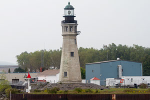
South Buffalo (NY 3)
latitude 42° 50' 7.4" N longitude 78° 52' 2.1" W
September 22, 2011 access: car + walk or boat
If you are coming from the Buffalo Main Lighthouse, just drive south on Fuhrmann Boulevard for about 3 miles to just beyond Tift Street. It's necessary to get on the foot bridge across the canal to see lighthouse. ARLHS # USA-770 |
|
| 25 |
| Buffalo Breakwater (NY 3A)
latitude 42° 53' 4.1" N longitude 78° 54' 5.3" W
September 22, 2011 access: boat
The light is visible from NY5 just north of the coast guard station.
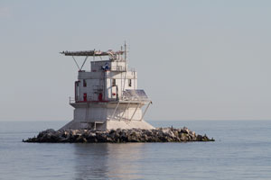
The best views are from the water. ARLHS # USA-1302 |
| 26 |
Buffalo Intake Crib (NY 3B)
September 22, 2011 access: boat
Well out in the channel, this is a unique lighthouse, but difficult to see. It is intended as a fresh water intake, but protected by a light. This photo is taken from the Buffalo Main Light. ARLHS # USA-1301 |
|
| 26.5 |
Buffalo South Breakwater (leaning) (NY 3C) |
ARLHS # USA-091 |
| 27 |
Buffalo Harbor (NY 4)
latitude 42° 52' 39.6" N longitude 78° 53' 24.3" W
September 22, 2011 access: car
Built in 1903, it looks more appropriate for a Jules Verne movie than a functional light. Typically placed on the end of a pier. ARLHS # USA-770 |
|
| 28 |
| Buffalo Main (Old) (NY 5)
latitude 42° 52' 40.1" N longitude 78° 53' 21.8" W
September 22, 2011 access: car
This light was built in 1833 replacing a beacon built in 1818. It is built of limestone and has withstood time very well at the mouth of the Buffalo River.
This is on the site of the Coast Guard Station, so 9/11 security may complicate viewing. ARLHS # USA-090 |
| 28.5 |
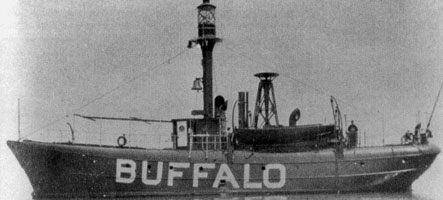
Buffalo Lightship (NY 5A)
access: none
This ship was built in 1882 and sank in 1913. |
|
| 30 |
| Horseshoe Reef (ruins) (NY 6)
latitude 42° 52' 52.6" N longitude 78° 54' 54.2" W
September 22, 2011 access: boat
Best viewed from the water, but a distant view is possible from the Buffalo Main Lighthouse. ARLHS # USA-386 |
| 31 |
Old Grand Island Front Range (NY 7)
latitude 42° 58' 33.9" N longitude 78° 56' 47.1" W
September 22, 2011 access: car
We're guessing this light was moved from the southern tip of Grand Island, but haven't found any verification of that fact. It currently is located in a Yacht Club at the corner of Bush and East River drive. The light is located within the Club on private property, but on a quiet Wednesday morning in April, nobody objected to us parking in their lot and taking a few pictures. ARLHS # USA-1144 |
|
| 32 |
| Point Abino (ON 1)
latitude 42° 50' 7.4" N longitude 79° 5' 42.6" W
access: boat or custom tour
This lighthouse is located at the end Point Abino Road which sits in a private community of mostly wealthy US citizens. ARLHS # CAN-385
Photo courtesy Dave Johnson [Flickr] |
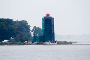
| 32 |
Point Abino (under reconstruction) (ON 1A)
latitude 42° 50' 7.4" N longitude 79° 5' 42.6" W
September 22, 2011 access: boat
This lighthouse is located at the end Point Abino Road which sits in a private community of mostly wealthy US citizens. This photo from the water shows what it is like while under construction. ARLHS # CAN-385 |
|
| 32.2 |
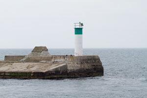
| Port Colborne Outer (ON 1O)
latitude 42° 51' 45.6" N longitude 79° 15' 17.3" W
September 23, 2011 access: boat
This little lighthouse marks the southern entrance to the Welland Canal. Located at the south end of the T-shaped west breakwater at the canal entrance in Port Colborne. Visible distantly from Lakeview Park at the end of Elm Street. Accessible only by boat (breakwater does not connect to shore). canal |
| 32.3 |
Port Colborne Inner (ON 1I)
latitude 42° 52' 3.2" N longitude 79° 15' 9.9" W
September 23, 2011 access: car
Located at the northeast end of the T-shaped west breakwater at the canal entrance in Port Colborne. Visible distantly from Lakeview Park at the end of Elm Street. |
|
| 32.5 |
| Port Colborne East (ON 1E)
latitude 42° 52' 0.1" N longitude 79° 15' 1.6" W
September 23, 2011 access: boat
Marks the east side of the south entrance to the Welland canal. From here boats have 8 locks to navigate and travel time is about 11 hours. |
| 32.7 |
Port Colborne West (ON 1W)
latitude 42° 52' 0.1" N longitude 79° 15' 1.6" W
September 23, 2011 access: boat
Marks the westside of the Port Colbourne breakwater. |
|
| 33 |
| Mohawk Island (ON 2)
latitude 42° 50' 1.8" N longitude 79° 31' 21.3" W
September 23, 2014 access: car
From Ontario Highway 3 in Port Colborne, travel west on Niagara Region Highway 3. Continue through Lowbanks past Mohawk Point Road. Look for Dickhout Road. The next road is Pyle Road. Turn left (south) on Pyle. The lighthouse can be seen from the end of Pyle Road. ARLHS # CAN-324 |
| 34 |
Port Maitland Front Range (ON 3)
latitude 42° 51' 9.6" N longitude 79° 34' 47.8" W
September 23, 2011 access: car
Located at the end of the West Pier near Canal Feeder Road in Port Maitland. ARLHS # CAN-617 |
|
| 34.3 |
| Port Maitland East (ON 3E)
latitude 42° 51' 14.9" N longitude 79° 34' 40.5" W
September 23, 2011 access: car
Located at the East side of the entrance near Canal Feeder Road in Port Maitland. |
| 34 |
Port Maitland Rear Range (ON 3R)
latitude 42° 51' 49.5" N longitude 79° 34' 26.2" W
September 23, 2011 access: boat
Located behind the harbor near Canal Feeder Road in Port Maitland. |
|
| 35 |
| Port Dover (ON 4)
latitude 42° 46' 51.8" N longitude 80° 12' 6.1" W
September 23, 2011 access: car
A pyramidal wooden tower currently with aluminum siding. (Built in 1846, that probably is not original equipment.) ARLHS # CAN-616 |
| 35.5 |
Port Dover East (ON 4E)
latitude 42° 46' 52.4" N longitude 80° 12' 4" W
September 23, 2011 access: car
Standard Sewer Pipe light on the East Pier |
|
| 36 |
| Long Point (ON 6)
latitude 42° 32' 55.3" N longitude 80° 2' 58" W
September 23, 2011 access: boat
The light is at the far end of the point and is within a wildlife preservation area. The only way to see the light is by boat. ARLHS # CAN-580 |
| 37 |
Long Point Cut (ON 5)
latitude 42° 34' 54.1" N longitude 80° 23' 47.3" W
March 23, 2001 access: car
This used to protect a channel through the island that is now out of service. It is a private residence now. ARLHS # CAN-759 |
|
| 38 |
| Port Burwell West (ON 7W)
latitude 42° 38' 23.1" N longitude 80° 48' 26.3" W
September 22, 2011 access: boat
On the East Breakwater into the river, this light is still West of the main Light ARLHS # CAN-405 |
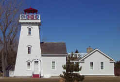
| 38.5 |
Port Burwell (ON 7)
latitude 42° 38' 42.5" N longitude 80° 48' 25.1" W
January 11, 2004 access: car
Built in 1840, the lighthouse is Canada's oldest wooden lighthouse. Although all the lumber used in the original structure came from the Big Otter Valley, the lamp mechanism had to be imported from France.
A museum is located directly across the street. |
|
| 39 |
| Port Stanley (ON 8)
latitude 42° 39' 18.6" N longitude 81° 12' 47.9" W
March 23, 2001 access: car
End of west pier, accessible only by telephoto lens from main pier. ARLHS # CAN-622 |
| 39.3 |
Erieau Front Range (ON 9F)
latitude 42° 8' 31.2" N longitude 82° 22' 30" W
September 21, 2011 access: car
A concrete tower on the west pier at Erieau. This entrance leads into Rondeau Bay |
|
| 39.5 |
| Erieau Rear Range (ON 9R)
latitude 42° 8' 31.2" N longitude 82° 22' 30" W
September 22, 2011 access: car
A skeletal tower at the middle of the west pier in Erieau This entrance leads into Rondeau Bay |
| 39.7 |
Erieau Exit (ON 9X)
latitude 42° 8' 31.2" N longitude 82° 22' 30" W
September 22, 2011 access: car
The exit light as you go into Rondeau Bay. It's on the west pier. |
|
| 40 |
| Erieau East Pier (ON 9)
access: car
This light is located at the end of the east pier in Erieau, near Rondeau Provincial Park. It can easily be seen and photographed from the west breakwater in Rondeau Harbour.
Photo courtesy ncattrysse [Webshots] |
| 41 |
Southeast Shoal Lightship (ON 10) |
From 1901 to 1910, SS Kewaunee was assigned to the Southeast Shoal |
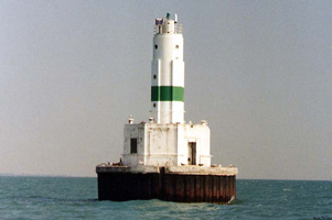
| 42 |
Southeast Shoal (ON 11)
latitude 41° 49' 25" N longitude 82° 28' 3.8" W
September 22, 2011 access: boat
The lighthouse marks the eastern end of the Pelee Passage and the beginning of the shallow portions of Lake Erie.
Accessible by boat only. ARLHS # CAN-468 |
|
| 43 |
Old Pelee Passage (ON 12) |
The reconstructed lighthouse is on the grounds of the Lakeview Park Marina in Windsor, Ontario. |
| 43.1 |
Pelee Passage (ON 12A)
latitude 41° 51' 22.2" N longitude 82° 34' 50.5" W
September 22, 2011 access: boat
The lighthouse marks the eastern end of the Pelee Passage and the beginning of the shallow portions of Lake Erie. The Southeast Shoal light marks the eastern edge of the Passage. ARLHS # CAN-371 |
|
| 44 |
| Pelee Island (ON 13)
latitude 41° 49' 54.9" N longitude 82° 38' 22.5" W
September 22, 2011 access: ferry
Pelee Island sits almost smack in the middle of Lake Erie. You can only get there by ferry - from either Leamington and Kingsville, Ontario or Sandusky, Ohio. ferry ARLHS # CAN-370 |
| 45 |
Leamington Light (ON 14)
March 23, 2001 access: car
Built as a private aid to navigation prior to an expansion of the modern harbor (sometime in the 1940s). It currently is located in a private residential area known as the Lighthouse Club. ARLHS # CAN-758 |
|
|
|
If you would like copies of any of my pictures, contact me and we'll discuss arrangements. There are others who do this commercially, I have no intention of competing directly, but you can make a proposal, and I'll react. mailto

 Lake Huron

