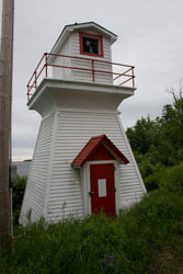
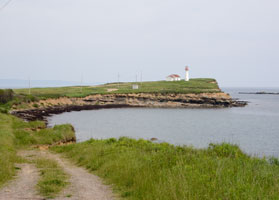
NS 1
[2] |
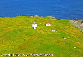
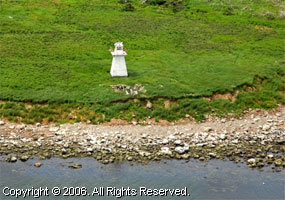
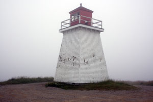
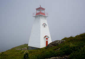
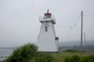
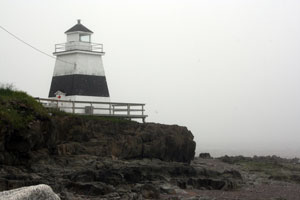
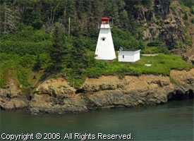
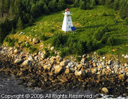
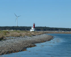
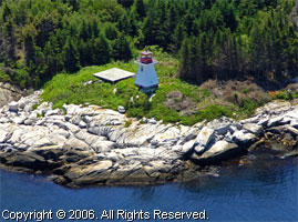
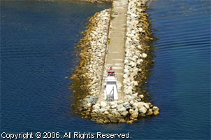
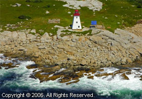
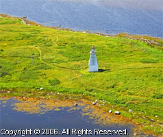
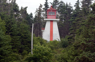
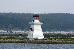
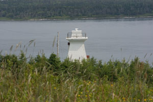
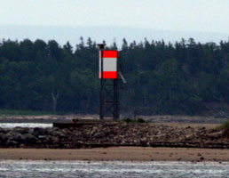
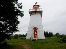
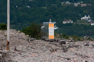
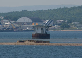
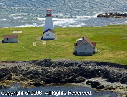
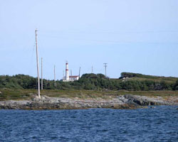
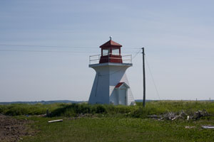
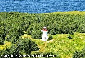
Bunker Island
It is rumored that Bunker Island Light can be seen from the road leading to Yarmouth Light at Cape Forchu. On July 8, 2008 the fog was so thick, we can't confirm that.
In Yarmouth follow Main Street to the Horse Monument and turn left on Vancouver Street. Watch for a Yarmouth Light sign ½ mile ahead; turn left onto Route 304. Follow the signs toward Yarmouth Light and watch for Bunker Island Light on your left. The lighthouse is sometimes accessible at low tide. (263) ARLHS # CAN 1287 |
|
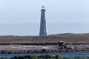
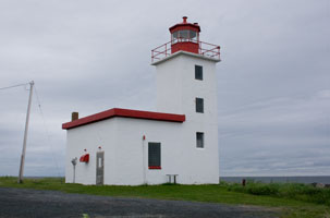
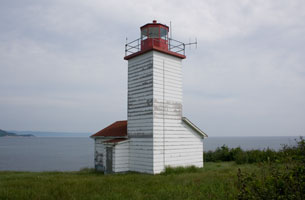
NS 2
[1] |
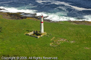
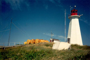
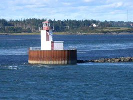
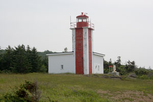
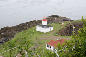
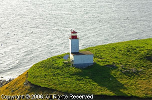
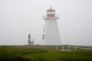
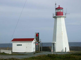
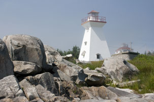
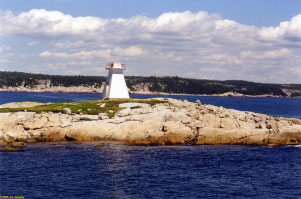
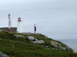
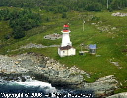
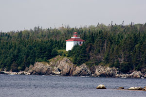
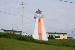
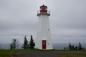
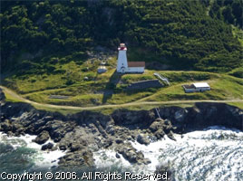
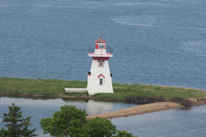
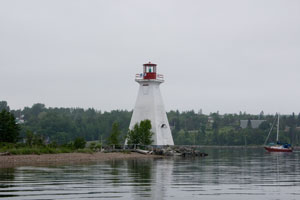
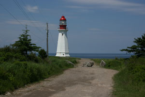
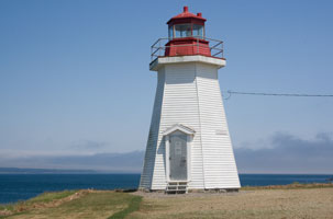
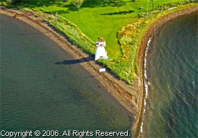
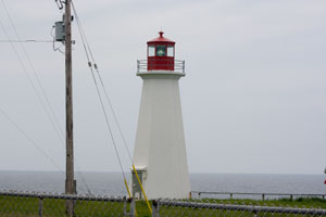
| Cape Forchu
latitude 43° 47' 40.9" N longitude 66° 9' 18.5" W
July 7, 2008
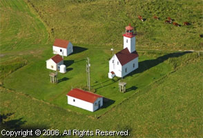
The Coast Guard decided in 1961 that the original Yarmouth Light must be replaced; area residents were surprised when the new tower turned out to be a radically different, slender tower, sometimes referred to as "apple core" shaped. The Friends of the Yarmouth Light Society runs a museum and gift shop in the keeper's house. (260) ARLHS # CAN 097 |
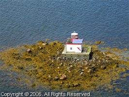
NS 2A
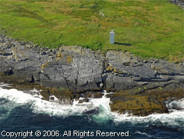
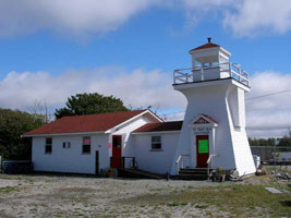
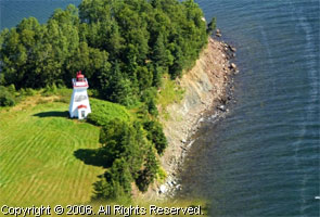
[1] |
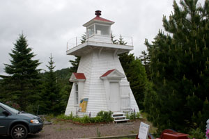
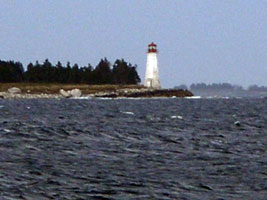
Yarmouth Bar |
(257) ARLHS # CAN 482 |
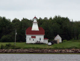
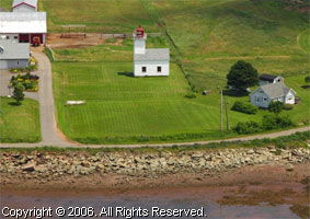
NS 3
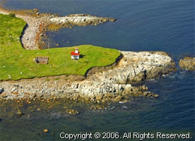
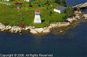
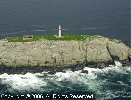
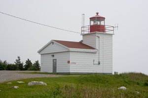
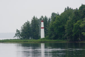
[3] |
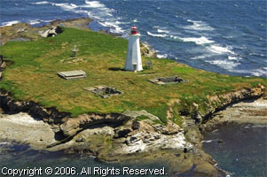
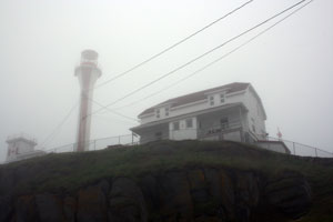
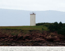
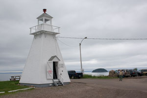
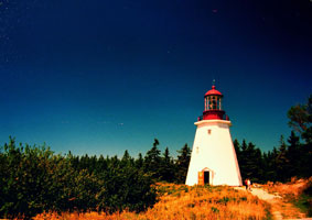
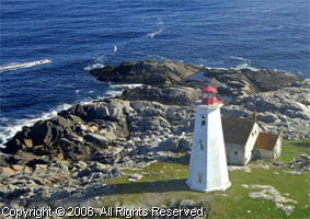
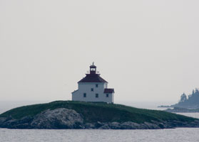
Cape St. Mary's
latitude 44° 5' 8.7" N longitude 66° 12' 39.7" W
July 7, 2008
In Mavilette, turn off Route 1 (Evangeline Trail) onto Cape St. Marys Road. (241) ARLHS # CAN 111 |
|
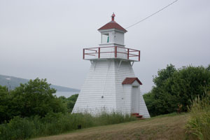
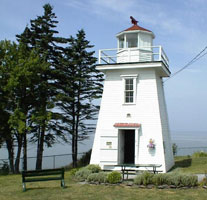
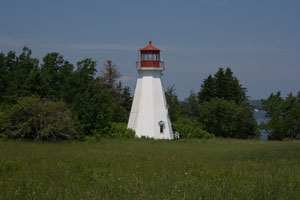
NS 4
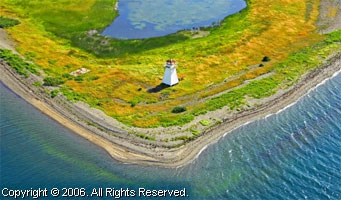
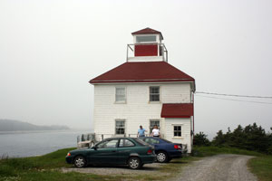
[5] |
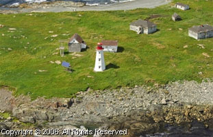
| Belliveau Cove
latitude 44° 23' 20.6" N longitude 66° 3' 49.7" W
July 7, 2008
There's a nice park and information center right on PH1. (234) ARLHS # CAN 030 |
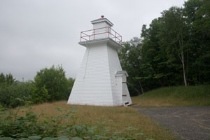
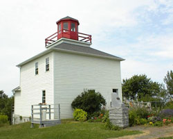
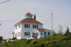
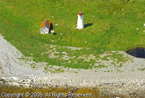
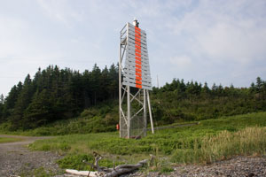
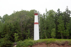
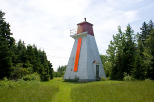
NS 4C
[4] |
Church Point
latitude 44° 19' 54.9" N longitude 66° 7' 33.1" W
July 7, 2008
From Route 1 (Evangeline Trail), take Le Chemin du Phare (Lighthouse Road) thru the University to its end and the lighthouse. ARLHS # CAN 138 |
|
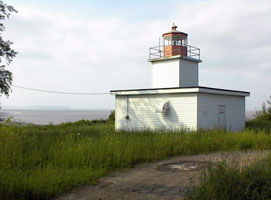
NS 4G
[6] |
| Gilbert's Cove
latitude 44° 29' 4.8" N longitude 65° 56' 52.2" W
July 7, 2008
Follow Lighthouse Road from Route 1 (Evangeline Trail) to the lighthouse. ARLHS # CAN 200 |
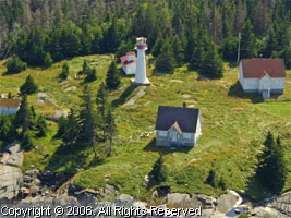
NS 5
[9] |
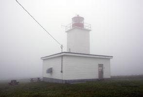
Brier Island (Western Light)
latitude 44° 14' 55.8" N longitude 66° 23' 33.4" W
July 8, 2008
Getting here will require 2 short ferry trips (and $10). Take 217 from Digby to Long Island (ferry on the 1/2 hour) and then to Brier Island (ferry on the hour.) Leaving the ferry dock, turn left, then turn right at the Robicheau General Merchant. Turn left at the end of the road and follow the sign to "Western light". (223) ARLHS # CAN 059 |
|
NS 6
[8] |
Grand Passage (Northern Light)
latitude 44° 17' 12.7" N longitude 66° 20' 35.5" W
July 8, 2008
See directions above to reach Brier Island. To reach the lighthouse from the ferry dock in Westport, turn right onto Water Street. Follow onto a gravel road to the end and the lighthouse. (221) ARLHS # CAN 206 |
|
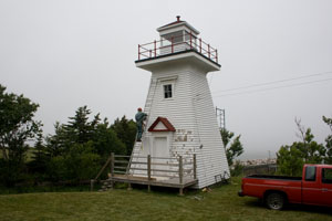
NS 7
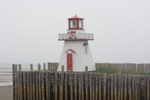
[7] |
| Boar's Head
latitude 44° 24' 14.6" N longitude 66° 12' 54.7" W
July 8, 2008
A ferry leaves East Ferry on the half-hour for Tiverton. Turn right from the ferry and follow a paved road to a gate. Follow the narrow road about ½ mile (up hill) on foot to the lighthouse. (216) ARLHS # CAN 047 |
NS 8
[10] |
Prim Point
latitude 44° 41' 29.8" N longitude 65° 47' 7.9" W
July 7, 2008
This lighthouse can be viewed from the ferry between St. John and Digby. To reach it by car, take Route 303 north in Digby. Past the intersection with Route 217, take a left on Lighthouse Road, then the first right. (Be careful not to confuse Prim Point in Nova Scotia with Point Prim on Prince Edward Island PE 26 (201) ARLHS # CAN 39/7 |
|
NS 9
[10] |
Digby Gut |
Access to the light is through private property.
The light is located 1.2km beyond Victoria Beach where there is a pathway down a steep bank to the light. (202) ARLHS # CAN 159 |
NS 10
[11] |
Bear River
latitude 44° 37' 1.6" N longitude 65° 41' 6.6" W
July 9, 2008
The lighthouse is accessible by car. From Route 101 from Digby, take Exit 24 and turn north. Travel 0.3 miles and turn sharp right on a small dirt road. This road leads to the lighthouse. ARLHS # CAN 027 |
|
NS 11
[14] |
| Victoria Beach
latitude 44° 40' 33" N longitude 65° 45' 15.4" W
July 9, 2008
From Route 1 take the exit that leads to Port Royal. Continue toward Victoria Beach. A short distance past a "Y" intersection in the road, take a left to the lighthouse. The lighthouse can be seen from the road. To get closer, it is necessary to walk across a private yard. (203) ARLHS # CAN 511 |
NS 12
[13] |
Schafner's Point
latitude 44° 42' 35.1" N longitude 65° 37' 8.7" W
July 9, 2008
From Route 1, follow the road to Port Royal. The lighthouse is about a half-mile past the historic Habitation at Port Royal. (210) ARLHS # CAN 452 |
|
NS 13
[13] |
| Annapolis Royal
latitude 44° 44' 40.2" N longitude 65° 31' 13" W
July 7, 2008
This lighthouse is easily accessible from Route 101. Take Route 8 into Annapolis Royal (it becomes St. George Street) and the lighthouse will be on your left. (211) ARLHS # CAN 013 |
NS 14
[15] |
Hampton
latitude 44° 54' 21.2" N longitude 65° 20' 57.9" W
July 7, 2008
Follow Highway 101 through Annapolis Valley; exit onto old Highway 1 towards Bridgetown. Turn right in Bridgetown on Church Street and follow over North Mountain to an intersection. Turn left and follow a short distance to Hampton. Look for a right turn to the wharf, beach and lighthouse. (198) ARLHS # CAN 222 |
|
NS 15
[16] |
| Port George
latitude 45° 16.7" N longitude 65° 9' 24.8" W
July 7, 2008
From Route 101, take Exit 18. Go left on Junction Road. At a stop sign turn left in Route 362 North and proceed about three miles to a stop sign at Moshers Corner. Go left and continue about 3.5 miles to the lighthouse. ARLHS # CAN 406 |
NS 16
[17] |
Margaretsville (Peter's Point)
July 7, 2008
From Route 101 take Exit 18 or 18A, (Middleton). Go north to Route 221 and turn right to Route 362, then left onto Route 362 for 6 miles to Margaretsville. (195) ARLHS # CAN 306 |
|
NS 17
[18] |
Black Rock |
Note carefully that this Black Rock light is on the mainland, not to be confused with Black Rock Point NS 87A
From Route 101, take Exit 15 and follow Route 360 North to Elsford. Turn right at Route 221 East and follow to Grafton. At an intersection turn left and drive to Canada Creek. At a stop sign turn right on a gravel road and follow to the lighthouse. (193) ARLHS # CAN 042 |
NS 17A
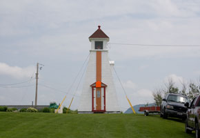
[18] |
Bass River (Saints Rest)
Built in 1907 on the point at the western side of entrance to the Bass River. The light was the easternmost beacon on Cobequid Bay, the eastern section of Minas Basin and the Bay of Fundy.
Location: North shore of Cobequid Bay, Bay of Fundy. ARLHS # CAN 023
Photo courtesy Doug Mercer [Flickr] |
|
NS 17B
[24] |
| Five Islands (Sand Point)
latitude 45° 23' 59.4" N longitude 64° 4' 11.6" W
June 28, 2008
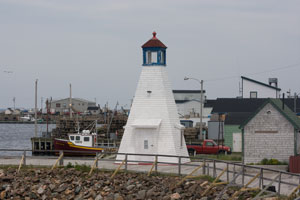
The Sand Point lighthouse was saved from destruction by the Five Islands Lighthouse Preservation Society. In 1996 it was moved from its eroding base to an adjacent campground. ARLHS # CAN 179 |
NS 18
[22] |
Parrsboro
latitude 45° 22' 40.9" N longitude 64° 19' 16.3" W
June 28, 2008
The lighthouse is at the end of Wharf Road, at the end of a breakwater in Parrsboro Harbour. The walk on the breakwater is strenuous. Or you can drive out Pier road and take the photo across the water (using the long lens). (172) ARLHS # CAN 364 |
|
NS 18A
[23] |
| Cape Sharp
From Route 102, take Exit #15 onto Route 104 towards New Brunswick. Exit right onto Glenholme Loop, then turn right onto old highway. Follow a short distance and exit left on Route 2 towards Parrsboro. At Parrsboro, continue through town past Partridge Island and onto gravel road towards Black Rock. At the bottom of a hill that veers right look for a left turn onto the old lighthouse access road. Park near this road and walk about 20 minutes or so to the lighthouse. (171) ARLHS # CAN 108
Photo courtesy marinas.com [marinas.com] |
NS 19
[20] |
Cape d'Or
latitude 45° 17' 28.7" N longitude 64° 46' 26.5" W
June 28, 2008
On Route 209, watch for signs for Cape d'Or and the Fundy Ecotour. Turn off between Spencers Island and Advocate Harbour. On that road turn left on a gravel road and follow about 3.4 miles to the light. To get to the light is a difficult path down the hill. (167) ARLHS # CAN 095 |
|
NS 19B
[20] |
| Port Greville
latitude 45° 24' 54.2" N longitude 64° 33' 8.5" W
June 28, 2008
The Port Greville Lighthouse is now located at the Age of Sail Museum, Port Greville, several kilometers from it's original location on the cliff above the harbour. In 1981, it was cut in half and moved to the grounds of the Coast Guard College in Sydney Cape Breton. In 1998, the community brought it home! ARLHS # CAN 407 |
NS 20
[20] |
Île Haute |
Location: Minas Channel, Bay of Fundy, five miles SSW of Cape Chignecto. (164) ARLHS # CAN 241 |
NS 20D
[20] |
Apple River
latitude 45° 28' 23.3" N longitude 64° 51' 24.8" W
June 28, 2008
Take Route 209 to the village of Apple River. Then take Apple River Road south and use your long lens. It is possible to take what appears to be a logging road down the peninsula that leads to the lighthouse, but the road ends long before the lighthouse. (163) ARLHS # CAN 014 |
|
NS 21
[21] |
| Spencer's Island
latitude 45° 21' 19" N longitude 64° 42' 36.7" W
June 28, 2008
Spencer's Island Lighthouse is located on the north shore of the Minas Channel, near Parrsboro in Cumberland County off Route 209. ARLHS # CAN 471 |
NS 22
[25] |
Burntcoat Head
From Amherst: Hwy 102 to Exit 14, follow Hwy 236, cross the Gosse Bridge, turn right onto Hwy 215, travel to Noel, turn right onto Burntcoat Road. ARLHS # CAN 064
Photo courtesy Phil Maynard [Webshots] |
|
NS 23
[26] |
| Walton
From Route 101 or 102, follow Route 215 to Walton. In Walton, signs will direct you. ARLHS # CAN 519
Photo courtesy Phil Maynard [Webshots] |
NS 24
[19] |
Horton Bluff Front Range
From Route 101, take Exit 9. Turn right on Bluff Road, then turn left onto Lighthouse Road and follow to the lighthouse. (188) ARLHS # CAN 231
Photo courtesy Phil Maynard [Webshots] |
|
NS 25
[19] |
Mitchener Point |
Location: Minas Basin, Bay of Fundy. Deactivated 2001. Now on private property
Starting at the visitor information booth in Hantsport, travel east on Highway 1 for 1.5km and then turn left on the second road (Lighthouse Road) past the RR track. Lighthouse road is marked as a private driveway. As you travel down the road you will get to a crest that overlooks the Avon River and the light is visible toward the right as you exit your vehicle. ARLHS # CAN 323 |
NS 27A
[19] |
Pease[s] Island
Location: Tusket Islands, south of Yarmouth, west coast of N.S. (283) ARLHS # CAN 368
Photo courtesy National Archives of Canada |
![Pease[s] Island](EC/NovaScotia/Peases.jpg)
|
NS 27B
[19] |
| Tusket River
Southwest point of Big Fish Island, entrance to Tusket River, west coast of Nova Scotia. (294) ARLHS # CAN 510
Photo courtesy marinas.com [marinas.com] |
NS 27C
[19] |
Whitehead Island (Argyle)
At the mouth of Argyle Bay. The original lighthouse was replaced in 1934, by a fiberglass tower in 1970, and then by the present tower in 1978. Located on the southwest side of the island off Whitehead Harbour. Accessible only by boat.
(Don't confuse this with the White Head Island below) NS 67C (295) ARLHS # CAN 532
Photo courtesy marinas.com [marinas.com] |
|
NS 28
[19] |
| Salmon River
This lighthouse was originally located on a breakwater at Salmon River near Yarmouth. It was discontinued and in the 1980s it was moved to West Pubnico (on route 335, near route 3) and became part of a craft shop. Visitors may go into the base of the lighthouse but not into the lantern. ARLHS # CAN 439
Photo courtesy djbjr [Webshots] |
NS 29
[19] |
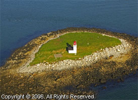
Seal Island
Seal Island is accessible by boat only. The Nova Scotia Lighthouse Preservation Society hosts a guided trip each September. This two-day trip includes a two-hour cruise on a Cape Island boat to the remote island. For more information email the NSLPS. You can also go to Seal Island with Charles Kenney at Seal Island Tours. You can email him. NSLPS (289) ARLHS # CAN 454
Photo courtesy njdodge [Flickr] |
|
NS 30
[19] |

| Abbott's Harbour
From Exit 31 on Highway 103, or on Route 3, take Route 335, 5.2 km Just before the Red Cap Motel, turn right onto Abbotts arbour Road, 1 km to the lighthouse. (296.2) ARLHS # CAN-001
Photo courtesy djbjr [Webshots] |
NS 32
[69] |
Pubnico Harbor
Leave Route 3 in Charlesville and follow Lighthouse Road (gravel) to a gate. Park at the gate and walk a few minutes to the lighthouse. ARLHS # CAN 417
Photo courtesy 1942harold [Webshots] |
|
|
|
NS 34
[69] |
Woods Harbour
Woods Harbour Lighthouse was constructed to mark the dangerous Big Ledge, which is covered at high tide, and to mark the southern entrance to Cockerwit Passage between the Mutton Islands and the community of Lower Woods Harbour.
On Route 3 (Lighthouse Route)in Lower Wood Harbour turn west onto New Wharf Road and continue to the wharf. (312) ARLHS # CAN 538
Photo courtesy marinas.com [marinas.com] |
|
NS 35
[70] |
West Head |
Follow Route 330 toward Clark's Harbour. Just before a welcome sign, turn right. Park near the wharf and the Linco Fisheries plant. (320) ARLHS # CAN 522 |
NS 36
[70] |
Cape Sable
Accessible by boat only. A short distance off Cape Sable Island (not to be confused with Sable Island which is east of Halifax.) NS 68 (327) ARLHS # CAN 106
Photo courtesy raptor710 [Webshots] |
|
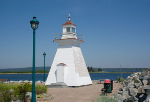
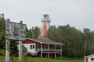
NS 37
[71] |
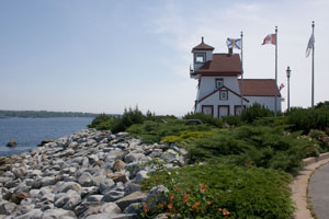
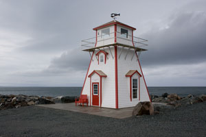
| Seal Island Lighthouse Museum
latitude 43° 34' 0.8" N longitude 65° 34' 50.6" W
July 6, 2008
On route 3 in Barrington. This is a 1/2 scale replica of the original light on Seal Island. It also contains the original lens. It is located just of PH 3 in Barrington. |
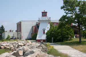
NS 38
[72] |
Baccaro Point
latitude 43° 26' 57.8" N longitude 65° 28' 16.2" W
July 6, 2008
From Route 103 in Clyde River, take Route 309 south (watch for a sign for the Baccaro Lighthouse). Drive 16 miles. At a Lighthouse Road sign, turn right, then continue on a gravel road to the lighthouse. (336) ARLHS # CAN 015 |
|
NS 39
[72] |
The Salvages |
Accessible by boat only; can be seen distantly from Baccaro Point Light. (348) ARLHS # CAN 440 |
NS 40
[72] |
Cape Negro Island |
Whispering Waves Cottages offers five oceanfront cottages in the harbor facing Cape Negro Island. They offer their guests tours of the island on request, via a "Cape Island" style fishing vessel. (349) ARLHS # CAN 102 |
NS 41
[72] |
Cape Roseway
Located at the south point of McNutt's Island in Shelburne Harbour. Accessible only by boat. (355) ARLHS # CAN 105
Photo courtesy marinas.com [marinas.com] |
|
NS 42
[73] |
| Sandy Point
latitude 43° 41' 32.4" N longitude 65° 19' 35.8" W
July 6, 2008
In Shelburne drive six miles south on the Lighthouse Route to Sandy Point. The Sandy Point Lighthouse Park, complete with concession stand is on your right and there is free parking. At low tide it is possible to walk out to the lighthouse. (359) ARLHS # CAN 447 |
NS 43
[73] |
Lockeport (Gull Rock)
Located on a small rocky island at the entrance to Lockeport Harbour. Accessible only by boat. (370) ARLHS # CAN 217
Photo courtesy farleigh12 [Webshots] |
|
NS 43A
[73] |
| Port Mouton
Location: Northeast point of Spectacle Island, Port Mouton Bay, southwest coast of Nova Scotia. This lighthouse can be seen from Summerville or Hunts Point, or by boat charter originating from Port Mouton. (396) ARLHS # CAN 410
Photo courtesy marinas.com [marinas.com] |
NS 45
[74] |
Western Head
From Route 3 in Liverpool, follow Bristol Avenue to a stop sign. Turn left on Main Street, then right on School Street. After about .7 mile turn right on Western Head Road and follow for 4.2 miles to Breakwater Road and turn left. (405) ARLHS # CAN 529
Photo courtesy djbjr [Webshots] |
|
NS 46
[74] |
| Coffin Island
Accessible by boat only, although the lighthouse can be seen from spots along the shore, including the Beach Meadows Roadside Pull-off on Route 331 east of Liverpool. (407) ARLHS # CAN 142
Photo courtesy djbjr [Webshots] |
NS 47
[75] |
Fort Point
latitude 44° 2' 37.2" N longitude 64° 42' 30.6" W
July 6, 2008
Fort Point Lighthouse Park is located at the end of Main Street in Liverpool. (410) ARLHS # CAN 184 |
|
NS 48
[76] |
| Medway Head
latitude 44° 6' 10.6" N longitude 64° 32' 22.6" W
July 6, 2008
From Route 103: Take Exit 17A and follow for 4.5 miles to Long Cove Road. Turn right and follow to the lighthouse. (415) ARLHS # CAN 313 |
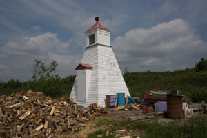
NS 48o
[76] |
Medway Head (1927)
latitude 44° 6' 8.2" N longitude 64° 32' 32" W
July 6, 2008
Across the road from the new light is the original lighthouse (with the light removed), probably now a private residence. |
|
NS 48P
[77] |
| Port Medway
latitude 44° 7' 54.8" N longitude 64° 34' 33.8" W
July 6, 2008
From Route 103: Take Exit 17A and follow for 4.5 miles to the intersection with Long Cove Road. Continue a short distance to the Port Medway Lighthouse Park. The park includes interpretive signs, green spaces, gardens, benches and a lookout area. (413) ARLHS # CAN-409 |
NS 48W
[77] |
Westhaver Island |
Location: Mahone Harbour entrance, south coast of Nova Scotia.
From Highway 103, take Exit 11 and travel south for 0.6 miles, and then turn left onto Highway 325 and continue for 1.7 miles to the Mahone Bay. In the town, turn right on Main Street (Route 3), and continue for 2 miles, and then turn left onto Maders Cove Road. Follow this road along the water and look for the lighthouse offshore. (451) ARLHS # CAN-530 |
NS 49
[77] |
Mosher's Island
The old wooden lighthouse was destroyed by the Canadian Coast Guard in 1989 and was replaced by a fiberglass structure. The Mosher Island Lighthouse Preservation Society seeks to preserve, protect and promote the light station (except the operational light), emphasizing its historical significance, educational opportunities and tourism potential. Creaser's Cove Boat Tours in Riverport offers trips to Mosher Island. Call (902) 527-6313 or email for details. eMail (423) ARLHS # CAN-325
Photo courtesy marinas.com [marinas.com] |
|
NS 49A
[77] |
| Battery Point Breakwater
latitude 44° 21' 36.3" N longitude 64° 17' 46.9" W
It is only seen VERY distantly from the major wharf in Lunenburg, or up close from tour boats. Located on a breakwater from National Sea Products. On the land side is a high steel security fence and guard DOGS (!) so "I" didn't try to go into property. (438) ARLHS # CAN-024
Photo courtesy marinas.com [marinas.com] |
NS 49C
[77] |
Quaker Island
latitude 44° 30' 53.3" N longitude 64° 13' 57.5" W |
Location: Off Chester Harbour, south coast of Nova Scotia. The light can be seen from the waterfront in Chester. (456) ARLHS # CAN-422 |
NS 49D
[77] |
Gunning Point Island (Tanner Pass) |
Location: East end of Tanner Island, Lunenberg Harbour, south shore of Nova Scotia. (446) ARLHS # CAN-218 |
NS 51
[77] |
East Ironbound Island
latitude 44° 26' 22.6" N longitude 64° 4' 58.8" W
Location: Highest point of land on east side of East Ironbound Island, entrance to Mahone Bay. (Need a boat to get here.) (469) ARLHS # CAN-164
Photo courtesy marinas.com [marinas.com] |
|
NS 51B
[78] |
Indian Harbour (Paddys Head)
latitude 44° 31' 19.2" N longitude 63° 56' 44.9" W
This lighthouse can be seen from Route 333. To reach the lighthouse, leave Route 333 and head south on Paddy's Head Road. Park near a gravel road and proceed on foot. It is a strenuous walk to the lighthouse. (482) ARLHS # CAN-247
Photo courtesy marinas.com [marinas.com] |
|
NS 52
[79] |
| Peggy's Point
latitude 44° 29' 31.3" N longitude 63° 55' 8.3" W
July 6, 2008
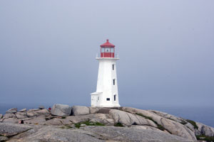
Turn south off Route 103 onto Route 333 at Exit 2A or Exit 5. Continue on St. Margaret's Bay Road for 3 kilometers. Turn west onto Prospect Road for about 40 kilometers and continue to Peggy's Cove. (487) ARLHS # CAN-369 |
NS 53
[79] |
Betty Island
latitude 44° 26' 19.7" N longitude 63° 46' 1.2" W
Location: Brig Point, Prospect Bay, South Shore of Nova Scotia. (495) ARLHS # CAN-034
Photo courtesy marinas.com [marinas.com] |
|
NS 54
[80] |
| Terence Bay
latitude 44° 27' 36.1" N longitude 63° 42' 20.2" W
Leave Highway 103 and take Route 333 to a left turn heading to Terence Bay. In the village of Terence Bay, turn left on Sandy Cove Road. Follow to the end of the road. There's a walkway to the lighthouse so access doesn't cross private property. (498) ARLHS # CAN-495
Photo courtesy P. J. Gergely [Flickr] |
NS 55
[80] |
Sambro Island
Established in 1758, this is the oldest operating lighthouse in North America. Louisbourg predates it, but the first light there was destroyed the same year this was built.
Located on Sambro Island about 3 km off the mouth of Halifax Harbour. Accessible by boat tours from Ketch Harbour. (507) ARLHS # CAN-442
Photo courtesy PW Hsu [Webshots] |
|
NS 55A
[80] |
| Sambro Harbour
latitude 44° 28' 30" N longitude 63° 35' 45.6" W
Located at the end of Bull Point Road, off NS 349 in Sambro. Accessible by a short walk from parking provided at the end of the road. (505) ARLHS # CAN-441
Photo courtesy marinas.com [marinas.com] |
NS 55P
[80] |
Pennant Harbour
latitude 44° 28' 15.5" N longitude 63° 38' 3.6" W |
Pennant Harbour, north side of entrance to Pennant Cove, south coast of Nova Scotia (less than 1000' from route 349).
From the junction of NS 349 and 306 in Sambro, go west on NS 349 (West Pennant Road) for 1.7 miles. The Pennant Harbour Lighthouse is hard to see through the trees, but there is a small turnoff at this point from which you can bushwhack your way to the shore. (501) ARLHS # CAN 373 |
NS 56
[80] |
Chebucto Head
latitude 44° 30' 26.3" N longitude 63° 31' 20.9" W
Follow Route 253 to Herring Cove, then follow Route 349 to Duncan's Cove Road (left). (513) ARLHS # CAN 133
Photo courtesy djbjr [Webshots] |
|
NS 57
[80] |
| Maugher's Beach
latitude 44° 36' 8.3" N longitude 63° 32' 0.7" W
July 5, 2008
For information on the ferry to McNab's Island from Fishermans Cove, Eastern Passage, call (902) 465-4563 or check this site
The lighthouse is about a 30-minute walk from the ferry landing. One can take this photo from the harbor cruise. (527) ARLHS # CAN 308 |
NS 58
[80] |
George's Island (Halifax Harbour Inner Range)
latitude 44° 38' 26.1" N longitude 63° 33' 37.2" W
July 5, 2008
The island is the site of historic fortifications, which are being restored; the island will then be open to the public. Located on the west side of George's Island opposite downtown Halifax. (538) ARLHS # CAN 193 |
|
NS 59
[80] |
| Devil's Island
latitude 44° 34' 51.6" N longitude 63° 27' 28.8" W
Location: Southeast end of Devil's Island, northeast entrance to Halifax Harbour, south coast of Nova Scotia. (545) ARLHS # CAN 158
Photo courtesy marinas.com [marinas.com] |
NS 59A
[56] |
Musquodoboit Harbour Front Range
latitude 44° 41' 41.6" N longitude 63° 4' 40.8" W
Follow the road for Ostrea Lake from Route 7. After about 12.4 km follow Kent Road to the right. The Seaview Fisherman's B & B is a short distance ahead; the Rear Range Light is behind the B & B -- you should ask permission to access the property. (568) ARLHS # CAN 615
Photo courtesy marinas.com [marinas.com] |
|
NS 60
[56] |
Jeddore Rock
latitude 44° 39' 47.3" N longitude 63° 36.6" W |
Located atop a rocky islet about 6 km southeast of French Point (570) ARLHS # CAN 254 |
NS 61
[56] |
Egg Island |
East side of entrance to Clam Bay, eastern shore of Nova Scotia. (580) ARLHS # CAN 168 |
NS 61A
[56] |
Owls Head |
Location: Entrance to False Passage and Owls Bay, south coast of Nova Scotia. (582) ARLHS # CAN 1282 |
NS 61F
[56] |
Spry Bay Range (Tomlee Range)
Follow a gravel road about 0.8 miles east of Spry Bay and drive to the end, about ¾ miles, then follow the power line along a foot path for about 0.8 miles. (591) ARLHS # CAN 474
Photo courtesy marinas.com [marinas.com] |
|
NS 61G
[56] |
| Sheet Rock [Harbour]
The original lighthouse and dwelling were burned by the Canadian Coast Guard when the present tower was erected in 1980. (594) ARLHS # CAN 457
Photo courtesy marinas.com [marinas.com] |
|
|
NS 62
[57] |
Sheet Harbour Passage Front Range
latitude 44° 51' 28.5" N longitude 62° 26' 51.9" W
July 4, 2008
Driving west, exit route 7 at Beaver Harbour heading south to sheet Harbour Passage. Turn right after 1.5 km onto a gravel road. At 3.7 km turn left onto Davidson Road and immediately right on Back Cove Road to the front range (on the left.) (598) ARLHS # CAN 456 |
|
NS 62R
[57] |
| Sheet Harbour Passage Rear Range
latitude 44° 51' 42.7" N longitude 62° 27' 2.9" W
July 4, 2008
This light is on the opposite side of the passage, up the hill, and behind a house. It took us 3 tries up and down the road to find it. |
NS 64
[57] |
Liscomb
Located on Cranberry Point, on the southwest side of the island, marking the entrance to Liscomb Harbour. Accessible only by boat. (615) ARLHS # CAN 277
Photo courtesy marinas.com [marinas.com] |
|
NS 65
[58] |
| Port Bickerton (1963)
latitude 45° 5' 25" N longitude 61° 42' 1.6" W
July 4, 2008
At the right-angle intersection on route 211, follow the sign for lighthouse road along the edge of the water for a distance of 3.3 km. (629) ARLHS # CAN 404 |
NS 65o
[58] |
Port Bickerton (1919)
latitude 45° 5' 25" N longitude 61° 42' 1.6" W
July 4, 2008
According to the Antigonish-Eastern Shore tourist association, this is an earlier light here. Our local docents said this was the original keeper's dwelling. Other documents imply that both are true. |
|
NS 66
[59] |
| Fisherman's Harbour
July 4, 2008
Take the exit for Fisherman's Harbour off Route 211. Follow to the wharf. To reach the lighthouse, a short boat ride is necessary out to the spit of land that forms the Harbour Channel. (634) ARLHS # CAN 177 |
NS 66A
[60] |
Isaacs Harbour
latitude 45° 9' 49.1" N longitude 61° 39' 10.6" W
July 4, 2008
Follow the paved road from route 316 south into Isaac's Harbour. At 3.1 km, the pavement ends and at 3.5 km there is a gate leading into the road used by the pulpwood trucks. Park at the gate and walk about 2 miles to the light. (635) ARLHS # CAN 251 |
|
NS 66B
[60] |
| Country Island
The keeper's houses at this station were destroyed by the Canadian Coast Guard in February 2004. The island is an important bird nesting site; Environment Canada is considering Country Island as a potential Migratory Bird Sanctuary. (639) ARLHS # CAN 752
Photo courtesy marinas.com [marinas.com] |
NS 67
[61] |
| Charlo's Cove
latitude 45° 14' 44.3" N longitude 61° 20' 25.1" W
July 4, 2008
On the north side of Route 316 at the west end of the village, you'll see it just before the church. (648) |
NS 67A
[61] |
Hog Island (Port Felix) |
Location: East end of Hog Island, Tor Bay, southeast coast of Nova Scotia. (654) ARLHS # CAN 228 |
NS 67B
[61] |
Three Top Island (Whitehaven) |
Location: Entrance to Whitehead Harbour, Tor Bay, south coast of Nova Scotia. (657) ARLHS # CAN 1242 |
NS 68
[61] |
Sable Island West |
This lighthouse has been rebuilt and moved several times. The present structure was discontinued on July 1, 2004. (665) ARLHS # CAN 522 |
NS 69
[61] |
Sable Island East |
Written permission from the Canadian Coast Guard is needed to visit Sable Island. (666) ARLHS # CAN 106 |
NS 69F
[61] |
Canso Front Range
latitude 45° 19' 54.4" N longitude 60° 58' 44.9" W
July 4, 2008
The front light is near the water, 1,261 feet further on Union street from the rear light (see below). |
|
NS 70
[62] |
| Canso Rear Range
latitude 45° 19' 55.6" N longitude 60° 59' 3.3" W
July 4, 2008
Follow Union Street in Canso to a hospital. Park near the hospital. The rear range light is just off the road ahead on the right. (672) ARLHS # CAN 077 |
NS 70C
[62] |
Cranberry Islands (Cape Canso) |
Location: Southern end of Cranberry Island, Canso Harbour, Cape Breton. Accessible by boat only, the lighthouse can be seen from near the hospital on Union Street in Canso. (668) ARLHS # CAN 153 |
NS 71
[62] |
Queensport
July 4, 2008
You can see the lighthouse from a picnic area (Queensport Lighthouse Look-off) on Highway 16. Another view is just west of the look-off. (683) ARLHS # CAN 425 |
|
NS 71A
[62] |
Guysborough [Harbour] |
Location: Peart Point, west side of the entrance to Guysborough Harbour. ARLHS # CAN 220 |
NS 73
[63] |
| Eddy Point Front Range
latitude 45° 31' 12.4" N longitude 61° 15' 7.2" W
July 4, 2008
The white, conical steel lighthouse in this location was removed in March 2002. It's been replaced by this range pair. (689.3) ARLHS # CAN-1274 |
NS 73R
[63] |
Eddy Point Rear Range
latitude 45° 31' 7.2" N longitude 61° 14' 59.5" W
July 4, 2008
I guess the song about the Eddy Point light (popular in the '60s, has become historical.)
This light is just uphill from the front range. |
|
NS 74
[63] |
| North Canso
From Route 4 in East Havre Boucher, a small lane leads to the light. Walking, rather than driving, down the lane is recommended; it's about a mile to the light (883) ARLHS # CAN 344
Photo courtesy bigsister861 [Webshots] |
NS 75
[34] |
Havre Boucher Rear Range
latitude 45° 40' 34.7" N longitude 61° 31' 40.3" W
June 30, 2008
From Route 104 (Trans-Canada Highway) take the east exit for Havre Boucher. Turn left at a stop sign. After a short distance you will see the rear range light on a hill and the front range light about 1429 feet away. (884) |
|
NS 75F
[34] |
| Havre Boucher Front Range
latitude 45° 40' 55.2" N longitude 61° 31' 37.2" W
June 30, 2008
If you carefully cross the railroad tracks, you can see the front range light as well. ARLHS # CAN 224 |
NS 76
[33] |
| Cape George Point
latitude 45° 52' 28" N longitude 61° 54' 2.1" W
June 29, 2008
From Route 337 near Ballantynes Cove turn onto Lighthouse Road. There is parking near the lighthouse -- it's a spectacular view. (892) |
NS 76A
[33] |
Arisaig
latitude 45° 45' 43.3" N longitude 62° 10' 18.8" W
June 29, 2008
A new light (2007) is the model of an old light, marking the end of the breakwater for the commercial fishery. ARLHS # CAN 1272 |
|
NS 77F
[32] |
| Trenton Front Range (East River)
latitude 45° 37' 25.7" N longitude 62° 38' 52.8" W
June 29, 2008
This light can be seen just after you leave the harbour bridge from Pictou going into Trenton. (910) ARLHS # CAN 883 |
NS 77R
[32] |
Trenton Rear Range
June 29, 2008
Standing next to the front range, you can see the rear range in the distance. |
|
NS 78
[31] |
| Pictou Bar
June 29, 2008
The wooden tower that was here has been destroyed. A minimal metal structure replaces it. To get close to this light, cross over to the east side of the channel, go past Pictou landing, park on the beach and walk out to the light. (906.3) ARLHS # CAN 377 |
NS 78F
[30] |
Pictou Harbour Front Range
June 29, 2008
Location: North side of the entrance to Pictou Harbour, Northumberland Strait. From the seaview Cemetery, follow the beach about 1/4 mile (away from the cemetery and accross the stream). The front range will be above you. (903.4) ARLHS # CAN-378 |
|
NS 78R
[30] |
| Pictou Harbour Rear Range
June 29, 2008
From the front range, you can see the rear range across private property and in front of the trees. |
NS 78M
[30] |
Museum in Pictou Harbour
latitude 45° 40' 28" N longitude 62° 42' 26.3" W
June 29, 2008
This is a recent addition based on a gift to the museum. It is a faux light, but based on Nova Scotia designs. |
|
NS 78B
[30] |
Pictou Island East End |
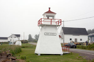
There have been three lighthouses on Pictou Island, located about 7.5 miles offshore. The East End Light is now a skeleton structure. (899.5) ARLHS # CAN 379 |
NS 79
[29] |
Caribou Island
latitude 45° 45' 52.4" N longitude 62° 40' 49" W
June 29, 2008
Take Highway 6 at the Pictou Rotary towards River John. Turn right after about four miles at Three Brooks. Follow this road for approximately 2.5 miles. Just before Central Caribou you will turn left onto Shore road. Travel Shore road for two miles until you come to Waterside. When you reach Waterside, follow the signs for the Provincial Park and turn right towards the shore. You continue through the parking area eventually turning left onto the road that runs the length of the island. The lighthouse is at the other end of the peninsula. (918) ARLHS # CAN-119 |
|
NS 80
[28] |
| Wallace Harbour Front Range
latitude 45° 48' 46.4" N longitude 63° 27' 43.2" W
June 28, 2008
This lighthouse is located on the side of Route 6 in Wallace. (924) ARLHS # CAN-518 |
NS 80A
[28] |
Mullins Point Range
June 28, 2008
The 1894 lighthouse still exists but has been moved. Its design is unique in the Atlantic provinces, although a few examples of this style are known in Ontario's Georgian Bay (Jones Island Rear Light and Snug Harbour Rear Light). The Mullins Point Lighthouse, now a private property, has been recognized as a heritage structure. (North Wallace, on the North side of the harbor entrance.)
From Route 6 just west of Wallace, drive north on Ferry Road crossing the Wallace Harbour Bridge and then turn right onto North Wallace Road. The Mullins Point Range Rear, now a private residence, is located 2.4 miles down North Wallace Road. ARLHS # CAN-327 |
|
NS 81
[28] |
| Pugwash
The old lighthouse is easily viewed from the road in Pugwash. (On 6/29/2008, we didn't find this light on highway 6. (926)
Photo courtesy marinas.com [marinas.com] |
NS 82
[27] |
Coldspring Head
latitude 45° 57' 44.9" N longitude 63° 51' 53.8" W
June 29, 2008
From Route 366 (Sunrise Trail) take a right on Lane #26. Look for a sign for Cold Spring Head. Follow that road for about .4 mile. Look for a right, then an immediate left to an open field and the lighthouse. (941) ARLHS # CAN-144 |
|
NS 84
[27] |
Cape North
This light marks the northern extremity of Cape Breton Island. The light station is accessible from the Cabot Trail spur at Bay St. Lawrence, but the last few miles are by a dirt road, probably not passable except by hiking or 4WD. (854) ARLHS # CAN-103
Photo courtesy marinas.com [marinas.com] |
|
NS 84M
[41] |
| Man of War Point Rear Range
latitude 46° 11' 2.6" N longitude 60° 33' 4" W
July 2, 2008
This light is on private property and the owner's request that you respect their privacy. Permission to visit may be granted if you contact them by eMail "md AT cantares.on.ca". (809.7) ARLHS # CAN-301 |
NS 85
[40] |
Neil's Harbour
latitude 46° 48' 23.4" N longitude 60° 19' 12" W
July 1, 2008
Take the road to Neil's Harbour from the Cabot Trail. Turn right on Lighthouse Road (gravel) to the lighthouse. (851) ARLHS # CAN 339 |
|
NS 86
[40] |
| Ingonish Harbour
July 1, 2008
This is the light that is at the entrance to Ingonish Harbour. Not very impressive. There was a rumor that there is a light on "the point" south of the village of Ingonish, but we couldn't find that. (847) ARLHS # CAN 1221 |
NS 86C
[42] |
McNeil's Beach (Boularderie)
July 2, 2008
This lighthouse is on private property near Kelly's View Road (dirt road), near Exit 13 off the Trans-Canada Highway, close to the Seal Island Bridge. ; Basically, the only good view is from the bridge. ARLHS # CAN 295 |
|
NS 86D
[42] |
Gregory Island |
Accessible only by boat. The lighthouse can be seen distantly from near Cape George Harbour Lighthouse. (841) ARLHS # CAN 215 |
NS 86E
[42] |
Cameron Island |
The lighthouse was originally the front light of the Clarke Cove Range (which no longer exists). Located at the northeast end of the island in Bras d'Or Lake. Accessible only by boat. (838) ARLHS # CAN 069 |
NS 86H
[46] |
Gillis Point
Location: Entrance to Maskell's Harbour, Great Bras d'Or Channel, Cape Breton. (832) ARLHS # CAN 201
Photo courtesy marinas.com [marinas.com] |
|
NS 86J
[46] |
| Little Narrows
June 30, 2008
Driving North on PH 105, take the Little Narrows Exit and park in front of the Ferry dock. That's where I took this picture. (830) ARLHS # CAN 280 |
NS 86K
[46] |
Kidston Island East (Baddeck)
June 30, 2008
There's a light on each end of Kidston Island. With the help of Mel from Inverary Resorts, we made a loop around the island and captured both. (815) ARLHS # CAN 261 |
|
NS 86L
[46] |
| Kidston Island West
June 30, 2008
This is clearly not as impressive a light as the one on the other end, but Mel tells me it originally had an enclosed cap on it as well. |
NS 86P
[47] |
Cape George Harbor (St. Peter's)
From Route 4 in St. Peter's, look for a sign that says "Bras d'Or Lighthouse Campground." Turn right on this dirt road and follow to a parking area. The lighthouse can be seen after a hike over a hill.
Photo courtesy Bill Clyne [Flickr] |
|
NS 87
[43] |
| Great Bras d'Or Range
latitude 46° 17' 8.6" N longitude 60° 25' 1.8" W
July 2, 2008
From Route 105 take Exit 14 into Big Bras d'Or. Take a left at a sign for Ferry Road and follow to the end. The rear range light is near the end of the road. (I couldn't find it.) The front range light is located in a private area and is difficult to see. (803) ARLHS # CAN 209 |
NS 87A
[44] |
Black Rock Point
latitude 46° 18' 18.3" N longitude 60° 23' 29.5" W
July 2, 2008
From Route 105, take Exit 14. At the fire station turn onto Black Point Road and follow it to the end. Turn left and drive about a half-mile on a dirt road to a gate. The lighthouse is a few minutes walk from here. (799) ARLHS # CAN 043 |
|
NS 88
[45] |
| Point Aconi
latitude 46° 20' 9.3" N longitude 60° 17' 32.5" W
July 2, 2008
At Highway 105 the Bras d'Or Lakes Scenic Drive turns left across a bridge. Just after crossing the bridge, a right turn off Highway 105 leads to the Point Aconi Lighthouse. (796) ARLHS # CAN 386 |
NS 89
[55] |
Sydney Range
latitude 46° 10' 48.7" N longitude 60° 15' 0.4" W
July 2, 2008
The Sydney Range Lights are located off Route 239. Take Exit 4 off Highway 125 and follow to a second stop sign. Turn left and follow until you see a small dirt road. The Front Range Light is near this road. The Rear Range Light is just before the dirt road, on the left. (782) ARLHS # CAN 494 |
|
NS 89R
[55] |
| Sydney Rear Range
latitude 46° 10' 27.7" N longitude 60° 15' 20" W
July 2, 2008
Just south of the front range is a farm marked as "two lights farm." Three driveways south of that is the driveway that leads to the rear range. This is private property, so permission is necessary. ARLHS # CAN 641 |
NS 89S
[55] |
Sydney Bar
July 3, 2008
Earlier lights at this exposed location were destroyed repeatedly by storms. Located on the end of the southeast bar in Sydney Harbour. Accessible only by boat. (778) |
|
NS 90
[54] |
| Low Point
latitude 46° 16' 1.7" N longitude 60° 7' 32.6" W
July 2, 2008
Follow Route 28 to New Victoria. Turn left on Brown's Road; after .4 mile turn right and continue for .4 mile. Turn left on a dirt road and drive a short distance to a gate. The lighthouse is a very short walk past the gate. (775) ARLHS # CAN 287 |
NS 91
[53] |
Louisbourg
latitude 45° 54' 24.5" N longitude 59° 57' 30" W
July 3, 2008
This was Canada's first lighthouse station and the second in North America. From Louisburg take Havenside Road to Lighthouse Point. It is NOT close to the fort exhibits in Louisburg. (756) ARLHS # CAN 286 |
|
NS 91A
[53] |
Main à Dieu |
It may be that the light can be seen across the Main-à-Dieu Channel from the village of Main-à-Dieu, but on July 3, 2008, WE couldn't find it. (766) ARLHS # CAN 296 |
NS 91B
[53] |
Glace Bay North Breakwater
latitude 46° 11' 56.8" N longitude 59° 56' 52.8" W
July 3, 2008
Location: Outer end of North Breakwater, Glace Bay, southeast coast of Cape Breton. (774) ARLHS # CAN 202 |
|
NS 91S
[53] |
| Scatarie
Location: Northeast point of Scatarie Island, off easternmost point of Cape Breton. (767) ARLHS # CAN 451
Photo courtesy marinas.com [marinas.com] |
NS 92
[52] |
| Gabarus
latitude 45° 50' 36.6" N longitude 60° 8' 50.3" W
July 3, 2008
Follow Harbour Point Road from the village of Gabarus. Watch for an open grassy area at about ½ km. The lighthouse can be reached via a short walk following the narrow path from here. (753) ARLHS # CAN 189 |
NS 93A
[52] |
Rouse Point
latitude 45° 50' 36.5" N longitude 60° 7' 56.9" W |
Location: Rouse Point, southeastern Cape Breton.
From Route 327, the Fleur-de-Lis Trail, go east on Gabarus Highway for 2.7 miles to reach Gabarus, and then turn left onto Rouse Island Road and drive to its end. The Rouse Point Lighthouse can be reached by following a path northeast from the end of the road. (752.6) ARLHS # CAN 435 |
NS 94
[51] |
Fourchu Head
latitude 45° 43' 2.6" N longitude 60° 13' 48" W
This light station is accessible via a fairly rugged hike from South Fourchu, beginning at a breakwater near fishing wharves and a cemetery. (747) ARLHS # CAN 182
Photo courtesy djbjr [Webshots] |
|
NS 95
[50] |
| Jerome Point
latitude 45° 38' 53.9" N longitude 60° 52' 22.8" W
July 3, 2008
Follow Route 4 into Battery Provincial Park just east of St. Peter's. (734) ARLHS # CAN 255 |
NS 95R
[50] |
River Bourgeois (Lennox Passage)
latitude 45° 37' 33.2" N longitude 60° 56' 50.6" W
July 3, 2008
Location: East side of entrance to River Bourgeois, south coast of Cape Breton. This light is a replica built in 2004 of the original 1903 light. (732) ARLHS # CAN 1309 |
|
NS 96
[49] |
| Grandique Point (Isle Madame)
The lighthouse is easily accessible in Lennox Passage Provincial Park, on Route 320. Enter the park and follow the gravel road to the lighthouse. (729) ARLHS # CAN 208
Photo courtesy marinas.com [marinas.com] |
NS 97
[49] |
Green Island |
Six miles south of Cape Forchu, off western end of Nova Scotia. Thus boat's about the only way to get here. (722) |
NS 98
[48] |
Isle Madame (Arichat)
"This was pretty remote. Out a long paved road, where it turned to undrivable dirt road which you can walk. Just before it turned to dirt there was an abandoned house, anyone looking for a house in Arichat could probably pick it up on the cheap." (704.8) ARLHS # CAN 1215
Photo courtesy Martin [Flickr] |
|
NS 99
[35] |
| Balache Point Range
latitude 45° 38' 53.6" N longitude 61° 24' 52.8" W
June 30, 2008
From the Trans-Canada Highway from Port Hastings, turn right just after the bridge on the way from the Canso Causeway. (701) ARLHS # CAN 017 |
NS 99A
[35] |
Margaree Island (Sea Wolf Island)
Location: Off the west coast of Cape Breton Island. Accessible by boat only. The island, but not the light, can be seen from the mainland. (See the range lights on the island below.) NS 102 (874) ARLHS # CAN 305
Photo courtesy marinas.com [marinas.com] |
|
NS 100
[35] |
Henry Island |
Located on the west side of the island facing St. George's Bay. The island is privately owned, but tours to the island and lighthouse can be arranged. tours
Accessible only by boat. (881) ARLHS # CAN 227 |
NS 101
[36] |
Maubau Harbor
latitude 46° 5' 9.3" N longitude 61° 27' 54.8" W
June 29, 2008
From Route 19 in Mabou, take Mabou Harbour Road. Turn left at the sign for Mabou Harbour Wharf (dirt road) and follow to the end. (876) ARLHS # CAN 291 |
|
NS 102
[37] |
| Margaree Harbour Front Range
latitude 46° 26' 22.3" N longitude 61° 6' 46" W
June 30, 2008
From Route 219, take the Margaree Harbour Shore Road. Turn right and follow to the end of the road at Margaree Harbour. Climb the hill to the left to see the lighthouses. (872) ARLHS # CAN 304 |
NS 102R
[37] |
Margaree Harbour Rear Range
latitude 46° 26' 20.6" N longitude 61° 6' 45.6" W
June 30, 2008
It's a fairly steep climb up to the Front Range, but an easy walk to a place where you can take this photo. |
|
NS 103
[38] |
| Enragée Point
latitude 46° 38' 59.2" N longitude 61° 1' 30.4" W
July 1, 2008
From the Cabot Trail, follow the sign to Cheticamp Island. Take a right onto a dirt road leading to the harbour. The lighthouse is past a warning sign stating that visitors are only allowed during the day. (867) ARLHS # CAN 170 |
NS 103A
[38] |
Chéticamp Harbour
latitude 46° 37' 57.2" N longitude 61° 41" W
July 1, 2008
This lighthouse is in the center of town on the boardwalk below the Harbour Restaurant & Bar. It now serves as the office for Acadian Whale Cruise. ARLHS # CAN 135 |
|
NS 104
[39] |
| Caveau Point Rear Range
latitude 46° 38' 51" N longitude 60° 59' 55.1" W
July 1, 2008
On the point, at the entrance to the Eastern Harbour, west coast of Cape Breton Island. If you are driving south on the Cabot Trail, this will be on the left at the same time you spot Enragee Point on the right. (862) ARLHS # CAN 123 |
NS 104F
[39] |
Caveau Point Front Range
latitude 46° 38' 51.5" N longitude 61° 2.8" W
July 1, 2008
This light is right next to the water below the other side of private property, so ask before crossing. |
|
|
|