|
This page shows the documentation of the Lighthouses of Poland. You can always click on the photo of the light to go to a specific (larger resolution) copy. Each lighthouse name is linked to (in our editorial opinion) the best reference site for that light. I would like to include directions on how to get to these lights. If you know such data, could you eMail me and I'll post it here (with your choice of attribution.) mailme There has been significant usage of the Lighthouse Directory prepared by Russ Rowlett (UNC). lhDirectory Lighthouse coordinates and some additional lights are via ARLHS List of lights, my thanks to them for providing this basis for understanding. arlhs |
|
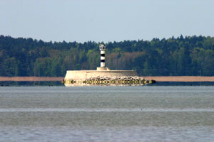
| PL 1 |
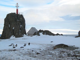
Arctowski (Antarctica)
This is the most southerly lighthouse in the world and constructed at the Polish research station. ARLHS # POL-001
Photo courtesy Artzt [wikipedia] |
|
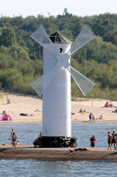
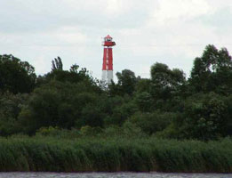
| PL 2 |
Bad Ziegenort |
ARLHS # POL-035 |
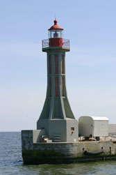
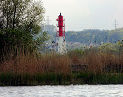
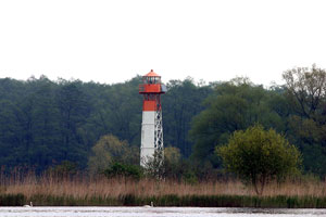
| PL 3 |
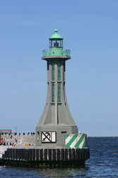
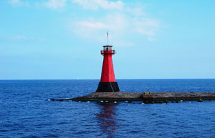
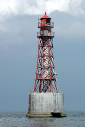
Kikut (Wisleka)
latitude 53° 58' 52.7" N longitude 14° 34' 50.1" E
Located on a headland on the north shore of the island of Wolin, in the Elbe delta. (C 2892) ARLHS # POL-011
Photo courtesy Red81 [wikipedia] |
|
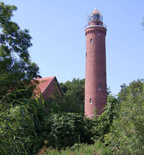
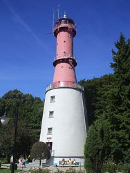
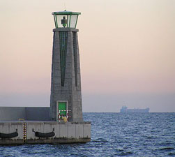
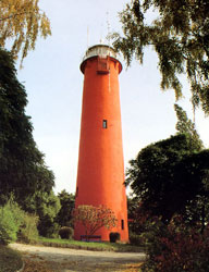
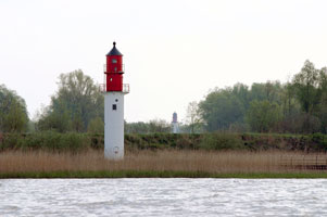
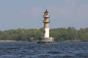
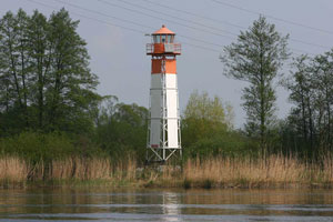
| PL 4 |
| Niechorze (Horst)
latitude 54° 5' 40.8" N longitude 15° 3' 49.8" E
The tower was heavily damaged in World War II and required extensive reconstruction, which was completed in 1948. The lighthouse was fully restored in 1999-2000. Located just outside the seaside resort town of Niechorze about halfway between Kikut and Kołobrzeg. niechorze (C 2904) ARLHS # POL-014
Photo courtesy El Cid [wikipedia] |
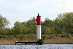
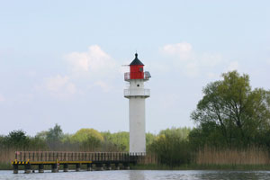
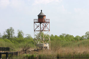
| PL 5 |
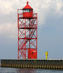
Kolobrzeg {Kolberg}
latitude 54° 11' 10.8" N longitude 15° 33' 15.5" E
Kołobrzeg has a long history, and lights are said to have been displayed here as early as 1666. The fortress on which the lighthouse stands was built by Prussia in the 1830s.Located in town, on the waterfront, near the base of the east mole. ARLHS # POL-012
Photo courtesy Jason Prini [Flickr] |
|
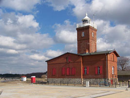
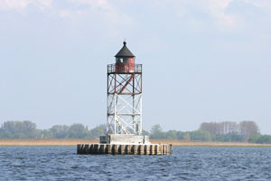
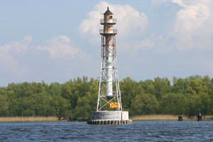
| PL 6 |
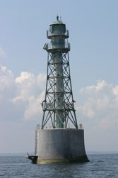
| Gaski {Funkenhagen}
latitude 54° 14' 34.2" N longitude 15° 52' 21.6" E
Unlike other Polish lighthouses, this handsome tower escaped major damage during World War II. After having its deteriorating brickwork patched up repeatedly over the years, the tower was thoroughly restored in 1995-97. Located on the coast about 20 km east of Kołobrzeg. (C 2914) ARLHS # POL-004
Photo courtesy Paweł Nowicki [wikipedia] |
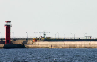
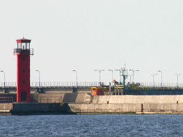
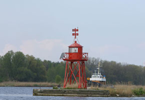
| PL 7 |
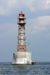
Darlowo {Rügenwalde}
latitude 54° 26' 25" N longitude 16° 22' 43" E
Located on the east side of the entrance to the Wieprza River in Darłowo, a small town halfway between Świnoujście and Gdynia. (C 2918) ARLHS # POL-003
Photo courtesy własna praca [wikipedia] |
|
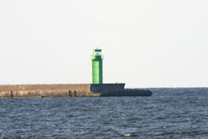
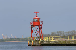
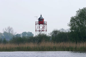
| PL 8 |
| Darlowo Harbour/East Breakwater
latitude 54° 26' 29.7" N longitude 16° 22' 18.2" E (C 2920) ARLHS # POL-021
Photo courtesy Alex Trabas [ListOfLights] |
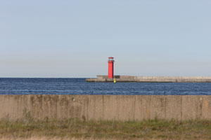
| PL 9 |
Darlowo Harbour/West Breakwater
latitude 54° 26' 31.2" N longitude 16° 22' 19.1" E (C 2922) ARLHS # POL-022
Photo courtesy Alex Trabas [ListOfLights] |
|
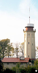
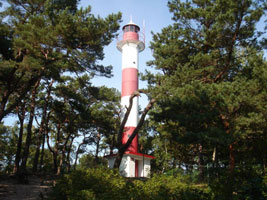
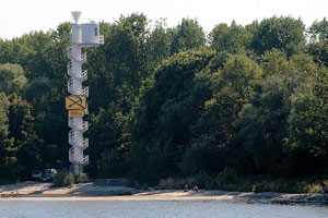
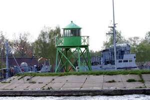
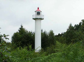
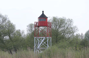
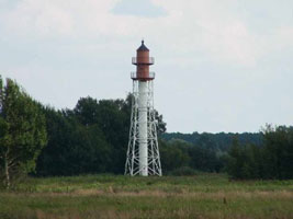
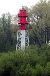
| PL 10 |
| Jaroslawiec {Jershöft}
In 1996 the lighthouse was restored and opened to the public as a tourist attraction. Located near the village of Jarosławiec, about 30 km northeast of Darłowo. ARLHS # POL-009
Photo courtesy Alina Zienowicz [Wikipedia] |
| PL 11 |
Ustka {Stolpmünde}
latitude 54° 35' 16.8" N longitude 16° 51' 16.2" E
Located at Ustka, a popular seaside resort town about 30 km northwest of the city of Słupsk. (C 2930) ARLHS # POL-020
Photo courtesy Maria Golinski [wikipedia] |
|
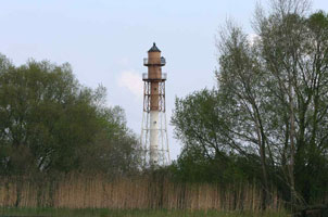
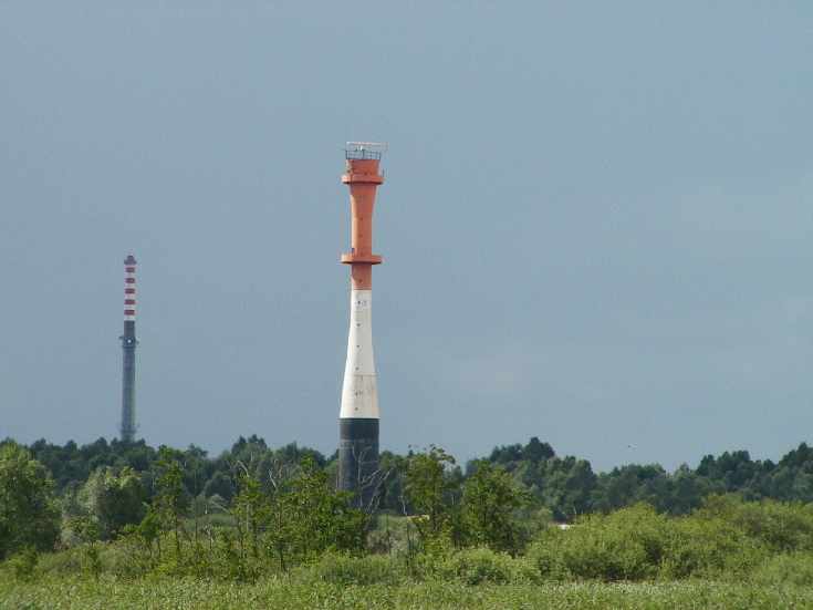
| PL 12 |
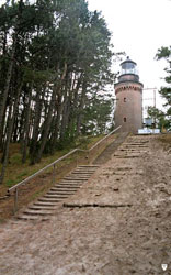
| Czolpino {Scholpin}
The lighthouse stands about 1 km from the beach atop a forested dune in the Słowiński National Park, an international biosphere reserve. Accessible at the end of a hiking trail (about 1 hour round trip). ARLHS # POL-002
Photo courtesy ? [wikipedia] |
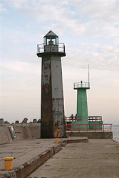
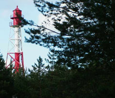
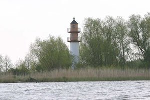
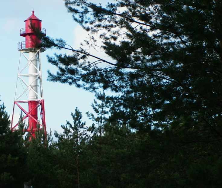
| PL 13 |
Stilo
latitude 54° 47' 42.4" N longitude 17° 44' 3.7" E
This beautiful cast iron lighthouse survived both world wars intact and looks today much as it did when it was built. Located about 7 km east of Łeba. (C 2954) ARLHS # POL-017
Photo courtesy ? [wikipedia] |
|
| PL 14 |
| Rozewie East Tower {Rixhöft}
latitude 54° 49' 49.2" N longitude 18° 20' 10.8" E
The lighthouse marks Cape Rozewie, the northernmost point of Poland and the western entrance to the Gulf of Gdańsk. Located on the cape about 10 km northwest of Władysławowo. (C 2960) ARLHS # POL-016
Photo courtesy Jan Jerszyński [wikipedia] |
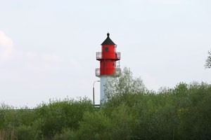
| PL 15 |
Rozewie West Tower
This lighthouse was built to make Rozewie a double light for better identification at a distance. Located about 220 yd west of the historic east tower. ARLHS # POL-038
Photo courtesy Wikipedia.pl |
|
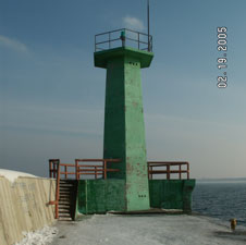
| PL 16 |
| Władysławowo North Breakwater Front Range
latitude 54° 47' 48.7" N longitude 18° 25' 22.9" E
Located near the end of the breakwater sheltering the harbor of Władysławowo.
Photo courtesy Adam Krzyzanowski [panoramio] |
| PL 17 |
Wladyslawowo North Breakwater
latitude 54° 47' 48" N longitude 18° 25' 24.6" E
Located at the end of the breakwater sheltering the harbor of Władysławowo. (C 2961) ARLHS # POL-040
Photo courtesy oldek [panoramio] |
|
| PL 18 |
| Gdynia Entrance North
latitude 54° 32' 11.1" N longitude 18° 33' 47.2" E
Located on a detached breakwater on the south side of the main entrance to Gdynia harbor, the entrance used by Stena Line ferries. (C 3015.2)
Photo courtesy Alex Trabas [ListOfLights] |
| PL 19 |
Gdynia Entrance South
latitude 54° 32' 6.3" N longitude 18° 33' 47.4" E
Located on a detached breakwater on the north side of the main entrance to Gdynia harbor, the entrance used by Stena Line ferries. (C 3016)
Photo courtesy Terry Douma [webshots] |
|
| PL 20 |
| Gdynia Entrance Front Range
latitude 54° 32' 9.6" N longitude 18° 32' 52.2" E
Located on the breakwater quay on the north side of the entrance to the inner harbor known as the Awanport. (C 3018)
Photo courtesy Alex Trabas [ListOfLights] |
| PL 21 |
Gdynia Entrance Rear Range
latitude 54° 32' 10.6" N longitude 18° 31' 54.2" E
It appears that the quay is called the Rumunska Quay today; NGA calls it the Yugoslav Quay. Located at the end of the second of three large piers on the south side of the Awanport. (C 3018.1)
Photo courtesy Alex Trabas [ListOfLights] |
|
| PL 22 |
| Gdynia Breakwater North
This light is on the South breakwater at the north end. (C 3016) ARLHS # POL-078
Photo courtesy Alex Trabas [ListOfLights] |
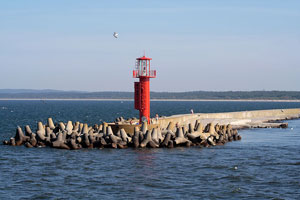
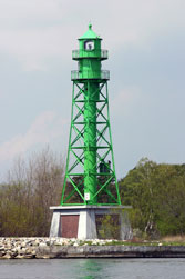
| PL 23 |
Gdynia Breakwater South
latitude 54° 31' 1.5" N longitude 18° 33' 42.3" E
Located at the extreme south end of the Gdynia breakwater, which extends about 3 km south from the Entrance South Light. (C 3016.2) ARLHS # POL-079
Photo courtesy kkic [wikipedia] |
|
|
|
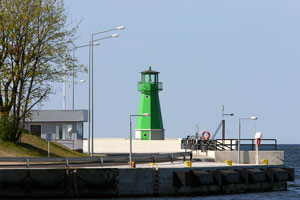
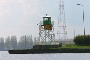
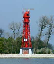
| PL 24 |
| Sopot
latitude 54° 26' 43.2" N longitude 18° 34' 13.8" E
Sopot, sometimes called the "summer capital" of Poland, is a town on the Gulf of Gdańsk on the southern outskirts of Gdynia. The light guides ships into the town's harbor, which is protected by a long L-shaped mole. (C 3046) ARLHS # POL-034
Photo courtesy aronski [Flickr] |
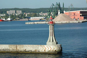
| PL 25 |
Gdansk Head East Breakwater |
|
| PL 26 |
Gdansk Northern Port |
|
| PL 27 |
Gdansk Nowy Port West Breakwater
Nowy Port (New Port) was built in the 19th century to expand the traditional harbor of Gdańsk. Located at the end of the short east breakwater. (C 3066)
Photo courtesy Alex Trabas [ListOfLights] |
|
| PL 28 |
| Gdansk Nowy Port East Breakwater
latitude 54° 24' 59" N longitude 18° 39' 32.8" E
Located at the end of the east breakwater. There are good views from many places around the harbor.
Photo courtesy Peter Ford [Flickr] |
| PL 29 |
Gdańsk Inner Range Front
latitude 54° 24' 36" N longitude 18° 39' 44.9" E
Located near the base of the east breakwater. (C 3064)
Photo courtesy Alex Trabas [ListOfLights] |
|
| PL 30 |
| Gdańsk Inner Range Rear
Located 370 m southeast of the front light. (C 3065)
Photo courtesy Alex Trabas [ListOfLights] |
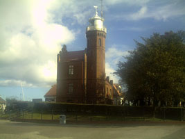
| PL 31 |
Gdańsk Nowy Port {Danzig Neufahrwasser}
The historic lighthouse was protected as a historic site in 1986. Located just off the waterfront at Nowy Port in Gdańsk. Source: Gdansk City Hall ARLHS # POL-033
Photo courtesy Brosen [wikipedia] |
|
| PL 32 |
| Gdansk Port Polnocny (Northern Port)
The tower houses the harbor control facilities for Gdańsk and Gdynia. Located at the harbormaster's office, to which it is attached, at the base of the north breakwater of the new harbor on the east side of Gdańsk. ARLHS # POL-007
Photo courtesy Jakub Raciborski [racibo.pl] |
| PL 33 |
Gdańsk Falochron Północny (Liquid Fuel Jetty)
Located on a spur of the north (main) breakwater of the new Northern Port of Gdańsk. (C 3081.28)
Photo courtesy Alex Trabas [ListOfLights] |
|
| PL 34 |
| Gdańsk Dock #2
Located at the end of Dock #2, which branches from the north breakwater. (C 3081.21)
Photo courtesy Alex Trabas [ListOfLights] |
| PL 35 |
Gdańsk Detached Breakwater (North Head)
Located at the north end of a short detached breakwater protecting the Northern Port from northeast winds. (C 3081.5)
Photo courtesy Alex Trabas [ListOfLights] |
|
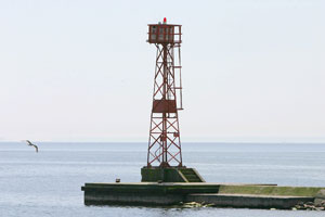
| PL 36 |
| Jastarnia Harbour East Pier Head
latitude 54° 41' 33.9" N longitude 18° 40' 29.2" E (C 2984) ARLHS # POL-081
Photo courtesy Alexander Trabas [ListOfLights] |
| PL 37 |
Jastarnia Harbour West Pier Head
latitude 54° 41' 33.6" N longitude 18° 40' 24.6" E (C 2985) ARLHS # POL-082
Photo courtesy Alexander Trabas [ListOfLights] |
|
| PL 38 |
| Jastarnia Wies {Heisternest}
latitude 54° 42' 0.6" N longitude 18° 40' 54.1" E
There were two earlier stations not far away on the peninsula, the first one established in 1872. Located at Jastarnia, on highway 216 about 40 km southeast of Władysławowo (C 2965) ARLHS # POL-010
Photo courtesy Daniel Nuszkiewicz [Flickr] |
| PL 39 |
Gora Szwedow (Hel Peninsula)
Located atop a dune at the easternmost bulge of the Hel peninsula about 3 km north of the Hel lighthouse. ARLHS # POL-043
Photo courtesy Mclion [Wikipedia] |
|
| PL 40 |
| Hel
Located at the end of highway 216, about 72 km southeast of Władysławowo ARLHS # POL-008
Photo courtesy Tomasz Kolowski Jr. [wikipedia] |
| PL 41 |
Elblag
At the junction of the Fairways, Zalew Wislany in the Gulf of Gdańsk. (C 3224) ARLHS # POL-080
Photo courtesy Alexander Trabas [ListOfLights] |
|
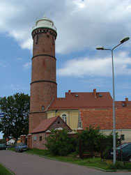
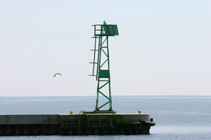
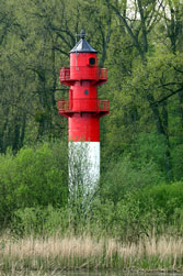
| PL 42 |
| Krynica Morska {Kahlberg}
The east end of the peninsula lies across the Russian frontier. Located on highway 501 about 100 km east of Gdańsk and midway on the Polish portion of the peninsula. (C 3090) ARLHS # POL-013
Photo courtesy Joan und Gary Trigwell [ListOfLights] |
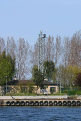
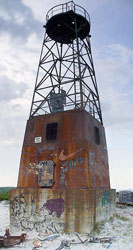
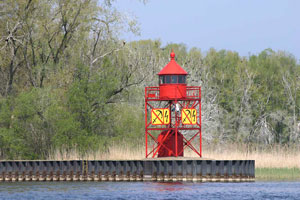
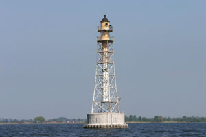
| PL 45 |
Oksywie {Oxhöft} |
Lost. Located in the Gulf of Gdańsk north of Gdynia. ARLHS # POL-044 |
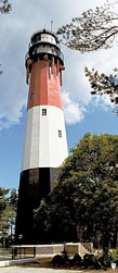
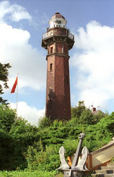
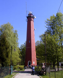
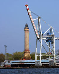
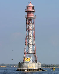
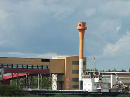
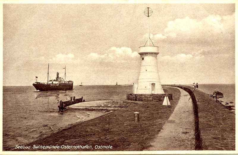
| PL 47 |
Swinoujscie (Swinemünde)
This magnificent lighthouse is the tallest brick lighthouse ever built; it is nearly 13 ft taller than the Cape Hatteras Light in the U.S. Located on the east bank of the river Świna just inside the entrance. (C 2668) ARLHS # POL-019
Photo courtesy Alex Trabas [ListOfLights] |
|
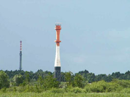
| PL 48 |
| Swinoujscie - Mlyny Front Range
latitude 53° 55' 34.3" N longitude 14° 16' 36.7" E
Located at the end of the short west mole at the mouth of the river; accessible by walking the mole. (C 2670) ARLHS # POL-028
Photo courtesy Helmut Seger [ListOfLights] |
|
|
| PL 49 |
Swinoujscie - Mlyny Galeriowa Rear
latitude 53° 55' 17.7" N longitude 14° 16' 41.6" E
The modern light tower is located on the west bank of the Świna 520 m south southwest of the front light. (C 2670.1) ARLHS # POL-027
Photo courtesy Helmut Seger [ListOfLights] |
|
| PL 50 |
| Swinoujscie East Mole
latitude 53° 55' 53.8" N longitude 14° 16' 38.4" E
Located at the end of the east mole, which curves northwestward in front of the Świnoujście lighthouse. (C 2672) ARLHS # POL-026
Photo courtesy Helmut Seger [ListOfLights] |
| PL 51 |
Kosa North End (Marine Pier)
latitude 53° 54' 22.3" N longitude 14° 15' 28.7" E
Located at the end of a long pier along the west side of the Świna channel about 2 km south southwest of the Galeriowa lighthouse. (C 2678) ARLHS # POL-036
Photo courtesy Alex Trabas [ListOfLights] |
|
| PL 52 |
| Kosa South End (Marine Pier)
latitude 53° 53' 47.1" N longitude 14° 15' 1.1" E
This tower is a twin of the North End light. (C 2678.75) ARLHS # POL-037
Photo courtesy Alex Trabas [ListOfLights] |
| PL 53 |
Mielen North End
latitude 53° 53' 37.7" N longitude 14° 15' 19" E
There was a light located at the north end of the island of Mielen, which divides the Świna for about 3.5 km, but its only a buoy now. (C 2680) ARLHS # POL-064
Photo courtesy Alex Trabas [ListOfLights] |
|
| PL 54 |
| Mielen South End
latitude 53° 51' 56.7" N longitude 14° 16' 44.3" E
Located at the south end of the island of Mielen, which divides the Świna for about 3.5 km. (C 2685) ARLHS # POL-065
Photo courtesy Alex Trabas [ListOfLights] |
| PL 55 |
Piastowski Kanal North End (Karsibór North End)
latitude 53° 51' 36.6" N longitude 14° 16' 51" E
Located at the north end of the Kanał Piastowski, a dredged channel about 8 km long connecting the Świna to the Zalew Szczeciński (Stettiner Haff). (C 2689) ARLHS # POL-068
Photo courtesy Alex Trabas [ListOfLights] |
|
| PL 56 |
| Karsibor Range Front
latitude 53° 51' 5.6" N longitude 14° 16' 46.6" E
Located on the west bank of the Kanał Piastowski, 1.3 km southeast of the rear light. ARLHS # POL-058
Photo courtesy Klaus Huelse [leuchtturme] |
| PL 57 |
Karsibor Range Rear
latitude 53° 51' 38.7" N longitude 14° 16' 1.7" E
The Karsibór range lights are located west of the Kanał Piastowski; they guide vessels northbound through the waterway. Located about 800 m west of the north end of the Kanał Piastowski ARLHS # POL-059
Photo courtesy Klaus Huelse [leuchtturme] |
|
| PL 58 |
| Piastowski Kanal Entrance East (Brama Tarowa 1E)
Located adjacent to the base of the east mole at the entrance to the Kanał Piastowski from the Zalew Szczeciński. (C 2693) ARLHS # POL-066
Photo courtesy Alex Trabas [ListOfLights] |
| PL 59 |
Piastowski Kanal Entrance West (Brama Tarowa 1W)
Located adjacent to the base of the west mole at the entrance to the Kanał Piastowski from the Zalew Szczeciński. (C 2694) ARLHS # POL-067
Photo courtesy Alex Trabas [ListOfLights] |
|
| PL 60 |
| Zalew Szeczecinski Northeast (Brama Tarowa 2E)
latitude 53° 45' 39.3" N longitude 14° 24' 17" E
Located near the center of the Zalew Szczeciński, about 6.5 km northeast of the south shore near Podgrodzie (C 2700) ARLHS # POL-075
Photo courtesy Alex Trabas [ListOfLights] |
| PL 61 |
Zalew Szeczecinski Northwest (Brama Tarowa 2W)
latitude 53° 45' 34.1" N longitude 14° 24' 5.9" E
( location ditto) (C 2701) ARLHS # POL-076
Photo courtesy Alex Trabas [ListOfLights] |
|
| PL 62 |
| Zalew Szeczecinski Southeast (Brama Tarowa 3E)
latitude 53° 42' 47.3" N longitude 14° 28' 8.4" E
Located in the southeastern part of the Zalew Szczeciński, about 5 km north of the south shore west of Trzebież. (C 2702) ARLHS # POL-077
Photo courtesy Alex Trabas [ListOfLights] |
| PL 63 |
Zalew Szeczecinski Southwest (Brama Tarowa 3W)
latitude 53° 42' 42.1" N longitude 14° 27' 56.9" E
(location ditto) (C 2703) ARLHS # POL-029
Photo courtesy Alex Trabas [ListOfLights] |

|
| PL 64 |
| Chelminek North (Roztoka Odrzańska)
latitude 53° 40' 27.4" N longitude 14° 31' 22.4" E
Located at the northwestern end of a mole along the edge of Chełminek Island that parallels and protects the channel leading into the southeastern extension of the Zalew Szczeciński, about 1.2 km north of Trzebież. (C 2719) ARLHS # POL-050
Photo courtesy Alex Trabas [ListOfLights] |
| PL 65 |
Chelminek South
latitude 53° 40' 12.9" N longitude 14° 31' 56.9" E
Located at the southeastern end of a mole along the edge of Chełminek Island. (C 2720) ARLHS # POL-051
Photo courtesy Alex Trabas [ListOfLights] |
|
| PL 66 |
| Brama Tarowa 4E
latitude 53° 39' 55.1" N longitude 14° 31' 59.1" E
Located on the east side of the channel a short distance south of the Chełminek South light. (C 2722) ARLHS # POL-046
Photo courtesy Alex Trabas [ListOfLights] |
| PL 67 |
Brama Tarowa 4W
latitude 53° 39' 49.9" N longitude 14° 31' 47.9" E
Located on the west side of the channel a short distance south of the Chełminek South light (C 2721) ARLHS # POL-047
Photo courtesy Alex Trabas [ListOfLights] |
|
| PL 68 |
| Stepnica Range Front
latitude 53° 38' 6.4" N longitude 14° 34' 41.2" E
Located 740 m south southeast of the rear light. (C 2730) ARLHS # POL-071
Photo courtesy Alex Trabas [ListOfLights] |
| PL 69 |
Stepnica Range Rear
latitude 53° 38' 29.6" N longitude 14° 34' 32.9" E
The range guides northbound ships headed for the main part of the sound. Located in the southeastern extension of the Zalew Szczeciński, about 4 km southwest of Stepnica (C 2730.1) ARLHS # POL-072
Photo courtesy Alex Trabas [ListOfLights] |
|
| PL 70 |
| Zulawy
latitude 53° 37' 46.4" N longitude 14° 35' 26.2" E
This directional light guides vessels in both directions. Located about 2 km southeast of the Stepnica range lights. (C 2732)
Photo courtesy Alex Trabas [ListOfLights] |
| PL 71 |
Mankow (Mńków) Front Range
latitude 53° 37' 4.6" N longitude 14° 35' 38.2" E
Located on the east bank of the Odra near the southeastern tip of the Zalew Szczeciński, where it guides southbound ships to the mouth of the Odra (Oder) River. (C 2728) ARLHS # POL-030
Photo courtesy Alex Trabas [ListOfLights] |
|
| PL 72 |
| Mankow (Mńków) Rear Range
latitude 53° 36' 29.1" N longitude 14° 36' 24.9" E
Located in a forest on the east bank of the Odra, 1.4 km southeast of the front light. (C 2728.1) ARLHS # POL-031
Photo courtesy Alex Trabas [ListOfLights] |
| PL 73 |
Krepa Range Front
latitude 53° 35' 51.3" N longitude 14° 35' 36.4" E
Siblings of the Stepnica Range lighthouses. Located just off the mouth of the Odra, 650 m south of the rear light. (C 2736) ARLHS # POL-060
Photo courtesy Alex Trabas [ListOfLights] |
|
| PL 74 |
| Krepa Range Rear
latitude 53° 36' 12.4" N longitude 14° 35' 34" E
The range guides northbound ships exiting the mouth of the Odra (Oder) River. Located about 1000 m north of the river's mouth. (C 2736.1) ARLHS # POL-061
Photo courtesy Alex Trabas [ListOfLights] |
| PL 75 |
Radun Range Front (Odra River)
latitude 53° 34' 40.7" N longitude 14° 35' 54.1" E
This is the southbound entrance range for the Odra. Located on the east bank of the river about 2.5 km north of Police. (C 2734) ARLHS # POL-024
Photo courtesy Alex Trabas [ListofLights] |
|
| PL 76 |
| Radun Range Rear (Odra River)
latitude 53° 34' 15.4" N longitude 14° 36' 3.3" E
Located on the east bank of the river 800 m south southeast of the front light. (C 2734.1) ARLHS # POL-025
Photo courtesy Alex Trabas [ListofLights] |
| PL 77 |
Police Range Front (Odra River)
latitude 53° 33' 42.6" N longitude 14° 35' 26.7" E
Located on a wharf on the west bank of the river in Police, adjacent to an industrial plant. (C 2738.5) ARLHS # POL-069
Photo courtesy Klaus Huelse [leuchtturme] |
|
| PL 78 |
| Police Range Rear (Odra River)
latitude 53° 33' 53.3" N longitude 14° 35' 7" E
The range guides northbound ships departing Szczecin. Located about 250 m west of the river in an industrial area on the northeastern edge of Police. (C 2738.51) ARLHS # POL-070
Photo courtesy Klaus Huelse [leuchtturme] |
| PL 79 |
Domance (Cross Light)
latitude 53° 33' 21.9" N longitude 14° 35' 39.1" E
The light helps guide ships around a change in the direction of the channel at Police. Located on the west bank of the river at Police. (C 2741) ARLHS # POL-023
Photo courtesy Alex Trabas [ListOfLights] |
|
| PL 80 |
| Domance Front Range (Politzer Wiesen)
latitude 53° 33' 7.4" N longitude 14° 35' 55.8" E
This range guides southbound ships toward Szczecin. Located on the west bank of the river at Czaoliniec, just south of Police. (C 2743) ARLHS # POL-052
Photo courtesy Alex Trabas [ListOfLights] |
| PL 81 |
Domance Rear Range
latitude 53° 32' 46" N longitude 14° 35' 58.6" E
Located 660 m south of the front light. (C 2743.1) ARLHS # POL-053
Photo courtesy Alex Trabas [ListOfLights] |
|
| PL 82 |
| Łąki Range Front (Odra River)
latitude 53° 32' 51.1" N longitude 14° 37' 43.5" E
Located on the east bank of the Odra about 2.5 km southwest of the Domańce Front Light. (C 2756) ARLHS # POL-062 |
| PL 83 |
Łąki Range Rear (Odra River)
latitude 53° 33' 4.8" N longitude 14° 37' 41.4" E
Located about 500 m north of the front light. (C 2756.1) ARLHS # POL-063 |
|
| PL 84 |
| Inskie (Odra River)
latitude 53° 32' 28.7" N longitude 14° 38' 4.5" E
The light helps guide ships around a change in the direction of the channel near Święta. Located on the east baWnk of the river about 1.5 km south of Święta. (C 2754) ARLHS # POL-057
Photo courtesy Alex Trabas [ListOfLights] |
| PL 85 |
Ina Range Common Rear (Odra River)
latitude 53° 31' 59.2" N longitude 14° 38' 35.7" E
Located east of the river about 625 m southeast of the southbound front light and 850 m north northeast of the northbound front light. (C 2747) ARLHS # POL-054
Photo courtesy courtesy Klaus Huelse [leuchtturme] |
|
| PL 86 |
| Ina Range Northbound Front (Odra River)
latitude 53° 31' 32.8" N longitude 14° 38' 21.5" E
Located on the east bank of the river about 4 km south of Święta. (C 2746.9) ARLHS # POL-055
Photo courtesy Alex Trabas [ListOfLights] |
| PL 87 |
Ina Range Southbound Front (Odra River)
latitude 53° 32' 12.5" N longitude 14° 38' 11.4" E
Located on the east bank of the river about 2.2 km south of Święta. (C 2747.1) ARLHS # POL-056
Photo courtesy Alex Trabas [ListOfLights] |
|
| PL 88 |
| Babina
latitude 53° 30' 57.9" N longitude 14° 38' 20.3" E
This directional light is located on the west side of the island of Mewia, at the northwestern corner of Czarna Łąka, a large lake through which the river flows north of Szczecin. (C 2750) ARLHS # POL-045
Photo courtesy Alex Trabas [ListOfLights] |
| PL 89 |
Bykowo Range Front
latitude 53° 30' 31.3" N longitude 14° 38' 8.4" E
This range guides vessels southbound to the entrance of a canal (originally the Königsfahrt) west of Czarna Łąka, leading to Szczecin. Located on the east side of the canal. (C 2762) ARLHS # POL-048
Photo courtesy Alex Trabas [ListOfLights] |
|
| PL 90 |
| Bykowo Range Rear
latitude 53° 30' 11.8" N longitude 14° 38' 12.1" E
Located on the east side of the canal about 600 m south of the front light. (C 2762.1) ARLHS # POL-049
Photo courtesy Alex Trabas [ListOfLights] |
| PL 91 |
Swieta Range Front
latitude 53° 28' 5.2" N longitude 14° 36' 29.7" E |
This is the southbound range guiding ships down the canal (originally the Königsfahrt) west of Czarna Łąka, leading to Szczecin. Located on the west side of the canal. (C 2764) ARLHS # POL-073 |
| PL 92 |
Swieta Range Rear
latitude 53° 27' 39.4" N longitude 14° 36' 15" E |
(C 2764.1) ARLHS # POL-074 |
|
|
 Germany
 Lithuania


_latarnia3.jpg)


