latitude 46° 40' 23.1" N
longitude 86° 8' 21.6" W
September 7, 2009
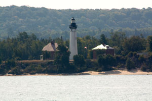
Just as its keepers once did, visitors today must walk to it, but only 1.5 miles. Take Alger County Road (H-58) at the Pictured Rocks National Lakeshore, a dirt and gravel access road, for about 12 miles. When you reach the Hurricane River Campground, park near the Hurricane River and take the two track access path to the lighthouse and Lake Superior. ARLHS # USA 022
| home | Superior lights | map this |
| prev | region page | next |
| GL/Superior () / Superior MI30 |