latitude 37° 7' 23" N
longitude 75° 54' 23.3" W
September 16, 2013
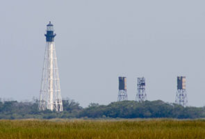
Best viewed from the water (on the west side of the Southern Section of Smith Island (just N of the entrance to Chesapeake Bay). You can take a boat out of Kiptopeke State Park. This is the second highest VA light.
From the ground, take the Chesapeake bridge/tunnel North, turn right on first road after the welcome center, turn left on Seaside road, the right again on Dixon drive. It's about 2 miles of dirt lane out to a dock from which you can get very nice pictures. ARLHS # USA-109
| home | Virginia lights | map this |
| prev | region page | next |
| ECU/Virginia () / Virginia VA2 |