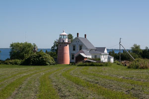
latitude 44° 54' 23.5" N
longitude 73° 20' 36.3" W
July 2, 2010
From Highway 2, which runs north/south along the islands of Lake Champlain, turn west on Highway 129 and follow it onto Isle La Motte. Turn right onto Shrine Road and then right onto Lighthouse Point Road. You will have to walk the last few hundred yards and cross a field to where you will see the light. ARLHS # USA-405
| home | NHVT lights | map this |
| prev | region page | next |
| ECU/NHVT () / NHVT VT2 |