|
This page shows my understanding of Lighthouses of Québec. Copies of these pictures are stored on the web if you want to download them. Click on [most] any photo and that will take you to that photo. Orange italicized numbers in parentheses are references to the Canadian Coast Guard List of Lights INLAND WATERS |
|
Inland Waters
| QC 1 |
Ash Island Range Front (Île Ash, Île aux Têtes)
latitude 45° 3' 34.2" N longitude 73° 19' 41.4" W
This was a northbound (downstream) range guiding vessels in the northernmost end of Lake Champlain as they approached Ash Island, a large island in the river at Lacolle. Located on the south bank of the island, about ¼ mile south of the Lacolle railroad bridge and 3 miles north of the U.S. border. (G 5676) ARLHS # CAN-866
Photo courtesy Marinas.com [Marinas.com] |
|
| QC 3 |
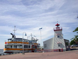
| Pointe aux Anglais
July 1, 2010
This was located on a reef in the Lac des Deux Montagnes at Oka. It looks like it has been relocated to a Marina just north of the ferry connection from Hudson. [1245] ARLHS # CAN-1271 |
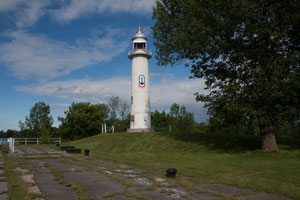
| QC 5 |
Lower Allumette Lake |
Located on the east side of the Île des Allumettes
off the riverside road about 8 km south of Waltham. The site is open, but difficult to find and the building is endangered. ARLHS # CAN-1122 |
| QC 7 |
Passage Lower |
Located on the north side of the river on the west end of the Île Leblanc, off the Île des Allumettes about 5 km west of Pembroke, Ontario. Accessible only by boat. [1308] ARLHS # CAN-891 |
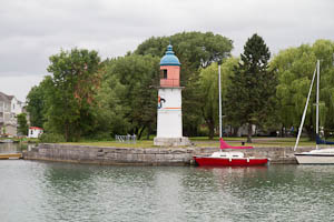
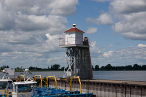
| QC 9 |
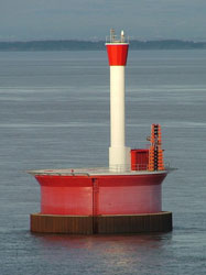
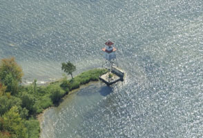
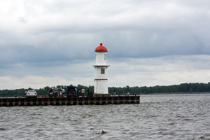
Soulanges Canal Lower Entrance Range Front
latitude 45° 20' 9.5" N longitude 73° 57' 18.6" W
July 1, 2010
Located in Pointe-des-Cascades at the end of the north pier at the eastern canal entrance; this is also at the confluence of the Ottawa and St. Lawrence Rivers. From the park, travel down the lane about a mile. Much of it is dirt and potholes. ARLHS # CAN-1198 |
|
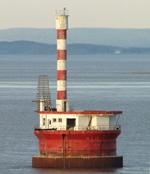
| QC 13 |
Soulanges Canal Upper Entrance Range Rear
latitude 45° 15' 40.6" N longitude 74° 11' 48.8" W
June 26, 2012
It is an attraction in a riverside public campground. Located near the campground entrance on the east side of the canal in Les Coteaux, about 480 m north of the front light.
Take highway 338 south from the Lower Entrance about 10 miles till you get to the upper entrance. Cross the canal and you are looking at the rear range light. ARLHS # CAN-1201 |

|
| QC 17 |
Pointe Beaudette (Pointe au Beaudet, McKie Point)
latitude 45° 11' 50.8" N longitude 74° 19' 21.2" W |
Located on a sharp point on the north side of the river near Rivière Beaudette and the Ontario border. On private land so the best viewing may be from the river. [99] ARLHS # CAN-1124 |
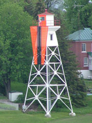
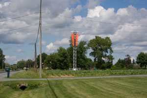
| QC 19 |
Dixie Range Rear
latitude 45° 25' 57.8" N longitude 73° 43' 32.5" W
June 24, 2008
This is an upstream range guiding ships past Lachine. Located in the river off Dorval, about 3.2 km west of Lachine [1202] |
|
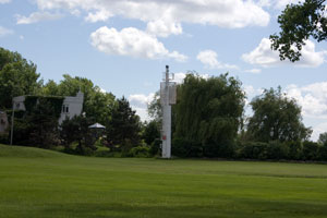
| QC 21 |
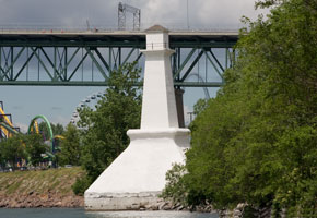
| Lachine Front Range (Montreal)
latitude 45° 25' 56.1" N longitude 73° 41' 41.6" W
June 24, 2008
Located at Fort Rolland Park in Lachine and on St-Joseph street near 32nd Avenue at the point where the old Lachine Canal empties into the St-Laurence river (which is closed to navigation beyond this point because of the Lachine Rapids). [1194] ARLHS # CAN-268 |
| QC 23 |
Lachine Rear Range
latitude 45° 25' 59.3" N longitude 73° 41' 31.1" W
June 24, 2008
This is the back half of the above light. As you can see, it's in a city park. Technically, at this point, the trees hide it from the lake. [1195] ARLHS # CAN-267 |
|
| QC 25 |
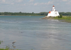
| Île Sainte-Hélène (Île Ronde Range Rear)
latitude 45° 31' 6.8" N longitude 73° 32' 17.5" W
June 24, 2008
The only lighthouse in the city of Montréal, it has been repeatedly vandalized and is clearly endangered. Located below the Fort de l'Île Sainte-Hélène at the west side of the island in Montréal harbor. Accessible from the Jacques Cartier Bridge (QC 134). The nearest parking is for the"Rounde" amusement park. We walked around that parking lot to get this photo. ARLHS # CAN-244 |
| QC 27 |
Île Bouchard Range Rear
latitude 45° 48' 20.2" N longitude 73° 20' 14.3" W |
This is a downstream range; the front light is on a mast 935 m southwest. Located on the southeast side of the island, a long narrow island that divides the river near Verchères, roughly 20 km northeast of Montréal. [2327] ARLHS # CAN-1262 |
| QC 29 |
Verchères Village Range Rear
latitude 45° 46' 36.6" N longitude 73° 21' 40.2" W
The rear light is on a skeletal tower about 635 m southwest of the light below. [2320]
Photo courtesy Larry Myhre [Flickr] |
|
| QC 31 |
| Verchères Village Range Front
latitude 45° 46' 45.8" N longitude 73° 21' 22.6" W
June 24, 2008
This light is located on the breakwater at Verchères, on the southeast side of the river about 25 km northeast of Montréal. [2319] ARLHS # CAN-1206 |
| QC 33 |
Verchères Traverse Range Rear (Moulin à Vent, Verchères Windmill)
latitude 45° 47' 51.9" N longitude 73° 19' 26.9" W
June 24, 2004
Located on the Rue St.-Étienne in Verchères. We found it by following the road to it's indicated geotags, and there it was (darn, as advertized.) [2317] ARLHS # CAN-1343 |
|
| QC 35 |
| Verchères Traverse Range Front
June 24, 2004
To find this light, you need to walk south from the rear range thru several private yards. I was lucky, everybody was pleasant. |
| QC 37 |
Contrecoeur-Verchères Range Front
Located about 3.5 km northeast of Verchères. This is a downstream range; the rear light is on a skeletal tower 1725 m northeast. [2315] ARLHS # CAN-965
Photo courtesy nanouk36b [webshots] |
|
| QC 39 |
Contrecoeur-Verchères Range Rear
latitude 45° 49' 43.2" N longitude 73° 17' 0.6" W |
Located on the south side of the river about 4 km southeast of Contrecoeur. Accessible only by boat. [2316] |
| QC 42 |
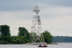
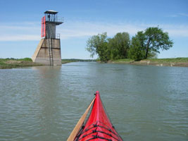
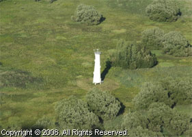
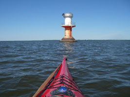
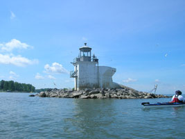
Île Ronde Range Rear
The range guided vessels headed upstream around the north side of the Îles de Verchères. Located on the west side of the Îles de Verchères opposite St.-Sulpice.
Photo courtesy ©2007 Lloyd Gross ALL RIGHTS RESERVED [Flickr] |
|
| QC 44 |
| Lavaltrie Range Rear
latitude 45° 52' 59.2" N longitude 73° 15' 50.4" W
June 24, 2004
This is an upstream range. Located on l’Île Hervieux, a low island off the waterfront of Lavaltrie. Accessible only boat or over the ice in winter. [2292]
Photo courtesy pamlingo [webshots] |
| QC 46 |
Île Dupas Range Front |
This is a downstream range; the rear light is on a skeletal tower 625 m north. Located on an island on the northwest side of the river south of Berthierville; probably visible distantly from the southeast side south of Tracy. [2274] ARLHS # CAN-1103 |
| QC 48 |
Île du Moine Range Front |
This is an downstream range. Located on a small island near the southwestern end of the Lac St.-Pierre basin south of Louiseville. Accessible only by boat. (2180) ARLHS # CAN-1101 |
| QC 50 |
Île du Moine Range Rear |
Located on a small island near the southwestern end of the Lac St.-Pierre basin south of Louiseville, 1/3 mi east of the front light. [2181] ARLHS # CAN-1102 |
| QC 56 |
Île de Grâce Range Rear
Located about 600 m east northeast of the front range (this is a downstream range). Accessible only by boat. [2176] ARLHS # CAN-1096
Photo courtesy marinas.com [marinas.com] |
|
|
|
| QC 58 |
| Île de Grâce Range Front
Located at the lower (northeast) end of the Île de Grâce, an island at the upper end of the Lac St.-Pierre basin about 10 km northeast of Sorel. Accessible only by boat. [2175] ARLHS # CAN-1095
Photo courtesy marinas.com [marinas.com] |
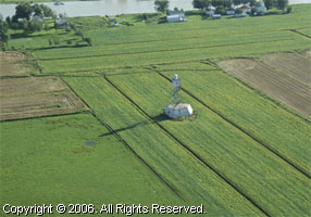
| QC 60 |
Île des Barques Range Front
This is an upstream range; the rear light is 0.3 mi southwest. Located on a small island near the southwestern end of the Lac St.-Pierre basin south of Louiseville. [2168] ARLHS # CAN-1097
Photo courtesy pamlingo [webshots] |
|
| QC 62 |
| Courbe Maskinongé
Located on the south side of the channel at a bend in the middle of Lac St.-Pierre southeast of Louiseville. [2153] ARLHS # CAN-1263
Photo courtesy nanouk36b [webshots] |
| QC 64 |
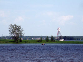
Nicolet Sector (Range Front)
Located on an islet in the river at the east end of the Lac St.-Pierre basin north of Nicolet. Accessible only by boat. [2120] ARLHS # CAN-1264
Photo courtesy Yvon27 [webshots] |
|
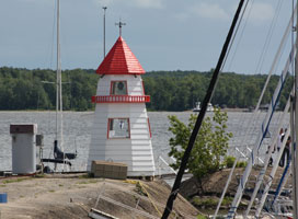
| QC 66 |
| Port Saint François Range
This is a downstream range; the front light is mounted on a pier in the river about 1370 m southwest. Located on the south side of the river at Port-Saint-François, opposite Trois-Rivières. front [2112] ARLHS # CAN-1266
Photo courtesy Michel [webshots] |
| QC 68 |
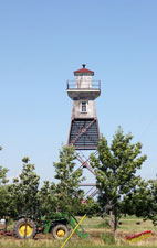
Bécancour Front Range
latitude 46° 22' 24.7" N longitude 72° 26' 58" W
Location: West of the Bécancour River, south shore of the St. Lawrence River, below Trois-Rivières. Not accessible by car. [2073] ARLHS # CAN-873
Photo courtesy Canadian Coast Guard [Lighthouse Digest] |
|
| QC 70 |
| Bécancour Rear Range
latitude 46° 21' 47.5" N longitude 72° 28' 2.6" W
Location: West of the Bécancour River, south shore of the St. Lawrence River, below Trois-Rivières. [2074] ARLHS # CAN-1175
Photo courtesy Canadian Coast Guard [Lighthouse Digest] |
| QC 72 |
Traverse de Bécancour Range
latitude 46° 23' 21.5" N longitude 72° 23' 42.8" W |
Trevarese de Bécancour [2075] ARLHS # CAN-873 |
| QC 74 |
Champlain Upper Range Rear |
This is an upstream range; the front light is on a mast about ¼ mi east. Located on the north shore of the river west of Champlain, about 10 km northeast of Trois-Rivières. [2064] ARLHS # CAN-1181 |
| QC 78 |
Gentilly Range Front
latitude 46° 25' 48" N longitude 72° 15' 46.8" W |
This is an upstream range; the rear tower (entry above) is about 2.6 km south. Located in the river north of Gentilly, about 20 km northeast of Trois-Rivières; should be visible from the south shore in the Gentilly area. Accessible only by boat. [2050] ARLHS # CAN-952 |
| QC 80 |
Batiscan Range Rear |
This is an upstream range; the front light is mounted on a small platform ¼ mi northeast. Located on the north shore of the river northeast of Batiscan. ARLHS # CAN-870 |
| QC 82 |
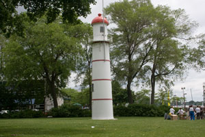
Deschaillons
June 25, 2008
This is a faux light located on the south side of the St. Lawrence, at a rest area beside highway 132, on the west side of Deschaillons-sur-St. Laurent. [2028] |
|
| QC 84 |
| Deschaillons Range
latitude 46° 33' 21.7" N longitude 72° 5' 7.6" W
June 25, 2008
Here is the real Deschaillons range, located on the west side of the village. [2028.5] |
| QC 86 |
Deschaillons Rear Range
latitude 46° 32' 57.9" N longitude 72° 6' 47.6" W
June 25, 2008
While you can technically see this in the photo above, here it is blown up to a finite size. |
|
| QC 91 |
Leclercville Range Rear
June 25, 2008
This is a downstream range; the front light is on a skeletal tower 0.65 mi west. Located about 1 km back from the south shore of the river west of Leclercville. Back in 1915, this was a real house, but some time recently(?) it was rebuilt without the enclosure on the top. [2016] ARLHS # CAN-1147 |
|
| QC 93 |
| Leclercville Range Front (Sainte-Emmélie)
latitude 46° 33' 45.2" N longitude 72° 50.2" W
June 25, 2008
As you drive down PH 132, this light just hits you in the face. You have to find the rear range (above.) (There are many of these ranges. I not attempted to capture all of them either as pictures in this documentary.) ARLHS # CAN-1147 |
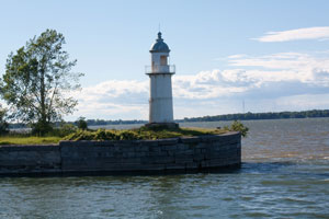
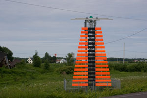
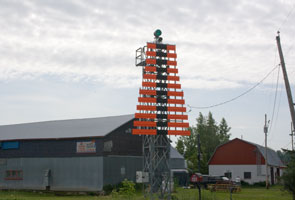
| QC 94 |
Lotbinière Range Front |
Located on the south shore of the St. Lawrence River in La Vieille-Église, west of Lotbinière.
From QC-132 in La Vieille-Église, turn toward the river on Route du Quai. It is on your right behind a house. [2006] ARLHS # CAN-1148 |
| QC 95 |
Saint-Antoine Common
latitude 46° 40' 0.5" N longitude 71° 34' 51.6" W
June 25, 2008
This is a rear for the downstream range and also the front for an upstream range. The upstream rear light is on a skeletal tower 250 m northeast. Located west of Sainte-Antoine de Tilly, on the south side of the river off PH 132. Turn right down a very steep hill onto Rue de Phare and note that this is private land at the bottom. [1975] ARLHS # CAN-1268 |
|
Atlantic Coast
| QC 99 |
Saint-Michel Range Front |
The rear light is on a tripod skeletal tower. Located on the south shore of the river near Saint-Michel-de-Bellechasse, about 18 km east of Québec ARLHS # CAN-1333 |
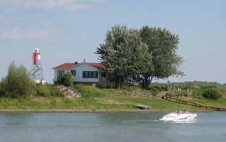
| QC 101 |
Banc du Cap Brûlé Downstream Front
latitude 47° 5' 50.1" N longitude 70° 42' 12.6" W |
Located in the river off Cap Brulé, which is on the north bank about 18 km northeast of Beaupré. Accessible only by boat. [1898] ARLHS # CAN-1136 |
| QC 109 |
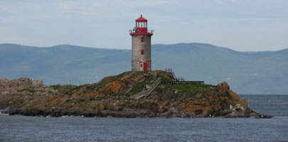
| Pilier de Pierre
The island and lighthouse can be seen in the distance from the Halte les Piliers (rest stop) on Highway 132 west of Saint-Jean-Port-Joli. ARLHS # CAN-979
Photo courtesy Jean Parent |
|
|
| QC 110 |
Grande Île Kamouraska |
This lighthouse no longer exists, it was replaced by a skeleton tower in 1982 and was demolished because of its poor condition.
South side of the St. Lawrence river ARLHS # CAN-972 |
| QC 111 |
Pointe de la Prairie (Île aux Coudres)
The mainland terminal of the Ile aux Coudres ferry is at Saint-Joseph-de-la-Rive. The 15-minute ferry ride is free in both directions. (Call (418) 438-2743 or email for more information on the ferry.) The lighthouse can be seen from the ferry. eMail
For a closer look, after arriving on Ile aux Coudres go to the top of the hill, then turn right on the Rue Royale Ouest until it becomes the Chemin des Coudriers. Look for the Chemin des Prairies (unpaved road and bicycle path), which provides the best views of the lighthouse. [1851] ARLHS # CAN-234
Photo courtesy Hans Raffelt [Flickr] |
|
| QC 113 |
| Cap au Saumon
There is a path (steep and rocky) to the station that starts behind a poultry processing plant west of the small village of Port-au-Persil -- the distance to the lighthouse is about 2 miles. [1836] ARLHS # CAN-078
Photo courtesy MPO-DFO Quebec [Flickr] |
| QC 117 |
| Le Long Pèlerin
The dwelling was demolished in the 1980s but the old tower remains, next to the skeleton tower that replaced it. The island and its two towers can be barely seen from the waterfront in Saint-André. There is currently no public access, but boat tours to the Pilgrims can be arranged on request by Société Duvetnor, P.O. Box 305, Rivière-du-Loup, QC Canada G5R 3Y9; phone: (418) 867-1660. [1832] ARLHS # CAN-284
Photo courtesy Michel Beaupré [Webshots] |
| QC 119 |
St. Andre (faux)
latitude 47° 40' 46.5" N longitude 69° 43' 31" W
A brand new construction, this light looks like it's being used as a bird watching site. It is marked a public nature watching area. |
|
| QC 123 |
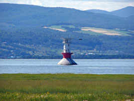
Île Blanche Reef |
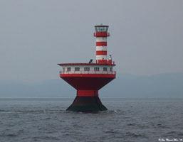
The Ile Blanche Pillar Lighthouse replaced the White Island Reef lightship station, established in 1886. The station was only accessible by boat when it was established, with keepers tending the light on a rotational basis, but a helipad was added in 1969. The light was fully automated in 1982. The lighthouse was discontinued in August 1995 and the structure was dismantled. [1824] ARLHS # CAN-974 |
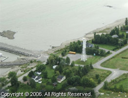
| QC 125 |
Cap de l'Est (Saguenay River) |
Located on the north side of the Saguenay in the municipality of Sainte-Rose-du-Nord off QC 172 about 40 km east of Chicoutimi. SaintRose [1798] ARLHS # CAN-963 |
| QC 127 |
Cap Bon Désir
North shore of St. Lawrence, east of Tadoussac, near Bergeronnes. From Highway 138 about two miles east of Grandes-Bergeronnes, follow the Chemin du Cap-Bon-Désir. Call (418) 232-6751 for information. [1755] ARLHS # CAN-080
Photo courtesy NPO-DFO Quebec [Flickr] |
|
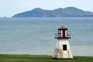
| QC 129 |
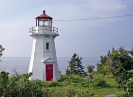
| Île Verte
The ferry to the island can accommodate a few cars ($30 each way for non-residents). From Highway 132 near the mainland village of L'Isle-Verte, follow the road for Notre-Dame-des-Sept-Douleurs which ends at the ferry wharf. The trip to the island takes about 30 minutes. At the top of the hill after arriving on the island, turn left and then almost immediately right on the road to the lighthouse. [1761] ARLHS # CAN-244
Photo courtesy Tjerk Bartlema [Flickr] |
| QC 131 |
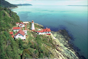
Pointe Noire (Saguenay River) |
The 1903 lighthouse here was replaced by a steel tower in 1952. A new steel skeleton tower was built in 1977. The light was automated in 1980.
on the south side of the entrance to the Saguenay River, St. Lawrence River. [1779] ARLHS # CAN-399 |
| QC 133 |
Haut Fond Prince
The lighthouse can be seen from some of the whale-watching tour boats operating out of Tadoussac and Baie-Sainte-Catherine on the north shore of the St. Lawrence, and Rivière-du-Loup on the south shore. [1773] ARLHS # CAN-223
Photo courtesy John Clement Howe [Flickr] |
|
| QC 135 |
Île Rouge |
The lighthouse can be seen from some of the whale-watching tour boats operating out of Tadoussac and Baie-Sainte-Catherine on the north shore of the St. Lawrence, and Rivière-du-Loup on the south shore [1770] ARLHS # CAN-245 |
| QC 137 |
Île Bicquette
Located on a small island near the larger Île du Bic, on the south side of the river about 40 km west of Rimouski. Accessible only by boat. Ile [1748] ARLHS # CAN-237
Photo courtesy marinas.com [marinas.com] |
|
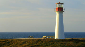
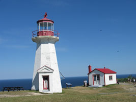
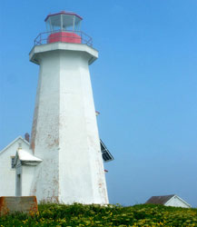
| QC 139 |
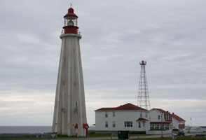
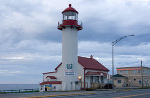
| Pointe au Père
latitude 48° 31' N longitude 68° 28' W
June 24, 2008
This light is located 300 km East of Québec city. You can get there via Highway 20/Route 132 East. When 132 again becomes near Rimouski, take exit 614 and return north to 132. Travel 4 miles, then turn left on Rue de Parc to the light.
This is a full complex with museum and exhibits. Well worth the time to stay and look. ARLHS # CAN-394 |
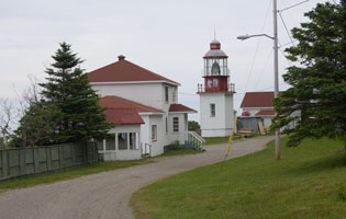
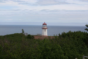
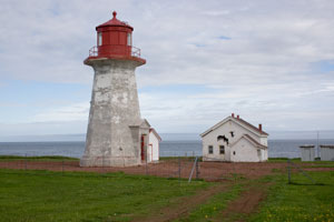
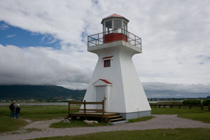
| QC 141 |
Pointe Mitis
June 25, 2008
As you can see, this is now a fully blocked off research station. Visitors are not welcome.
From Highway 132 about 1.5 miles west of the village of Métis--sur-Mer (Metis Beach), follow a road marked "Rue du Phare" for about 2 miles. [1707] ARLHS # CAN-376 |
|
| QC 143 |
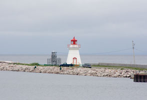
| Matane East Breakwater
latitude 48° 50' 60" N longitude 67° 32' 56.9" W
June 25, 2008
The lighthouse (now also the tourist information bureau) is located on Highway 132 on the western side of the city. [1705.6] ARLHS # CAN-956 |
| QC 145 |
Cap Chat
latitude 49° 5' 20.4" N longitude 66° 44' 27.6" W
June 26, 2008
From Highway 132 about 3 miles west of the town of Cap-Chat, look for a sign marked "Vents et Mer" (white lettering on black background), across the road from a number of "eolians" (windmills). It now is a recreation area with a big sign marked d'Arbre en Arbre. [1685] ARLHS # CAN-089 |
|
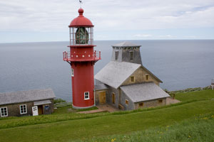
| QC 147 |
| La Martre de Gaspé
latitude 49° 12' 22" N longitude 66° 10' 15.5" W
June 26, 2008
It's the only wooden lighthouse on the list of Quebec Phares, and about the only lighthouse in the world with the optic still supported by mercury.
The lighthouse is in the village of La Martre; it is easily accessible on a steep hill from Highway 132. [1657] ARLHS # CAN-266 |
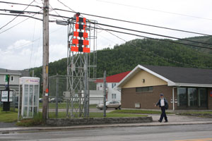
| QC 149 |
Mont Luis
latitude 49° 13' 45.2" N longitude 65° 43' 57" W
June 26, 2008
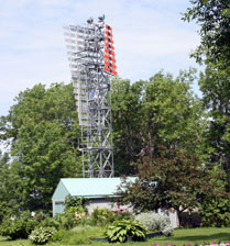
We stopped here because it had a Post office on the main road. I was intrigued by the design - the same as the range lights between Montreal and Quebec city. |
|
| QC 151 |
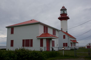
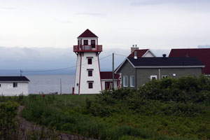
| Cap de la Madeleine
latitude 49° 15' 3.6" N longitude 65° 19' 33.6" W
June 26, 2008
From Highway 132 in the village of Rivière-la-Madeleine, take the Rue du Phare. There is a coffee shop, a craft shop, a museum and a picnic area. Parking is available. Guided tours of the lighthouse are available from mid-June to early September. [1651] ARLHS # CAN-081 |
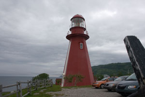
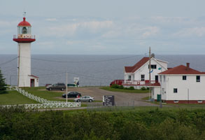
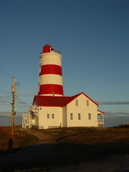
| QC 153 |
Pointe à la Renommée
latitude 49° 6' 23.8" N longitude 64° 36' 7.9" W
June 26, 2008
On Highway 132 about 3 miles west of L’Anse-à-Valleau, watch for the sign announcing the lighthouse. An unpaved road (about 2.5 miles) leads to the reconstituted lightstation. ARLHS # CAN-392 |
|
| QC 155 |
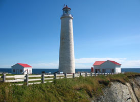
| Cap des Rosiers
latitude 48° 51' 22.7" N longitude 64° 12' 3.6" W
June 26, 2008
This is the tallest lighthouse in Canada (37 m) and it is in the village of Cap-des-Rosiers. You can't miss it from Highway 132. [1621] ARLHS # CAN-085
Photo courtesy Caroline Pilon [Flickr] |
| QC 157 |
Cap de Rabast (Pointe du Nord)
latitude 49° 57' 6.5" N longitude 64° 8' 58.6" W |
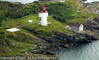
Gerard Barriault has a page on the history of the station, where his father was once the keeper. Located on the northernmost point of the island about 25 km north of Port-Menier. history (H 1882) [1602] ARLHS # CAN-084 |
| QC 159 |
Pointe Carleton
latitude 49° 43' 53.2" N longitude 62° 56' 33.3" W |
Week-long and shorter stays (3 or 4 days) are available in the keeper’s dwelling, now called Auberge Carleton; for information and reservations call (418) 535-0156 or (800) 665-6527. Not to be confused with the light at Carleton-sur-mer below (H 1884) [1601] ARLHS # CAN-395 |
| QC 161 |
Île Plate |
Located on an island on the northwest side of the strait south of Saint-Augustin. Accessible only by boat; should be visible from ferry steamers serving the isolated villages along the north shore of the strait and Gulf of St. Lawrence. (H 1894) [1543] ARLHS # CAN-242 |
| QC 163 |
Pointe de l'Ouest |
The original lighthouse and attached buildings here were demolished in 1967 and a steel tower was erected to replace the lighthouse. [1523] ARLHS # CAN-525 |
| QC 167 |
Baie Ellis Range Front |
The Baie Ellis range lights were established by the then-owner of Anticosti Island, Henri Menier, a Swiss-born chocolate magnate, for his own use. This lighthouse was restored in recent years; the lantern from the front light was installed on this one. (H 1870) [1519] ARLHS # CAN-958 |
| QC 168 |
Baie Ellis Range Rear (Île D'Anticosti) |
Located at Port-Menier, the island's only protected anchorage. (H 1870.1) [1520] ARLHS # CAN-958 |
| QC 169 |
Pointe du Sud Ouest
latitude 49° 23' 28.9" N longitude 63° 35' 40.3" W |
The original lighthouse here (it still stands but has been neglected and is in severe disrepair) was replaced in 1959 by a pyramidal metal tower with an automated light. That second tower was replaced in 1972 by a 50-foot square, skeleton tower, which is still active. photo (H 1866) [1515] ARLHS # CAN-398 |
| QC 171 |
Escarpment Bagot
latitude 49° 3' 58.1" N longitude 62° 15' 34.9" W |
For information on travelling to Anticosti Island and its lighthouses, contact Sépaq Anticosti, 801 chemin St-Louis, Suite 125, Québec City QC, G1S 1C1, Canada; phone: (800) 463-0863 (toll free in Quebec), or (418) 890-0863. sepaq (H 1864) [1514] ARLHS # CAN-172 |
| QC 173 |
Pointe Heath
latitude 49° 5' 4.9" N longitude 61° 42' 3.4" W |
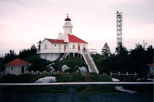
The lighthouse no longer stands; it was replaced by a square skeleton tower in 1965. The light on the skeleton tower was automated in 1973. The light was discontinued in 2002 and the skeleton tower was removed in 2003. There is a white aerobeacon light on the 123-meter tall communications tower located at the station. (1513) [1513] ARLHS # CAN-986 |
| QC 176 |
Île d'Entrée
latitude 47° 16' 3" N longitude 61° 42' 19.4" W |
Visitors are not allowed to take cars to Entry Island. Take the ferry from Havre-Aubert (return fare in 2002: $16); upon arriving, turn right to the Chemin de la Lighthouse; distance is less than a mile. photo (H 0894) [1509] ARLHS # CAN-777 |
| QC 178 |
Île du Havre Aubert (Amherst Island)
latitude 47° 12' 44.6" N longitude 61° 58' 19.2" W
From the village of Havre-Aubert, follow the Chemin du Bassin to the lighthouse (about 2.5 miles). If driving, the best way to reach the Magdalen Islands is by car ferry from Souris, Prince Edward Island (H 0906) [1500] ARLHS # CAN-772
Photo courtesy Corey Hallisey [Flickr] |
|
| QC 180 |
| Cap aux Meules (Grindstone Island)
latitude 47° 23' 5.1" N longitude 61° 57' 34.1" W
At Pointe Hérissée, on the west side of Ile du Cap aux Meules (Grindstone Island). If driving, the best way to reach the Magdalen Islands is by car ferry from Souris, Prince Edward Island. islands (H 0912) [1488] ARLHS # CAN-961
Photo courtesy Xavier Janssoone [Flickr] |
| QC 182 |
Cap Alright
latitude 47° 20' 45.7" N longitude 61° 52' 52.6" W
Located at the end of the Chemin des Echoueries, off QC 199 at the southeastern point of Île du Havre aux Maisons. (H 0900) [1496] ARLHS # CAN-775
Photo courtesy Michèle Séguin [wikimedia] |
|
| QC 184 |
Île Brion
latitude 47° 46' 57.3" N longitude 61° 30' 15.2" W |
The island is protected, and permission to visit must be obtained from the Ministry of the Environment at Grosse-Ile; phone: (418) 985-3595
(H 0886) [1479] ARLHS # CAN-774 |
| QC 186 |
Rocher aux Oiseaux (Bird Rocks)
latitude 47° 50' 17.7" N longitude 61° 8' 38.2" W |
The Centre Nautique de l’Istorlet provides boat tours of the Magdalens and their lighthouses; call (888) 937-8166 for information. (H 0882) [1478] |
| QC 188 |
Cap Gaspé
The lighthouse is located in Forillon National Park, which is primarily used by hikers and campers. From the town of Gaspé, follow Highway 132 Ouest to the village of Cap-aux-Os. About a mile past the village, follow signs for “Forillon - South Area” to the entrance gate. The way to the lighthouse begins at the end of the road, about 3 miles past the gate. At the parking spot, you have a 2.5-mile long hiking path, which should be attempted only by experienced hikers. (1426) ARLHS # CAN-087
Photo courtesy David Burk [Flickr] |
|
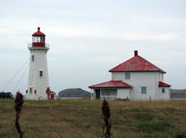
| QC 190 |
| Percé
latitude 48° 30' 5.1" N longitude 64° 13' 6.4" W
June 26, 2008
This light predates the campground, but now the campground is known as "Camping au Phare".
I'm told the campground coordinators get cranky for tourists who come only to look at the light. |
| QC 192 |
Cap d'Espoir
latitude 48° 25' 9.5" N longitude 64° 19' 1.2" W
June 26, 2008
Located at the end of Route du Phare, less than one mile off QC 132 6 miles south of Percé. The land is marked private, no parking and the light clearly needs work. (1403) ARLHS # CAN-086 |
|
| QC 194 |
| Port Daniel Ouest
The lighthouse can be accessed from the Chaleur Chalets resort, 160 Route de la Pointe, Port-Daniel, QC, Canada G0C 2N0; phone: 418-396-5667. (1379) ARLHS # CAN-781
Photo courtesy Michel Beaupré [Webshots] |
| QC 196 |
J. L. Roy
latitude 48° 1' 3.7" N longitude 65° 28' 11.3" W
June 27, 2008
Probably this is a private home, but it is well done. |
|
| QC 198 |
| Bonaventure Harbour
latitude 48° 2' 7.3" N longitude 65° 28' 58.7" W
June 27, 2008
We spotted this on the end of the harbour. Don't know if it's in active use, or not. |
| QC 200 |
Carleton (Pointe Tracadigache)
latitude 48° 5' 12.7" N longitude 66° 7' 28.7" W
June 29, 2008
Located on Pointe Tracadigache, near the Carleton campground off QC 132 in Carleton-sur-Mer. Don't confuse this with Pointe Carleton #QC159 [1365] ARLHS # CAN-964 |
|
| QC 202 |
Table Head
latitude 49° 21' 4.3" N longitude 61° 53' 44.6" W |
The lighthouse can be reached by road from Port-Menier. ARLHS # CAN-082 |
| QC 204 |
Natashquan Point |
The original lighthouse here was replaced by a 30-foot skeleton tower in 1992. Three years later (spring 1995), the lighthouse fell to the bottom of the cliff due to sea and wind erosion. ARLHS # CAN-336 |
| QC 208 |
Île au Perroquets
latitude 50° 13' 13.4" N longitude 64° 12' 24.2" W
For information on boat tours to the island, contact Excursions du Phare, 126, rue de la Mer, Longue-Pointe-de-Mingan, QC, Canada G0G1V0; phone (418) 949-2302 excursions
Located on an island off the north shore near Longue-Pointe, west of Mingan. Accessible only by boat. (H 1958) ARLHS # CAN-236
Photo courtesy Jean-Sebastien Chouinard [Flickr] |
|
| QC 210 |
Carousel Island
latitude 50° 5' 19.7" N longitude 66° 22' 42.4" W |
The island is a migratory bird sanctuary and is not accessible to the public. However, some boat tours leaving from the Sept-Iles marina may offer views of the lighthouse ARLHS # CAN-239 |
| QC 212 |
Great Cawee (Île du Grand Caouis)
latitude 49° 49' 35.7" N longitude 67° 21.1" W |
Located on an island off the north shore about 50 km south of Port-Cartier. Accessible only by boat. (H 2010) |
| QC 214 |
Île aux Oeuf
latitude 49° 37' 19.1" N longitude 67° 10' 32" W |
The keeper's house at this station was demolished in the 1970s. (H 2018) ARLHS # CAN-235 |
| QC 216 |
Point des Monts
latitude 49° 19' 32.8" N longitude 67° 22' 0.8" W
The area is accessible via QC 138 from Québec city or by ferry from Matane on the south shore. Located about 4 km southwest of Baie Trinité off QC 138. Accessible by a footbridge about 150 ft long. (H 2024) ARLHS # CAN-396
Photo courtesy mdmarkus [Flickr] |
|
|
|

 St. Lawrence River Map