|
This page shows a portion of Lighthouses of Spain. You can click on the photo of the light to go to it's specific (larger resolution) copy. The name of each lighthouse is linked to (in our editorial opinion) the best reference site for that light. |
|
Guipúzcoa
| SP 1 |
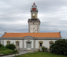
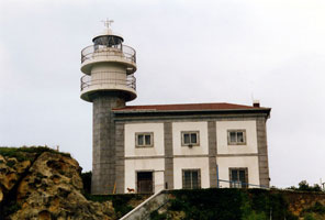
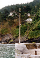
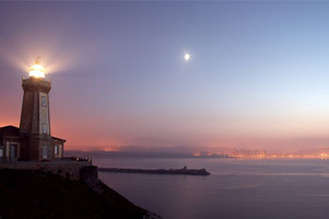
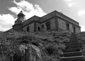
Cabo Higuer
latitude 43° 23' 31.4" N longitude 1° 47' 31.1" W
Cabo Higuer shelters the entrance to the Bahía de Txingudi (Baie de Chingoudy), an international harbor that serves both Hondarribia, Spain, and Hendaye, France. Located on the cape, about 3.5 km north of Hondarribia. (D 1452)
Photo courtesy Crivicris [Flickr] |
|
| SP 2 |
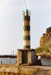
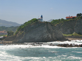
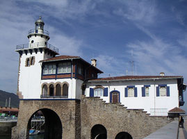
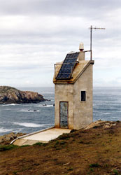
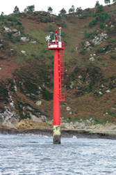
| Pasaia Entrada
latitude 43° 20' 8.5" N longitude 1° 55' 40.8" W
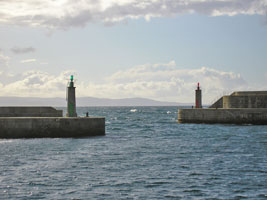
The light marks the entrance to the Bahía de Pasajes, a narrow water gap in a steep mountain ridge. Located at the end of a short jetty on the east side of the entrance, about 4 km north of Pasai Donibane.
Photo courtesy Jesus Jiminez [Flickr] |
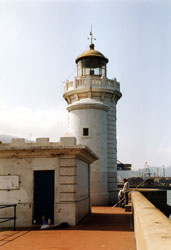
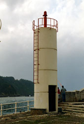
| SP 4 |
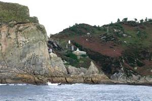
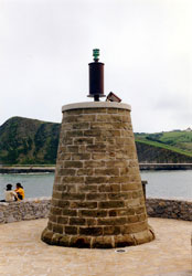
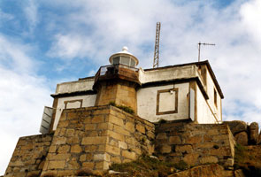
Punta Teodoro Arroca
East side of entrance to harbor at Pasaia. This light and the one above clearly fail the definition of LightHouse, but they are fixed aids to navigation. (D 1472)
Photo courtesy Alex Trabas [ListOfLights] |
|
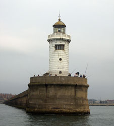
| SP 6 |
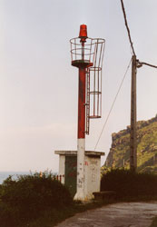
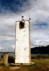
Punta de Senokozulúa
West side of entrance to Bahía de Pasajes. The Basque translates as "Small Bay of the hollow".
Photo courtesy Alberto Martinez Subtil [Flickr] |
|
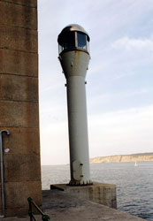
| SP 6D |
| Dique de Senokozulúa
latitude 43° 19' 56.9" N longitude 1° 55' 35.1" W
Located at the end of a breakwater sheltering a small harbor on the east side of the Bahía de Pasajes about 500 m southwest of the Faro de San Juan. (D 1460)
Photo courtesy Arno Siering [ListOfLights] |
| SP 7 |
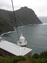
Cabo La Plata
latitude 43° 20' 9.9" N longitude 1° 56' 1.9" W
Monte Ulía, west side of entrance to Bahía de Pasajes. The name means "the Silver Lighthouse". (D 1456)
Photo courtesy Alberto Martinez Subtil [Flickr] |
|
| SP 8 |
| Isla de Santa Clara
latitude 43° 19' 17.9" N longitude 1° 59' 56.4" W
Island in mouth of Bahía de la Concha. The island is accessible by passenger ferry during the summer. (D 1482)
Photo courtesy Alex Trabas [ListOfLights] |
| SP 9 |
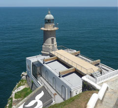
Monte Igueldo
latitude 43° 19' 24" N longitude 2° 36.7" W
Monte Igueldo is a mountain on the west side of the Bahía de la Concha on the northwest side of San Sebastián. The mountain is incorporated in a park that features natural features and historical attractions (such as the lighthouse) as well as amusement rides. (D 1483)
Photo courtesy Paloma Luismi [Flickr] |
|
| SP 10 |
| Guetaria (Punta de San Antón)
Northern end of peninsula north of Guetaria. (D 1489)
Photo courtesy Arno Siering [ListOfLights] |
| SP 11 |
Zumaya (Zumaia, Monte Atalaya)
West side of entrance to Río Urola estuary north of the town of Zumaya.
Photo courtesy Jonatan Sills [Flickr] |
|
| SP 13 |
| Rompeolas de Zumaya (Zumaya Breakwater)
Located at the end of a massive, curving breakwater (completed in 1927) that protects the west side of the entrance to the Río Urola estuary. (D 1494)
Photo courtesy Arno Siering [ListOfLights] |
| SP 14 |
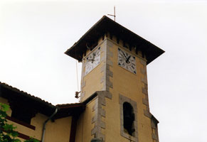
Mutriku (Motrico) (Rear Range)
Harbor at Mutriku (Motrico), the rear range is no more than a light shown from the tower of the church of San Miguel Arcangel. (D 1496.1)
Photo courtesy Alex Trabas [ListOfLights] |
|
| SP 14F |
| Mutriku Front Range (Motriko)
Inner Basin Breakwater Head (D 1496)
Photo courtesy Alex Trabas [ListOfLights] |
Vizcaya (Bizcaia)
| SP 15 |
Cabo de Santa Catalina (Lekeitio)
latitude 43° 22' 38.1" N longitude 2° 30' 36.2" W
End of Avenida de Santa Catalina north of Lekeitio.
Photo courtesy kakapoEH [Flickr] |
|
| SP 17 |
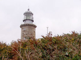
Cabo Machichaco (1909) (Matxitxako)
The lighthouse marks the most prominent and dangerous cape of the Basque coastline and is said to be Spain's most powerful light, with a range of 24 mi. Located on the cape, at the end of the BI-4203 highway, about 10 km northwest of Bermeo.
Photo courtesy Joseba Barrenetxea [Flickr] |
|
| SP 18 |
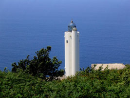
| Górliz (Cabo Villano)
latitude 43° 25' 59" N longitude 2° 56' 36" W
It was built as part of the Plan de Señales Marítimas 1985-89, a national plan to upgrade coastal aids to navigation. Note: not to be confused with another Cabo Villano lighthouse in Galicia. Located atop a steep slope on Monte Ermua, about 5 km north of Górliz. Accessible by a winding mountain road, the site offers magnificent views of the sea. SP 86
Photo courtesy "Gorliz" [Flickr] |
| SP 19 |
Punta Galea
latitude 43° 22' 23.8" N longitude 3° 2' 9.9" W
Located on a bold promentory off the Camino de la Galea in Getxo, marking the eastern entrance to the Bahía de Getxo, the harbor of Bilbao.
Photo courtesy Big.eckzemos [Flickr] |
|
| SP 20 |
| Getxo Contradique de Algorta (East Breakwater)
latitude 43° 22' 23.4" N longitude 3° 2' 21.5" W
The Contradique de Algorta, 1148 m long, was built between 1893 and 1901 to provide a sheltered harbor at Getxo, the port of the city of Bilbao. Located at the end of the breakwater, guarding the narrow entrance to the inner harbor. (D 1525)
Photo courtesy Arno Siering [ListOfLights] |
| SP 21 |
Arriluze (Getxo Contradique de Algorta Arranque)
latitude 43° 20' 30.7" N longitude 3° 1' 39.3" W
Located on a short pier projecting from the root of the Contradique de Algorta, on the Algotaka Barradera in Getxo.
Photo courtesy gorkaotxan [Flickr] |
|
| SP 22 |
| Santurtzi
Santurtzi piers are on the west side of the harbor, northwest (outside) the Contradique de Algorta. Located at the easternmost corner of the piers. (D 1527)
Photo courtesy Arno Siering [ListOfLights] |
Cantabria
| SP 23 |
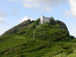
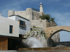
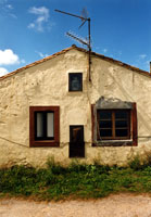
Castillo de Santa Ana (Castro-Urdiales)
The castle and the adjacent church of Santa Maria de la Asunción are among the oldest and best known Gothic buildings of the province, they are believed to date from the 13th century. The peninsula on which they stand provides natural shelter for a small harbor used by fishermen for many centuries. Located atop a vertical cliff at the point of the peninsula in Castro-Urdiales.
Photo courtesy Javier Martinez [Flickr] |
|
| SP 24 |
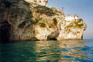
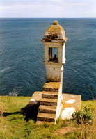
| Punta del Caballo
This lighthouse was built in a notch cut in the side of Monte Buciero, a near-vertical mountainside. 682 steps, a very challenging descent, lead down to the lighthouse. Located on an east-facing headland on the north side of the entrance to the Ría de Treto and the harbor of Santoña. Apparently accessible with some difficulty. (Don't confuse this with SP 100) SP 100
Photo courtesy Solabre [librodefaros] |
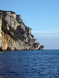
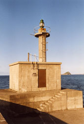
| SP 25 |
Punta del Pescador (Santoña)
Like Punta del Caballo, the light station is notched into the side of steep mountain, but in this case there is road access. Located on a north-facing headland about 4 km (2.5 mi) north of Santoña and only about 2 km northwest of Punta del Caballo. You need to look very carefully to see the light on the point just above the water.
Photo courtesy keszlerj [Flickr] |
|
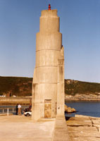
| SP 26 |
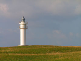
| Cabo de Ajo
This handsome modern tower, designed by Fernando Rodríguez Pérez, was one of the first new lighthouses built under the Plan de Señales Marítimas 1985-89. Located at the northernmost point of the Cantabrian coastline, about 8 km north of Ajo.
Photo courtesy Jorge Ordás [Flickr] |
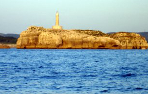
| SP 27 |
Isla Mouro
latitude 43° 28' 23.8" N longitude 3° 45' 21" W
Entrance to Bay of Santander, Cantabria. The island is a nature preserve.
Photo courtesy Javier [Flickr] |
|
| SP 28 |
| La Cerda (La Magdalena)
latitude 43° 28' 0.9" N longitude 3° 45' 50" W
Eastern tip of Península de la Magdalena.
Photo courtesy WendyPan [Flickr] |
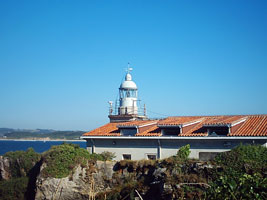
| SP 29 |
Cabo Mayor
latitude 43° 29' 25.6" N longitude 3° 47' 26.4" W
Parque de Cabo Mayor, west entrance to Port of Santander, Cantabrian Sea.
Photo courtesy Dani [Flickr] |
|
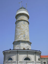
| SP 30 |
| Suances (Punta Torco de Afuera)
This lighthouse is built on the site of the medieval fortress of San Martín de la Arena. End of peninsula north of Suances, Cantabria.
Photo courtesy Orlok [Flickr] |
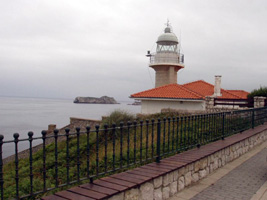
| SP 31 |
La Silla (San Vicente de la Barquera)
West side of entrance to harbor of San Vicente de la Barquera, Cantabria
Photo courtesy JL Keszler [Flickr] |
|
| SP 31A |
| San Vicente de la Barquera Channel Intermediate
Photo courtesy JL Keszler [Flickr] |
Eastern Asturias
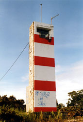
| SP 32 |
Punta San Emeterio |
Located atop a very steep bluff about 7 km north of Ribadedeva in easternmost Asturias. Accessible by a challenging road through the mountains. |
|
|
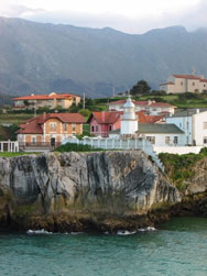
| SP 35 |
Ribadesella (Punta de Somos)
Ribadesella is a town facing a small semicircular bay, the Ría de Ribadesella, at the mouth of the river of the same name. Located on a headland about 1 km west of the bay.
Photo courtesy Todd Ulbrich [Flickr] |
|
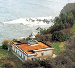
| SP 36 |
| Cabo Lastres
Located atop a steep headland about 6 km north of Colunga and 40 km east of Gijón.
Photo courtesy Dirk van der Eecken [Flickr] |
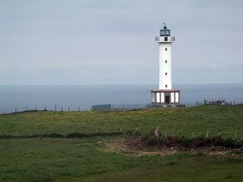
| SP 37 |
Tazones (Punta del Olivo)
Located on a headland about 9 km northeast of Villaviciosa and 28 km east of Gijón. (D 1592)
Photo courtesy Alex Trabas [ListOfLights] |
|
| SP 38 |
| Cabo de Torres
latitude 43° 34' 19.1" N longitude 5° 41' 58.3" W
Located on a sharp headland marking the western entrance to the harbor of Gijón.
Photo courtesy Autoridad Portuaria de Gijón [Rowlett] |
| SP 39 |
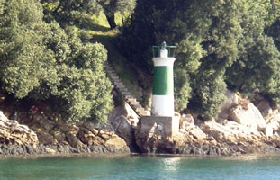
Candás (Cabo de San Antonio)
Located on a sharp promontory about 1 km northeast of the Carreño waterfront.
Photo courtesy SMB [Flickr] |
|
| SP 41 |
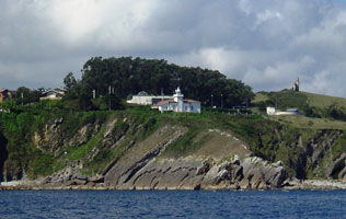
| Cabo Peñas
latitude 43° 39' 20.5" N longitude 5° 50' 56.1" W
The cape is designated a Biological Reserve and also a Protected Landscape (Paisaje Protegido). Located on the heights above the cape, at the end of the AS-328 highway, about 8 km northwest of Gozón.
Photo courtesy Nubera Na [Flickr] |
Western Asturias
| SP 42 |
Avilés
latitude 43° 35' 44.2" N longitude 5° 56' 42.8" W
North side of entrance to harbor at Avilés, western Asturias.
Photo courtesy Jorge Martinez [Flickr] |
|
| SP 43 |
Avilés Canal de Entrada (Entrance Channel)
latitude 43° 35' 35.1" N longitude 5° 56' 28.6" W |
End of south jetty, entrance to harbor at Avilés, western Asturias |
| SP 45 |
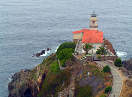
| Punta Roballera (Cudillero)
Located atop a vertical headland about 1.5 km north of Cudillero.
Photo courtesy Jorge Ordás [Flickr] |
| SP 46 |
Cabo Vidio
Cabo Vidio is a prominent cape that projects about 3 km into the Atlantic roughly 8 km west of Cudillero. Located on the point of the cape.
Photo courtesy Saúl Granda [Flickr] |
|
| SP 47 |
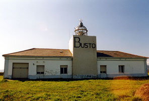
| Cabo Busto
Cabo Busto is a prominent cape that projects about 3 km into the Atlantic roughly 6 km east of Valdés. (D 1642)
Photo courtesy Alex Trabas [ListOfLights] |
| SP 48 |
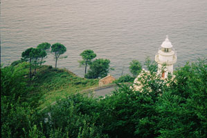
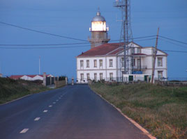
Luarca (Punta Atalaya)
Located on the promontory at the eastern entrance to the Ría de Luarca, the open embayment that includes the harbor of Luarca.
Photo courtesy reNET [Flickr] |
|
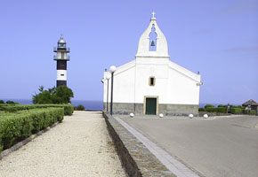
| SP 50 |
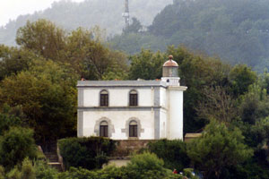
Cabo San Agustín (Ría de Navia)
latitude 43° 33' 48.7" N longitude 6° 44' 2.5" W
NW of Navia, western Asturias. Looks to me like the light has been named for the church right next door.
Photo courtesy bambino [Flickr] |
|
| SP 51 |
| Isla de Tapia
On island at entrance to harbor at Tapia de Casariego
Photo courtesy Mary Carmen López González [Flickr] |
Galicia
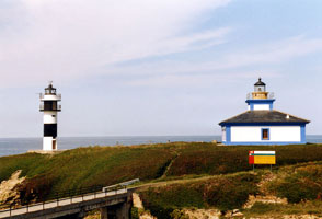
| SP 54 |
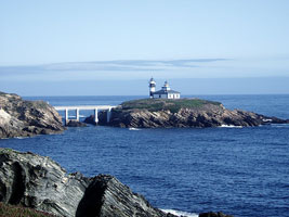
Isla Pancha (1860) (Ribadeo)
Isla Pancha is a small, rocky island at the northwestern entrance to the harbor of Ribadeo. A bridge connects the island to the mainland (see photo below). Located about 4 km north of Ribadeo. (D 1660)
Photo courtesy Alex Trabas [ListOfLights] |
|
| SP 55 |
| Isla Pancha (1953) (Ribadeo)
The photo above shows the new light (left) and the old light (right).
Photo courtesy Angel de Olavide [Flickr] |
| SP 56 |
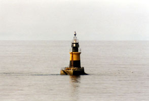
Piedra de Burela
latitude 43° 39' 48" N longitude 7° 20' 42" W
Located on a rocky ledge about 800m off the fishing port of Burela. Accessible only by boat, but there should be distant views from the shore. (D 1673)
Photo courtesy Alex Trabas [ListOfLights] |
|
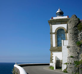
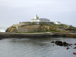
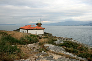
| SP 57 |
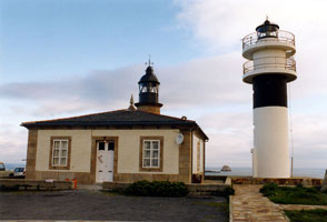
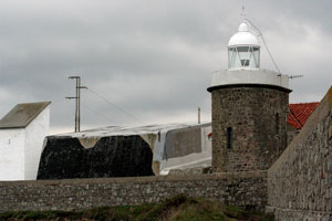
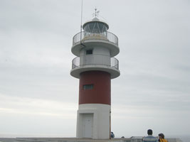
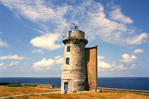
| San Cibrao (1864) (San Ciprián, Punta Atalaya)
latitude 43° 42' 1.8" N longitude 7° 26' 12.6" W
Located on a headland that provides natural shelter for the port of San Cibrao (San Ciprián). (D 1676)
Photo courtesy Alex Trabas [ListOfLights] |
Northern Coruña
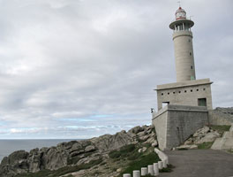
| SP 59 |
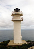
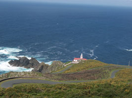
Punta Roncadoira
Roncadoira is a prominent cape, and it is surprising there was no light here long before 1974. Located on a steep headland about 7 km north of Xove. (D 1678)
Photo courtesy Alex Trabas [ListOfLights] |
|
| SP 60 |
| Isla Coelleiria
The island is a huge wedge of stone a short distance off the coast 5 km northeast of O Vicedo. Located on the highest point of the island. island
Photo courtesy Solabre [librodefaros] |
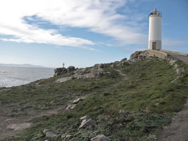
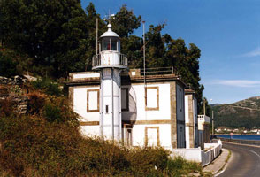
| SP 61 |
O Vicedo (Punta del Castro)
East side of entrance to Ría del Barquiero, Galicia. Don't confuse this with SP69 which has the same name. SP 69 (D 1685) ARLHS # SPA-361
Photo courtesy Alex Trabas [ListOfLights] |
|
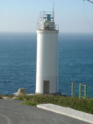
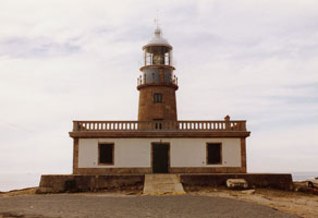
| SP 62 |
| Punta de la Barra
Located on the west side of the entrance to the Ría del Barquiero about 1.4 km northeast of the Porto de Barqueiro waterfront. (D 1685.2)
Photo courtesy Alex Trabas [ListOfLights] |
|
|
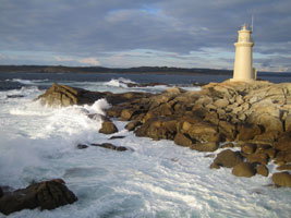
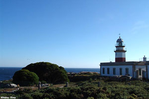
| SP 63 |
Estaca de Bares
Together with the light on Cabo Finisterre, it is one of the two lighthouses authorized in 1846 to light the northwestern corner of the Iberian Peninsula. Located at the tip of a peninsula 5 km long, accessible by road from Porto de Barqueiro at the base of the peninsula.
Photo courtesy Daniel Elinaro [Flickr] |
|
| SP 64 |
| Cabo Ortegal
latitude 43° 46' 15.6" N longitude 7° 52' 11.4" W
Cabo Ortegal is 12 km west and a little south of Punta de la Estaca de Bares; it is the point where the Spanish coastline changes direction from east-west to northeast-southwest. Located atop a very steep headland at the tip of the cape, about 5 km north of Cariño.
Photo courtesy radikalbyte [Flickr] |
| SP 65 |
Punta Candieira (Candelaria)
Port of Ferrol, Iberian coast. Located on a very steep point about 8 km north of Cedeira by a challenging road; 4WD recommended.
Photo courtesy birnarem [Flickr] |
|
| SP 66 |
| Punta Promontorio (Cedeira)
Located on a promontory in the middle of the Ría de Cedeira, about 2.5 km southwest of the town. (D 1688)
Photo courtesy Alex Trabas [ListOfLights] |
| SP 67 |
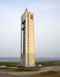
Punta Frouxeira
Close to beach resorts, this striking modern lighthouse is often photographed. Located on a headland about 5 km west of Valdoviño.
Photo courtesy Carlos Santos [Flickr] |
|
| SP 68 |
| Cabo Prior
latitude 43° 34' 4.2" N longitude 8° 18' 48.3" W
Located 14 km northwest of Ferrol and 4 km northwest of Pedreira.
Photo courtesy Jose C. Pappalardo [Flickr] |
| SP 69 |
O Priegal (Punta del Castro)
On a promontory at O Priegal, Galicia. Don't confuse this with SP61 which has the same name. SP 61 (D 1693) ARLHS # SPA-098
Photo courtesy Alex Trabas [ListOfLights] |
|
| SP 70 |
| Cabo Priorñio Chico
latitude 43° 27' 32.5" N longitude 8° 20' 23.1" W
This lighthouse stands at the end of a peninsula marking the entrance to the Ría de Ferrol and the approach to the harbor of Ferrol. Located 15 km southwest of Ferrol. (D 1694)
Photo courtesy Alex Trabas [l] |
| SP 71 |
San Martín Range Front
latitude 43° 27' 35" N longitude 8° 17' 2.8" W
Located on the south side of the Ría de Ferrol about 3 km west of El Baño. (D 1696)
Photo courtesy Alex Trabas [ListOfLights] |
|
| SP 72 |
| San Martín Range Rear
latitude 43° 27' 36.7" N longitude 8° 16' 31.9" W
Located on the south side of the Ría de Ferrol 700 m east of the front light. (D 1696.1)
Photo courtesy Alex Trabas [ListOfLights] |
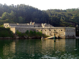
| SP 73 |
Castillo de la Palma
latitude 43° 27' 48.2" N longitude 8° 16' 23.5" W
South bank of Ría de Ferrol, northern Coruña. I believe the "light" is in one of the round towers you see in the middle of the castle.
Photo courtesy Noelia Amado [Flickr] |
|
| SP 74 |
| Ferrol Arsenal
latitude 43° 28' 25.8" N longitude 8° 14' 23.5" W
Located on a large quay on the west side of the inner harbor of Ferrol. (D 1698)
Photo courtesy Alex Trabas [ListOfLights] |
Ría de la Coruña
| SP 75 |
Punta Mera Anterior
The range guides ships on the initial approach to La Coruña. Located on a headland at the eastern side of the entrance to the Ría de la Coruña, 1.5 km west of Mera. (D 1706)
Photo courtesy Alex Trabas [ListOfLights] |
|
| SP 77 |
Punta Fieiteira Anterior
latitude 43° 20' 35.5" N longitude 8° 22' 15" W
Ships entering La Coruña follow the Punta Mera range to the middle of the entrance of the Ría de la Coruña and then turn 74° to the right onto the Punta Fieiteira Range. Located on a headland in Perillo, at the southern end of the Ría de la Coruña. (D 1710)
Photo courtesy Alex Trabas [ListOfLights] |
|
| SP 79 |
Oza
latitude 43° 20' 51" N longitude 8° 23' 2.8" W |
Entrance to harbor at La Coruña |
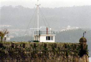
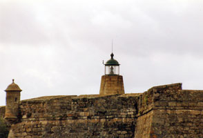
| SP 80 |
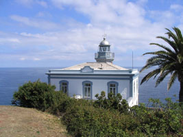
Castillo de San Antón
latitude 43° 21' 56.7" N longitude 8° 23' 14.4" W
Entrance to harbor at La Coruña. The fort here, which dates back to the late 1500s, has been a museum since 1964. The museum is open to the public, but the lighthouse tower is not open. (D 1716)
Photo courtesy Alex Trabas [ListOfLights] |
|
| SP 81 |
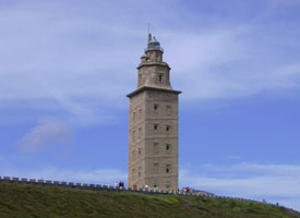
| Torre de Hercules
latitude 43° 23' 8.4" N longitude 8° 24' 23.7" W
This light dates to Roman times (when it had a bonfire on top of it as the source of light).
Photo courtesy Dani [Flickr] |
Cape Finisterre Area
| SP 82 |
Islas Sisargas
latitude 43° 21' 35.9" N longitude 8° 50' 40.4" W
The Islas Sisargas are rocky islands off Cabo de San Adrián, a prominent and dangerous cape about 35 km west of La Coruña. The islands are a protected wildlife refuge. Located about 5 km northwest of Malpica de Bergantiños. Accessible only by boat, but there is a good view from the point of Cabo de San Adrián. (D 1728)
Photo courtesy Alex Trabas [ListOfLights] |
|
| SP 83 |
| Punta Nariga
latitude 43° 19' 14.4" N longitude 8° 54' 36.2" W
This is about 5 miles NW of Mens.
Photo courtesy Ovillan [Flickr] |
| SP 84 |
Punta de Roncudo
latitude 43° 16' 29.9" N longitude 8° 59' 26.4" W
Coruñesa coast, Ria de Corme y Lage
Photo courtesy Ovillan [Flickr] |
|
| SP 85 |
| Punta Laxe (Punta Lage)
latitude 43° 13' 55.1" N longitude 9° 40" W
Laxe is a little and lovely village in the "península Ibérica" corner ,named "Costa da Morte" (Death Coast) but it's enough of life.
Photo courtesy Tony Kuki [Flickr] |
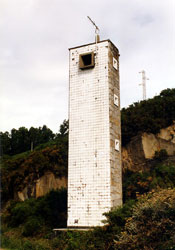
| SP 86 |
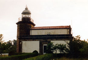
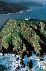
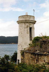
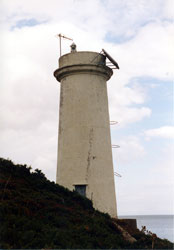
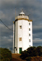
Cabo Villano (1854) (Vilán)
latitude 43° 9' 36.5" N longitude 9° 12' 41.4" W |
The "old" light is only a circular ruins at this point. Nearest Town or City: Camariñas, Spain |
| SP 88 |
| Punta de la Barca (Muxia)
This light marks the southern entrance to the Ría de Camariñas. Located on a point of land on the north side of Muxía. Do not confuse this light with Punto de Barca (in the Azores). PL 108
Photo courtesy Ricard Sentís [Flickr] |
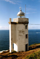
| SP 89 |
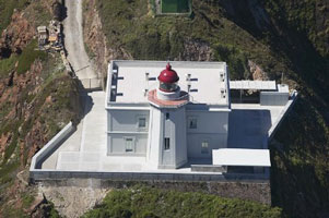
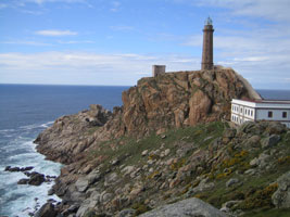
Cabo Toriñana (1898) (Cabo Tourñián)
latitude 43° 3' 11.8" N longitude 9° 17' 53.4" W
This lighthouse stands on the westernmost point of Spain at 9°17.9' W, extending about 2.1 km farther west than Cabo Finisterre. |
|
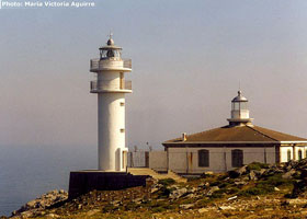
| SP 90 |
Cabo Toriñana (1981) (Cabo Tourñián)
latitude 43° 3' 11.5" N longitude 9° 17' 54.3" W |
The photo shows both the old light and the new light.
Photo courtesy Maria Victoria Aguirre [phares] |
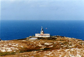
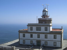
| SP 91 |
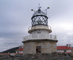
Cabo Finisterre (Cabo Fisterra)
Although Cabo Toriñana extends a little farther west, this is the point northward-bound ships must clear to round the northwestern corner of Spain. Located at the end of the AC-445 highway about 3 km south of Fisterra.
Photo courtesy freakyman [Flickr] |
|
| SP 92 |
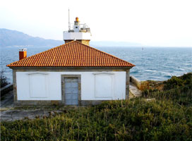
| Cabo Cée
latitude 42° 54' 58.9" N longitude 9° 11' 1.7" W
Located at the end of the peninsula marking the west entrance to the Ría de Corcubión, about 8 km south of Cée.
Photo courtesy elsusemueve [Flickr] |
Southern Coruña and Ría de Arousa
| SP 94 |
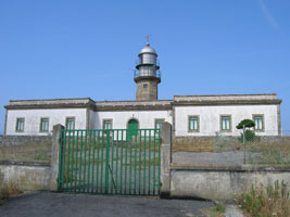
| Punta Ínsua
latitude 42° 46' 21.3" N longitude 9° 7' 30.1" W
This lighthouse was completed in 1913, but it was not activated until after the end of World War I. Its light filled in a dark zone between Capes Corrubedo and Finisterre. Located on a headland at Lariño.
Photo courtesy FreeCat [Flickr] |
| SP 95 |
Monte Louro (Punta Queixal)
latitude 42° 44' 21.3" N longitude 9° 4' 42.6" W
The lighthouse stands at the end of a south-pointing peninsula which shelters the northern entrance to the Ría de Muros e Noia. Located about 3 km south of Louro.
Photo courtesy Dirk Vde [Flickr] |
|
| SP 96 |
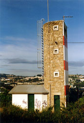
| Cabo Rebordñio
An unusual feature of this lighthouse is a bridge connecting the gallery to the flat roof of the keeper's house. Located on an east-pointing promontory, just off the AC-550 highway about 1 km southeast of Muros, marking the entrance to the harbor of that town. (D 1786)
Photo courtesy Alex Trabas [ListOfLights] |
| SP 97 |
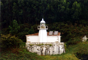
Corrubedo
latitude 42° 34' 34.2" N longitude 9° 5' 23.4" W
Cabo Corrubedo is the most dangerous Spanish cape south of Finisterre, since it projects far into the sea and the ridge continues underwater as a series of shoals. The unusual semicircular design of the keeper's house was meant to minimize wind resistance. Located on the point of the cape, about 1.5 km due west of the town of Corrubedo. (D 1794)
Photo courtesy Alex Trabas [ListOfLights] |
|
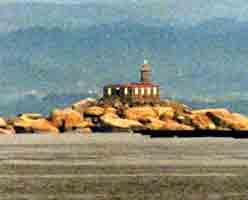
| SP 98 |
| Isla de Sálvora
latitude 42° 27' 56.7" N longitude 9° 46.1" W
Sálvora is a rocky island, about 2 km long, in the center of the entrance to the Ría de Arousa, which leads to the port of Vilagarcía. In 2002, the island was included with several others in a new national park. Located at the southern point of the island. Accessible only by boat, tours of the island can be arranged from Ribeira.
Photo courtesy Tine [phares] |
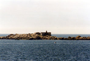
| SP 99 |
Isla Rúa
latitude 42° 32' 57" N longitude 8° 56' 21.6" W
Located on a small rocky island in the Ría de Arousa about 5 km east of Ribeira. Accessible only by boat. (D 1818)
Photo courtesy Alex Trabas [ListOfLights] |
|
| SP 100 |
| Punta Caballo (Illa de Arousa)
latitude 42° 34' 20.7" N longitude 8° 53' 2.3" W
The Isla de Arosa, or Illa de Arousa in Galego, is a substantial island, about 7 km long, on the eastern side of the Ría de Arousa. The island is accessible by a bridge on the PO-307 highway from Vilanova de Arousa. The lighthouse is on the rocky northwestern tip of the island. (Be careful not to confuse this with SP24.) SP 24 (D 1826)
Photo courtesy Alex Trabas [ListOfLights] |
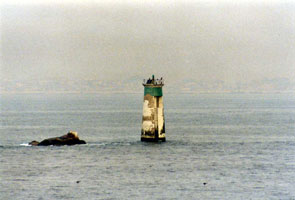
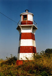
| SP 101 |
Bajo Pombeirñio
latitude 42° 28' 54.1" N longitude 8° 56' 48.1" W
Located on the south side of the entrance to the Ría de Arousa, about 1 km off the Barrio Carreiro northwest of Piedras Negras. Accessible only by boat. (D 1800)
Photo courtesy Alex Trabas [ListOfLights] |
|
Ría de Pontevedra
| SP 102 |
| Isla de Ons
latitude 42° 22' 57.6" N longitude 8° 56' 11.5" W
The Isla de Ons is the largest island of Spain's Atlantic coast, about 7 km long from north to south and located about 8 km west of the entrance to the Ría de Marín. The island is accessible, at least in the summer, by passenger ferry from Sanxenxo. The lighthouse is located at the center of the island, which is also the highest point. Ons
Photo courtesy courtesy Alfonso López [Flickr] |
| SP 103 |
Isla Tambo
latitude 42° 24' 29.6" N longitude 8° 42' 27.7" W
The wooded island, a nature reserve, is located in the middle of the Ría de Pontevedra about 2 km north of Marín. Located on the southern tip of the island. Accessible only by boat.
Photo courtesy Franes [Flickr] |
|
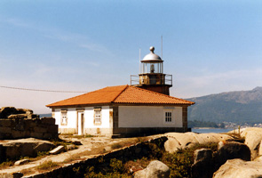
| SP 104 |
| Punta Couso
latitude 42° 18' 30.2" N longitude 8° 51' 26.8" W
Located on a promontory at the southern entrance to the Ría de Pontevedra about 8 km northwest of Cambados.
Photo courtesy Solabre [librodefaros] |
Southern Pontevedra
| SP 105 |
Cabo del Home Anterior (Range Front)
latitude 42° 15' 11.9" N longitude 8° 52' 23.9" W
This light and the Cabo del Home Posterior light form a range guiding ships into the northern entrance to the Ría de Vigo.
Photo courtesy Franes [Flickr] |
|
| SP 106 |
| Cabo del Home Posterior (Range Rear)
latitude 42° 15' 2.2" N longitude 8° 52' 21.9" W
Located on the eastern point of the two points of Cabo del Home, about 8 km due west of Cambados and 815 m east southeast of the front light.
Photo courtesy Franes [Flickr] |
| SP 107 |
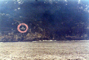
Monte Agudo
latitude 42° 14' 35.9" N longitude 8° 54' 11.3" W
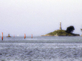
Located on the highest point of Isla Monteagudo, the northernmost of the three Islas Cíes (see next entry). Accessible by a hiking trail from Isla del Faro to the south (the two islands are joined by a sandbar). Oh the things we go through to get a picture. This clearly was taken from a long distance, and then digitally enhanced (I've done it myself). Circle added for clarity. (D 1882)
Photo courtesy Alex Trabas [ListOfLights] |
|
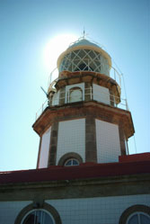
| SP 108 |
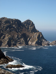
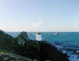
| Monte del Faro (Islas Cíes)
latitude 42° 12' 52.6" N longitude 8° 54' 53.5" W
The Islas Cíes are three steep, rocky islands arranged north to south off the entrance to the Ría de Vigo: Isla Monteagudo on the north, Isla de Faro in the center, and Isla de San Martiño in the south. Each island has a lighthouse, but this one is by far the best known. The lighthouse stands atop a sharp peak and is reached by a steep road having many switchbacks. The islands are part of a national park, accessible at least in the summer by passenger ferries from Cangas and from Vigo. Located at the highest point of Isla del Faro. If you look real hard, you can see the light on the top of the mountain on the right. cies
Photo courtesy Jose Ortigueira [private copy] |
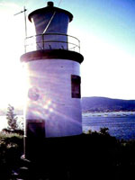
| SP 109 |
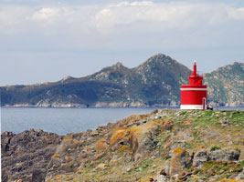
Punta Canabal ("Farol da Porta")
latitude 42° 12' 44.6" N longitude 8° 54' 45.5" W |
Located at the southern end of Isla del Faro, marking the passage between that island and the Isla de San Martiño. |
| SP 110 |
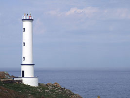
La Guía
latitude 42° 15' 34.4" N longitude 8° 42' 7.5" W
Located on a promontory at La Guía, a neighborhood northeast of Vigo on the south side of the Ría de Vigo.
Photo courtesy Solabre [librodefaros] |
|
| SP 111 |

| Cabo Estay Anterior (Range Front)
latitude 42° 11' 4" N longitude 8° 48' 48.7" W
Located on a headland on the south side of the lower Ría de Vigo, about 8 km southwest of Vigo and 2.5 km north of Saiáns. (D 1890)
Photo courtesy Alex Trabas [ListOfLights] |
| SP 113 |
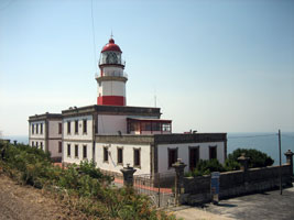
| Cabo Silleiro
latitude 42° 6' 40.6" N longitude 8° 53' 57.2" W
Cabo Silleiro is a very prominent headland at the southern entrance to the Ría de Vigo, and the lighthouse here is important as a landfall light for Vigo and all the ports of Galicia. Located just off the PO-552 coastal highway about 8 km southwest of Baiona.
Photo courtesy Job [Flickr] |
|
|


